Mount Neumayer
Mount Neumayer ist ein 719 m hoher Berg an der Scott-Küste des ostantarktischen Viktorialands. In den Prince Albert Mountains ragt er aus der D’Urville Wall an der Nordflanke des Übergangs des David-Gletschers in die Drygalski-Eiszunge auf.
| Mount Neumayer | ||
|---|---|---|
| Höhe | 719 m | |
| Lage | Viktorialand, Ostantarktika | |
| Gebirge | Prince Albert Mountains, Transantarktisches Gebirge | |
| Koordinaten | 75° 16′ 0″ S, 162° 17′ 0″ O | |
| ||
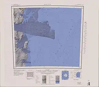
Topografische Karte mit der Drygalski-Eiszunge und Mount Neumayer (oben links) | ||

Teilnehmer der Discovery-Expedition (1901–1904) unter der Leitung des britischen Polarforschers Robert Falcon Scott entdeckten ihn. Scott benannte ihn nach dem deutschen Geophysiker Georg von Neumayer (1826–1909).
Weblinks
- Mount Neumayer im Geographic Names Information System des United States Geological Survey (englisch)
- Mount Neumayer auf geographic.org (englisch)
This article is issued from Wikipedia. The text is licensed under Creative Commons - Attribution - Sharealike. The authors of the article are listed here. Additional terms may apply for the media files, click on images to show image meta data.