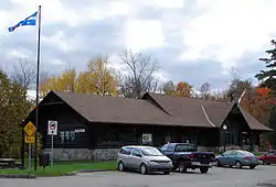
Montebello (Québec)
Montebello ist eine Gemeinde (französisch municipalité) im Süden der kanadischen Provinz Québec mit 983 Einwohnern (Stand: 2016). 2011 betrug die Einwohnerzahl 978.[2] Sie liegt etwa 50 km östlich von Gatineau in der municipalité régionale de comté Papineau.
| Montebello | |||
|---|---|---|---|
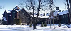 Château Montebello | |||
.svg.png.webp) Wappen |
|||
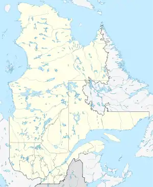
| Lage in Québec | |||
| |||
| Staat: | |||
| Provinz: | Québec | ||
| Région administrative: | Outaouais | ||
| MRC oder Äquivalent: | Papineau | ||
| Koordinaten: | 45° 39′ N, 74° 56′ W | ||
| Fläche: | 8,62 km² | ||
| Einwohner: | 983 (Stand: 2016[1]) | ||
| Bevölkerungsdichte: | 114 Einw./km² | ||
| Zeitzone: | Eastern Time (UTC−5) | ||
| Gemeindenummer: | 80010 | ||
| Postleitzahl: | J0V | ||
| Bürgermeister: | Pierre Bertrand | ||
| Website: | www.montebello.ca | ||
 | |||
Im Château Montebello, einem Hotel, logierten im Jahr 1981 die Teilnehmer des G7-Gipfels von Ottawa sowie im Jahr 1983 die Teilnehmer der Bilderberg-Konferenz.
Söhne und Töchter der Stadt
- Louis-Joseph Papineau (1786–1871), kanadischer Politiker
Weblinks
Commons: Montebello (Quebec) – Sammlung von Bildern, Videos und Audiodateien
Einzelnachweise
- Statistics Canada: Census Profile, 2016 Census – Montebello, Municipalité (Census subdivision), Quebec and Quebec (Province), abgerufen am 1. Juni 2021
- Montebello Community Profile. Census 2011. In: Statistics Canada. 9. Februar 2015, abgerufen am 27. November 2015 (englisch).
This article is issued from Wikipedia. The text is licensed under Creative Commons - Attribution - Sharealike. The authors of the article are listed here. Additional terms may apply for the media files, click on images to show image meta data.