Matnog
Matnog ist eine philippinische Stadtgemeinde in der Provinz Sorsogon. Sie hat 41.101 Einwohner (Zensus 1. August 2015), die in 40 Barangays lebten. Matnog gehört zur dritten Einkommensklasse der Gemeinden auf den Philippinen. Sie liegt ca. 48 km südlich der Provinzhauptstadt Sorsogon City an der San-Bernardino-Straße. Ihre Nachbargemeinden sind Bulan im Nordwesten, Irosin im Norden und Santa Magdalena im Nordosten.
| Municipality of Matnog | |||
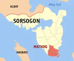
| Lage von Matnog in der Provinz Sorsogon | |||
|---|---|---|---|
 | |||
| Basisdaten | |||
| Region: | Bicol-Region | ||
| Provinz: | Sorsogon | ||
| Barangays: | 40 | ||
| Distrikt: | 2. Distrikt von Sorsogon | ||
| PSGC: | 056212000 | ||
| Einkommensklasse: | 3. Einkommensklasse | ||
| Haushalte: | Zensus 1. Mai 2000 | ||
| Einwohnerzahl: | 41.101 Zensus 1. August 2015 | ||
| Bevölkerungsdichte: | 253,1 Einwohner je km² | ||
| Fläche: | 162,40 km² | ||
| Koordinaten: | 12° 35′ N, 124° 5′ O | ||
| Postleitzahl: | 4708 | ||
| Geographische Lage auf den Philippinen | |||
| |||

Matnog ist ein wichtiger Fährhafen für den Verkehr auf die Nachbarinsel Samar und auf dem Maharlika Highway.
Baranggays
|
|
|
Weblinks
This article is issued from Wikipedia. The text is licensed under Creative Commons - Attribution - Sharealike. The authors of the article are listed here. Additional terms may apply for the media files, click on images to show image meta data.