M4 motorway (Irland)
Der M4 motorway (englisch für „Autobahn M4“, irisch Mótarbhealach M4) ist eine 44,8 km lange, abschnittsweise mautpflichtige hochrangige Straßenverbindung in der Republik Irland, die vom Dubliner Autobahnring M50 motorway über ein 5,6 km langes Verbindungsstück der Nationalstraße N4 nach Westnordwesten nach Kinnegad und weiter als N4 über Longford und Carrick-on-Shannon nach Sligo führt. Bei Kinnegad verzweigt sie sich mit dem M6 motorway, der über Athlone die Stadt Galway erreicht. Der weitere Ausbau Richtung Sligo bis Mullingar North ist geplant.[1]
| M4 motorway in Irland | |
 | |
| Karte | |
.png.webp) Verlauf der M4 | |
| Basisdaten | |
| Betreiber: | Transport Infrastructure Ireland |
| Straßenbeginn: | M50 motorway (Irland) Junction 7 |
| Straßenende: | Kinnegad |
| Gesamtlänge: | 44,8 km |
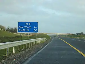 | |
| Straßenschild an der M4 bei Kinnegad | |

Mautstelle (“Toll Plaza”) an der M4
Einzelnachweise
- Ordnance Survey Ireland/Ordnance Survey Northern Ireland (Hrsg.): Official Road Atlas Ireland/Atlas oifigiúil Bóitre Éireann, 7th Edition 2018, ISBN 978-1-908852-83-0
This article is issued from Wikipedia. The text is licensed under Creative Commons - Attribution - Sharealike. The authors of the article are listed here. Additional terms may apply for the media files, click on images to show image meta data.