M2 motorway (Irland)
Der M2 motorway (englisch für „Autobahn M2“, irisch Mótarbhealach M2) ist eine 12,5 km lange, nicht mautpflichtige hochrangige Straßenverbindung in der Republik Irland, die vom Dubliner Autobahnring M50 motorway über ein 4,1 km langes Verbindungsstück der Nationalstraße N2 nach Nordnordwesten Richtung Ardee und Carrickmacross führt; die N2 führt in Irland weiter nach Monaghan und überschreitet dann die Grenze zu Nordirland.[1]
| M2 motorway in Irland | ||||||||||||||||||||||
 | ||||||||||||||||||||||
| Karte | ||||||||||||||||||||||
.png.webp) Verlauf der M2 | ||||||||||||||||||||||
| Basisdaten | ||||||||||||||||||||||
| Betreiber: | Transport Infrastructure Ireland | |||||||||||||||||||||
| Straßenbeginn: | M50 motorway (Irland) Junction 5 | |||||||||||||||||||||
| Straßenende: | Ashbourne | |||||||||||||||||||||
| Gesamtlänge: | 12,5 km | |||||||||||||||||||||
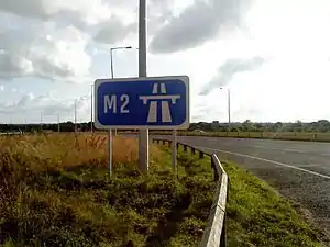 | ||||||||||||||||||||||
| Anfang der M2 bei Ashbourne | ||||||||||||||||||||||
Straßenverlauf
| ||||||||||||||||||||||
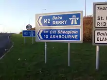
Wegweiser zum Motorway
Einzelnachweise
- Ordnance Survey Ireland/Ordnance Survey Northern Ireland (Hrsg.): Official Road Atlas Ireland/Atlas oifigiúil Bóitre Éireann, 7th Edition 2018, ISBN 978-1-908852-83-0
This article is issued from Wikipedia. The text is licensed under Creative Commons - Attribution - Sharealike. The authors of the article are listed here. Additional terms may apply for the media files, click on images to show image meta data.