M11 motorway (Irland)
Der M11 motorway (englisch für „Autobahn M11“, irisch Mótarbhealach M11) ist eine derzeit (2019) auf 90 km Länge ausgebaute, noch nicht auf ganzer Länge fertiggestellte hochrangige Straßenverbindung in der Republik Irland, die zusammen mit der N11 Dublin unter Umgehung von Wicklow, Arklow, Gorey und Enniscorthy mit Wexford verbindet.[1] Die Autobahn bildet einen Teil der Europastraße 1. Ein 27 km langes Teilstück bei Enniscorthy bis zum Kreisverkehr Scurlocksbush wurde am 18. Juli 2019 eröffnet.
| M11 motorway in Irland | ||||||||||||||||||||||||||||||||||||||||||||||||||||||||||||||||
 | ||||||||||||||||||||||||||||||||||||||||||||||||||||||||||||||||
| | ||||||||||||||||||||||||||||||||||||||||||||||||||||||||||||||||
| Karte | ||||||||||||||||||||||||||||||||||||||||||||||||||||||||||||||||
.png.webp) Verlauf der M11 | ||||||||||||||||||||||||||||||||||||||||||||||||||||||||||||||||
| Basisdaten | ||||||||||||||||||||||||||||||||||||||||||||||||||||||||||||||||
| Betreiber: | Transport Infrastructure Ireland | |||||||||||||||||||||||||||||||||||||||||||||||||||||||||||||||
| Straßenbeginn: | M50 motorway (Irland) Junction 17 | |||||||||||||||||||||||||||||||||||||||||||||||||||||||||||||||
| Straßenende: | Enniscorthy | |||||||||||||||||||||||||||||||||||||||||||||||||||||||||||||||
| Gesamtlänge: | 90 km derzeit | |||||||||||||||||||||||||||||||||||||||||||||||||||||||||||||||
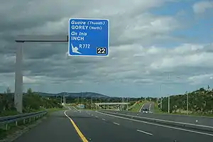 | ||||||||||||||||||||||||||||||||||||||||||||||||||||||||||||||||
| M11, Umgehung von Gorey (Gorey bypass) (Aufnahme 2009) | ||||||||||||||||||||||||||||||||||||||||||||||||||||||||||||||||
Straßenverlauf
| ||||||||||||||||||||||||||||||||||||||||||||||||||||||||||||||||
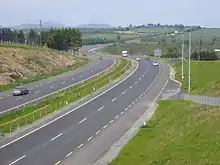
M11 in Shankill südlich von Dublin (Aufnahme 2007)
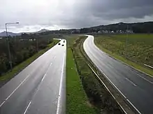
Die Straße südlich von Newtownmuontkennedy (Aufnahme 2005)
Einzelnachweise
- Ordnance Survey Ireland/Ordnance Survey Northern Ireland (Hrsg.): Official Road Atlas Ireland/Atlas oifigiúil Bóitre Éireann, 7th Edition 2018, ISBN 978-1-908852-83-0
This article is issued from Wikipedia. The text is licensed under Creative Commons - Attribution - Sharealike. The authors of the article are listed here. Additional terms may apply for the media files, click on images to show image meta data.