Lupi (Camarines Sur)
Lupi ist eine philippinische Stadtgemeinde in der Provinz Camarines Sur. Sie hat 32.167 Einwohner (Zensus 1. August 2015). Die Gemeinde liegt an der Küste des Golfes von Ragay. Teile des Bicol Natural Parks liegen auf dem Gemeindegebiet.
| Municipality of Lupi | |||
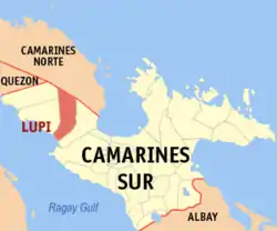
| Lage von Lupi in der Provinz Camarines Sur | |||
|---|---|---|---|
 | |||
| Basisdaten | |||
| Region: | Bicol-Region | ||
| Provinz: | Camarines Sur | ||
| Barangays: | 38 | ||
| Distrikt: | 1. Distrikt von Camarines Sur | ||
| PSGC: | 051719000 | ||
| Einkommensklasse: | 4. Einkommensklasse | ||
| Haushalte: | 4858 Zensus 1. Mai 2000 | ||
| Einwohnerzahl: | 32.167 Zensus 1. August 2015 | ||
| Bevölkerungsdichte: | 127,1 Einwohner je km² | ||
| Fläche: | 253,12 km² | ||
| Koordinaten: | 13° 49′ N, 122° 54′ O | ||
| Postleitzahl: | 4409 | ||
| Bürgermeister: | Roberto M. Matamorosa | ||
| Geographische Lage auf den Philippinen | |||
| |||

Baranggays
Lupi ist politisch in 38 Baranggays unterteilt.
|
|
|
This article is issued from Wikipedia. The text is licensed under Creative Commons - Attribution - Sharealike. The authors of the article are listed here. Additional terms may apply for the media files, click on images to show image meta data.