Liste von Court Tombs in Irland
Die Liste von Court Tombs in Irland enthält Court Tombs in der Republik Irland und in Nordirland.
Die Seite des irischen National Monument Service NMS[1] und die Seite des Northern Ireland Sites & Monument Record NISMR[2] enthalten alle bekannten Court Tombs.
Auf der irischen Insel sind über 400 Court Tombs bekannt.
In der Spalte Lage/ SMR werden die Geodaten, angegeben:
- Oben die Koordinaten
- darunter die Werte des Irish Grid des Ordnance Survey Ireland (OSI)
- darunter die SMR-Nummern des NMS oder NISMR.
Im Gaeltacht sind die Namen der Townlands auf NMS in irisch angegeben, während sie in der anderen Literatur überwiegend in englisch angegeben sind. Für das Gaeltacht werden hier beide Namen aufgeführt.
Liste der Court Tombs
County: Antrim Armagh Cavan Clare Derry Donegal Down Fermanagh Galway Kilkenny Leitrim Louth Mayo Monaghan Sligo Tipperary Tyrone Waterford
| Name (Townland) | Bekannt als | Ort | County | Bemerkung | Position | Bild |
|---|---|---|---|---|---|---|
| Antynanum | Glenarm | Antrim | 54,930268° N, 6,042032° W D 255 109 ANT 029:092 |
|||
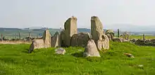
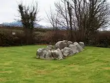
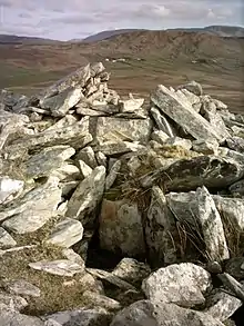
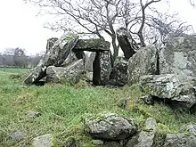
| Ballymacaldrack | Dooey’s Cairn | Dunloy | Antrim | 55,001556° N, 6,404389° W D 021 182 ANT 022:012 |
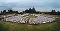
Jun2008.jpg.webp) | |
| Ballymarlagh | Ballymena | Antrim | 54,850518° N, 6,225274° W D 140 017 ANT 038:002 |
|||
| Ballyutoag | Belfast | Antrim | 54,64604° N, 6,00226° W J 290 794 ANT 056:024 |
|||
| Ballyvoy | Antrim | 55,208997° N, 6,181721° W D 152 417 ANT 005:003 |
||||
| Browndod | Antrim | Antrim | 54,764694° N, 6,12675° W J 201 923 ANT 044:035 |
|||
| Craigs | The Broad Stones | Rasharkin | Antrim | 54,99582° N, 6,47072° W C 979 175 ANT 022:023 |
||
| Lubitavish | Ossian’s Grave | Cushendall | Antrim | 55,088778° N, 6,101306° W D 212 284 ANT 019:006 |
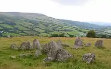 | |
| Tervillin | Cloghafadd | Ballycastle | Antrim | 55,208764° N, 6,143706° W D 182 417 ANT 005:016 |
||
| Annaghmare | Black Castle | Crossmaglen | Armagh | 54,10175° N, 6,61725° W H 904 178 ARM 027:007 |
||
| Ballintaggart | Armagh | Jetzt im Botanischen Garten Belfasts | 54,796896° N, 7,242027° W H 974 521 ARM 009:006 |
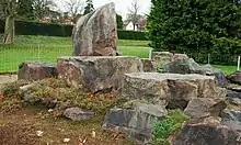 | ||
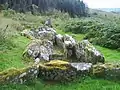
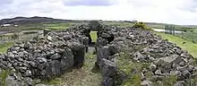
| Ballymacdermot | The Fairy Ring | Newry | Armagh | 54,15425° N, 6,369806° W J 065 240 ARM 026:015 |
.jpeg.webp) | |
| Clonlum | Slieve Gullion | Armagh | 54,130905° N, 6,402599° W J 044 213 ARM 029:004 |
|||
| Clontygora | The King’s Ring | Slieve Gullion | Armagh | 54,112206° N, 6,320906° W J 098 194 ARM 029:011 |
 | |
| Banagher | Cavan | Cavan | Nahezu zerstört | 53,944431° N, 7,282625° W N 469 996 CV026-005---- |
||
| Cohaw | Giant's Grave | Cootehill | Cavan | Dual Court | 54,053889° N, 7,028028° W H 643 124 CV018-005---- |
 |
| Gartnanoul | Killeshandra | Cavan | Dual Court | 54,010833° N, 7,491389° W H 333 069 CV019-035---- |
 | |
| Parknabinnia | Corofin | Clare | 52,987886° N, 9,101842° W R 260 935 CL017-180007- |
|||
| Teergonean | Doolin | Clare | 53,029362° N, 9,389867° W R 068 984 CL008-002001- |
 | ||
| Ballybriest | Carnanbane | Cookstown | Derry | Dual Court | 54,739444° N, 6,817778° W H 761 885 LDY045:003 |
 |
| Carrick East | Limavady | Derry | 54,998217° N, 6,902278° W C 704 173 LDY017:010 |
|||
| Knockoneill | Dungiven | Derry | 54,919668° N, 6,722496° W C 819 087 LDY026:052 |
 | ||
| Tamnyrankin | Swatragh | Derry | 54,933194° N, 6,698917° W C 834 103 LDY026:013 |
|||
| Ballymunterhiggin | Ballyshannon | Donegal | 54,48128° N, 8,18813° W G 878 592 DG107-083---- |
|||
| Bavan | Killybegs | Donegal | 54,62709° N, 8,54065° W G 651 755 DG097-020---- |
|||
| Carricknamoghil | Killybegs | Donegal | 54,6694° N, 8,4228° W G 727 802 DG091-002---- |
|||
| Croaghbeg An Chruach Bheag |
Pontabane Carn | Killybegs | Donegal | 54,623446° N, 8,548421° W G 646 751 DG097-017001- |
||
| Fearann Mhic Giolla Bhríde Farranmacbride |
Mannernamortee Einfriedung der Toten |
Glencolumbkille | Donegal | 54,713889° N, 8,718611° W G 535 854 DG080-006---- |
||
| Laraghirril | Temple of Deen | Culdaff | Donegal | 55,266806° N, 7,156944° W C 536 469 DG012-003---- |
 | |
| Garvagh Corradooey |
Ballybofey und Castlederg |
Donegal und Tyrone |
Liegt genau auf der Grenze | 54,729503° N, 7,689195° W H 201 869 DG087-007---- TYR015:005 |
 | |
| Malin More | Cloghanmore | Glencolumbkille | Donegal | 54,689167° N, 8,745861° W G 518 826 DG089-012---- |
 | |
| Shalwy | Muinner Carn | Kilcar | Donegal | 54,624722° N, 8,545556° W G 648 753 DG097-018---- |
 | |
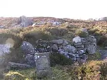
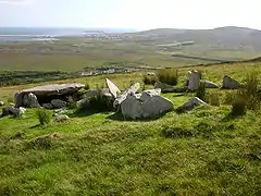
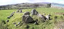
| Audleystown | Strangford Lough | Down | 54,376366° N, 5,597178° W J 561 503 DOW031:007 |
.JPG.webp) | ||
| Ballyalton | Downpatrick | Down | 54,328869° N, 5,646225° W J 530 448 DOW038:006 |
|||
| Burren | Warrenpoint | Down | 54,139155° N, 6,265173° W J 134 255 DOW051:031 |
|||
| Dunnaman | Giant’s Grave | Kilkeel | Down | 54,068509° N, 6,03258° W J 288 150 DOW055:030 |
 | |
| Moyad | Rush’s Cove | Kilkeel | Down | 54,108° N, 6,031° W J 288 196 DOW055:052 |
||
| Cleggan | Cleggan Bay | Galway | 53,56172° N, 10,10339° W L 606 589 GA022-014---- |
|||
| Letterfrack | Letterfrack | Galway | 53,54797° N, 9,950367° W L 707 570 GA023-020---- |
|||
| Mweelin | Letterfrack | Galway | 53,5544° N, 9,87761° W L 755 577 GA023-024---- |
|||
| Tonadooravaun | Renvyle | Galway | 53,599119° N, 10,03574° W L 649 630 GA009-021---- |
|||
| Aghanaglack | Enniskillen | Fermanagh | 54,34004° N, 7,852385° W H 097 435 FER210:034 |
 | ||
| Dog Little | Skaghlea Cairn | Marble Arch Caves | Fermanagh | 54,404904° N, 7,970257° W H 020 507 FER190:009 |
||
| Rossinure Beg | Giant's Grave | Derrygonnelly | Fermanagh | 54,402119° N, 7,881053° W H 077 504 FER191:038 |
||
| Farnogue | Mullinavat | Kilkenny | 52,35025° N, 7,11867° W S 600 224 KK040-020001- |
|||
| Corracloona | Prince Connell’s Grave | Garrison | Leitrim | Typ unklar; könnte auch Wedge Tomb sein | 54,33478° N, 8,00458° W G 997 429 LE008-013---- |
 |
| Fenagh Commons Townland |
Fenagh | Leitrim | Dual Court | 54,01656° N, 7,83828° W H 106 075 LE029-002---- |
||
| Shasgar | Manorhamilton | Leitrim | 54,40211° N, 8,16088° W G 896 504 LE004-011---- |
|||
| Tullyskeherny | Manorhamilton | Leitrim | Zwei Tombs liegen nebeneinander | 54,28139° N, 8,15542° W G 899 369 LE011-038002- |
||
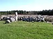
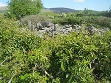
| Wardhouse (LE001-021) | Bundoran | Leitrim | Teil eines Komplexes mehrerer Tombs | 54,46943° N, 8,34709° W G 775 579 LE001-021---- |
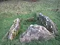
.jpg.webp) | |
| Wardhouse (LE001-024) | Bundoran | Leitrim | Teil eines Komplexes mehrerer Tombs | 54,46972° N, 8,34609° W G 776 580 LE001-024---- |
.jpg.webp) | |
| Aghnaskeagh | Dundalk | Louth | 54,06088° N, 6,35777° W J 075 136 LH004-033---- |
 | ||
| Commons | Carlingford | Louth | 54,02298° N, 6,19665° W J 182 096 LH008-022---- |
|||
| Rockmarshall | Cooley-Halbinsel | Louth | 54,00919° N, 6,28475° W J 125 080 LH008-033---- |
|||
| Aillemore | Louisburgh | Mayo | 53,69937° N, 9,87606° W L 761 738 MA095-020001- |
 | ||
| Ballyglass | Ballycastle | Mayo | 54,28161° N, 9,38636° W G 097 378 MA007-046---- |
|||
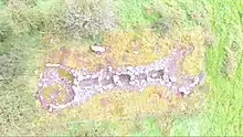
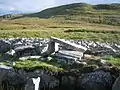
| Behy An Bheithigh |
Céide Fields | Mayo | Nahezu vom Moor verdeckt | 54,3043° N, 9,46264° W G 049 404 MA006-013---- |
||
| Cartronmacmanus | Foxford | Mayo | 54,01247° N, 8,97607° W G 360 074 MA049-058001- |
|||
| Drumcollagh | Ballycroy | Mayo | Zweitgrößtes Court Tomb Irlands, auch Drumgollagh | 53,97916° N, 9,83198° W F 798 048 MA056-004001- |
||
| Keel East | Acaill Achill Island |
Mayo | 53,9998° N, 10,05867° W F 649 075 MA042-021001- |
 | ||
| Rathlacken | Ballycastle | Mayo | 54,29077° N, 9,28152° W G 165 387 MA007-016006- |
 | ||
| Carn | Newbliss | Monaghan | 54,17955° N, 7,06597° W H 610 260 MO013-029---- |
|||
| Edergole | Rockcorry | Monaghan | 54,12159° N, 7,06191° W H 613 195 MO018-043---- |
|||
| Tiredigan | Newbliss | Monaghan | 54,19736° N, 7,07478° W H 604 279 MO012-041---- |
|||
| Carrownagh | Sligo | 54,20491° N, 8,41151° W G 732 285 SL021-020---- |
 | |||
| Carrowreagh Süd | Aclare | Sligo | 54,05734° N, 8,94112° W G 383 123 SL036-003---- |
|||
| Carrowreagh Nord | Giant's Grave Cashelnamon |
Aclare | Sligo | 54,05863° N, 8,94054° W G 383 128 SL036-002---- |
||
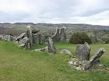
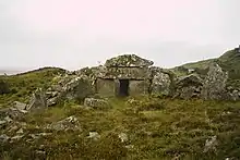
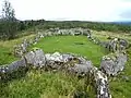
| Creevykeel | Cliffony | Sligo | Größtes Court Tomb Irlands | 54,43861° N, 8,43333° W G 719 545 SL003-032---- |
 | |
| Creevymore | Cliffony | Sligo | 54,43348° N, 8,44815° W G 709 539 SL002-010---- |
.jpg.webp) | ||
| Cummeen | Sligo | Sligo | 54,27701° N, 8,52677° W G 657 365 SL014-045---- |
|||
| Killaspugbrone | Strandhill | Sligo | 54,27498° N, 8,59838° W G 610 364 SL013-003---- |
 | ||
| Magheraghanrush | Deerpark | Lough Gill | Sligo | 54,27933° N, 8,38111° W G 752 367 SL015-050---- |
 | |
| Moytirra East | Giant’s Grave | Ballyfarnan | Sligo | 54,07582° N, 8,28378° W G 814 141 SL035-079---- |
||
| Shanballyedmond | Rear Cross | Tipperary | 52,67528° N, 8,25° W R 844 587 TN038-013---- |
|||
| Balix Lower | Plumbridge | Tyrone | 54,7969° N, 7,24203° W H 483 963 TYR006-006 |
|||
| Ballywholan | Carnagat | Clogher | Tyrone | 54,38588° N, 7,14558° W H 569 470 TYR065-002 |
 | |
| Beltany | Omagh | Tyrone | 54,68666° N, 7,3553° W H 416 826 TYR025-008 |
 | ||
| Carnanransy | Cloghmore | Tyrone | 54,71184° N, 7,03179° W H 624 853 TYR019-005 |
|||
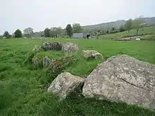
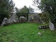
| Creggandevesky | Carrickmore | Tyrone | 54,61897° N, 7,00458° W H 645 750 TYR037-014 |
 | ||
| Loughmacrory | Omagh | Tyrone | 54,63759° N, 7,0952° W H 577 777 TYR027-014 |
 | ||
| Ballynamona Lower | Dungarvan | Waterford | Südlichstes in Irland | 52,00295° N, 7,58204° W X 287 836 WA039-007---- |
Literatur
- Archaeological Inventory of County Galway. Band 1: Paul Gosling: West Galway (including Connemara and the Aran Islands). Stationery Office, Dublin 1993, ISBN 0-7076-0322-6.
- William Copeland Borlase: The Dolmens of Ireland, their Distribution, structural Characteristics, and Affinities in other Countries; together with the Folk-lore attaching to them and Traditions of the Irish People. 3 Bände, Chapman & Hall, London 1897 (Online).
- Eammon Cody: Survey of the Megalithic tombs of Ireland. 6. Countiy Donegal. Stationery Office, Dublin 2002, ISBN 0-7557-1248-X (PDF (Teil 1); 20,1 MB, PDF (Teil 2); 20,3 MB, PDF (Teil 3); 23,4 MB, PDF (Teil 4); 17,9 MB, PDF (Teil 5); 19,8 MB, PDF (Teil 6); 23 MB, PDF (Teil 7); 20,4 MB, PDF (Teil 8); 16,3 MB, PDF (Teil 9); 13 MB).
- Michael Herity: The finds from Irish court tombs. In: Proceedings of the Royal Irish Academy. Section C: Archaeology, Celtic studies, history, linguistics, literature. Band 87C, 1987, S. 103–281, JSTOR 25506150.
- Carleton Jones: Temples of Stone: Exploring the megalithic Tombs of Ireland. Collins, Cork 2007, ISBN 978-1905172054.
- Seán Ó Nualláin: Survey of the Megalithic tombs of Ireland. 5. Countiy Sligo. Stationery Office, Dublin 1989, ISBN 0-7076-0080-4 (PDF (Textband); 16,2 MB, PDF (Tafelband); 9,4 MB).
- Ruaidhrí de Valera, Seán Ó Nualláin: Survey of the Megalithic tombs of Ireland. 1. County Clare. Stationery Office, Dublin 1961 (PDF (Textband); 13 MB).
- Ruaidhrí de Valera, Seán Ó Nualláin: Survey of the Megalithic tombs of Ireland. 2. County Mayo. Stationery Office, Dublin 1964 (PDF (Textband); 15,9 MB, PDF (Tafelband); 7,9 MB).
- Ruaidhrí de Valera, Seán Ó Nualláin: Survey of the Megalithic tombs of Ireland. 3. Counties Galway, Roscommon, Leitrim, Longford, Westmeath, Laoighis, Offaly, Kildare, Cavan. Stationery Office, Dublin 1972 (PDF (Textband); 17,9 MB, PDF (Tafelband); 4,8 MB).
- Ruaidhrí de Valera, Seán Ó Nualláin: Survey of the Megalithic tombs of Ireland. 4. Counties Cork, Kerry, Limerick, Tipperary. Stationery Office, Dublin 1982 (PDF (Textband); 14,9 MB, PDF (Tafelband); 8,1 MB).
- Elizabeth Shee Twohig: Irish Megalithic Tombs. Princes Risborough, Shire 1990. ISBN 0-7478-0094-4.
- Henry Welsh, June Welsh: The Prehistoric Burial Sites of Northern Ireland. Archaeopress, Oxford 2014, ISBN 978-1-78491-006-8.
Weblinks
- Megalithic Ireland
- Some spared stones of Ireland
- Megalithic Monuments of Ireland
- megalithomania (Memento vom 16. Februar 2006 im Internet Archive) – Anlagenliste (englisch) (Abgerufen am 20. November 2020)
Einzelnachweise
- Historic Environment Viewer NMS, auf webgis.archaeology.ie, abgerufen am 19. November 2020.
- Northern Ireland Sites & Monument Record NISMR, auf apps.communities-ni.gov.uk, abgerufen am 19. November 2020.
This article is issued from Wikipedia. The text is licensed under Creative Commons - Attribution - Sharealike. The authors of the article are listed here. Additional terms may apply for the media files, click on images to show image meta data.