Liste australischer Leuchttürme und Feuerschiffe
Diese Liste enthält Leuchttürme und Feuerschiffe in Australien.
An der 25.760 km langen Küstenlinie Australiens[1] befinden sich über 350 Leuchttürme und Navigationshilfen[2] und im Inland gibt es den Point-Malcolm-Leuchtturm, den einzigen im australischen Inland befindlichen Leuchtturm.[3]
Der erste Leuchtturm, der in Australien erbaut wurde, war das Macquarie Lighthouse, ein aufgestelltes hölzernes Dreibein mit einem Signalfeuer aus Kohle.[2][4] Die letzte von Menschen bediente Befeuerung fand in dem australischen Leuchtturm Maatsuyker Island Lighthouse auf Maatsuyker Island, vor der Südküste von Tasmaniens statt. Die Befeuerung wurde im Jahr 1996 automatisiert.[2]
Management
Die meisten Leuchttürme und Leuchtschiffe in Australien werden von der Australian Maritime Safety Authority (AMSA) gemeinsam mit den örtlich zuständigen Stellen betrieben. Sie sind für die Leuchttürme und die sie umgebenden Parks verantwortlich, obwohl die AMSA normalerweise lediglich für die Befeuerung zuständig ist.
In New South Wales werden die Leuchttürme und Parks vom Department of Environment, Climate Change and Water oder New South Wales Department of Lands[5] und im Northern Territory einige Leuchttürme von der Port Corporation in Darwin betrieben.[6] In South Australia sind einige Stationen durch das Department for Environment and Heritage verwaltet.[7] und in Tasmanien betreibt der Tasmania Parks and Wildlife Service zahlreiche Leuchttürme.[8] In Victoria leisten hauptsächlich die Port of Melbourne Corporation im Gebiet von Melbourne und die Victorian Regional Channels Authority Unterstützung,[9] da die meisten Parks durch die Verwaltung der Parks Victoria betrieben werden.[10] Ferner werden in Western Australia einige denkmalgeschützte Stationen vom Department of Environment and Conservation unterhalten.
Leuchttürme nach Bundesländern
Jervis Bay Territory
| Ort | Name | Bild | Koordinaten | Errichtet | Automatisiert | deaktiviert | Bemerkungen |
|---|---|---|---|---|---|---|---|
| Jervis Bay Village | Cape St George Lighthouse | 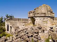 | 35° 9′ 6,6″ S, 150° 45′ 41,5″ O | 1860 | 1889 | zerstört[11] heute denkmalgeschützt |
New South Wales
In New South Wales gibt es verschiedene Leuchttürme, die etwa um dieselbe Zeit von den gleichen Architekten mit ähnlichem Design entworfen wurden und daher ein vergleichbares Design zeigen. Diese sind:
- Wollongong Breakwater Lighthouse und Warden Head Light, gebaut 1872–1873 und durch Edward O. Moriarty initiiert
- Crowdy Head Light, Fingal Head Light, Clarence River Light (das Original ist nun abgebaut), Tacking Point Lighthouse und Richmond River Light, 1878 entworfen von James Barnet
- Point-Perpendicular-Leuchtturm (1899), Cape Byron Light (1901) und Norah Head Light (1903), entworfen von Charles Assinder Harding
- Bradleys Head Light (1905) und Robertson Point Light (1910)
- The "Disney Castles", Grotto Point Light, Parriwi Head Light, Vaucluse Bay Range Front Light und Vaucluse Bay Range Rear Light, gebaut 1910–1911 von Maurice Festu
- The "Wedding Cakes", Eastern Channel Pile Light und Western Channel Pile Light 1924 gebaut
| Ort | Name | Bild | Koordinaten | Errichtet | Automatisiert | Deaktiviert | Bemerkungen |
|---|---|---|---|---|---|---|---|
| Balgowlah Heights | Grotto Point Light | 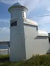 | 33° 49′ 3,7″ S, 151° 15′ 41,4″ O | 1911 | aktiv | ||
| Ballina | Richmond River Light |  | 28° 52′ 1,2″ S, 153° 35′ 30,5″ O | 1866 | 1920 | aktiv | |
| Bradleys Head | Bradleys Head Light | 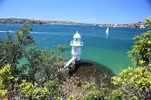 | 33° 51′ 13″ S, 151° 14′ 48,1″ O | 1905 | aktiv | ||
| Burrewarra Point | Burrewarra Point Light |  | 35° 50′ 2″ S, 150° 14′ 1″ O | 1974 | 1974 | aktiv | Solarbetrieb[12] |
| Cape Byron | Cape Byron Light | 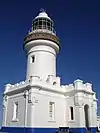 | 28° 38′ 18,7″ S, 153° 38′ 11″ O | 1901 | aktiv | ||
| Cremorne Point | Robertson Point Light | 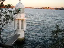 | 33° 50′ 55,3″ S, 151° 13′ 58,8″ O | 1910 | aktiv | ||
| Crowdy Head | Crowdy Head Light | 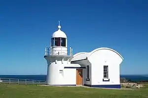 | 31° 50′ 36,4″ S, 152° 45′ 13″ O | 1878 | 1928 | aktiv | |
| Culburra Beach | Crookhaven Heads Light | 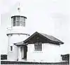 | 34° 53′ 56,9″ S, 150° 46′ 12,9″ O | 1882 | aktiv | Solarbetrieb[13] | |
| Fingal Head | Fingal Head Light | 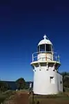 | 28° 12′ 0″ S, 153° 34′ 14,9″ O | 1872 | 1920 | aktiv | |
| Fort Denison | Fort Denison Light | 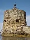 | 33° 51′ 16,6″ S, 151° 13′ 33,6″ O | 1913 | aktiv | ||
| Green Cape | Green Cape Lighthouse | 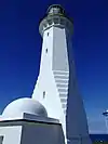 | 37° 15′ 41″ S, 150° 2′ 57,5″ O | 1883 | 1983 | 1997 | mit Solarbetrieb wieder aufgestellt[14] |
| Kiama | Kiama Light | 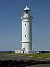 | 34° 40′ 18,5″ S, 150° 51′ 45,4″ O | 1887 | 1920 | aktiv | |
| Kurnell | Cape Bailey Light | 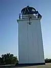 | 34° 2′ 6,7″ S, 151° 13′ 19,9″ O | 1950 | aktiv | ||
| Montague Island | Montague Island Light | 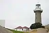 | 36° 15′ 7,2″ S, 150° 13′ 35″ O | 1881 | 1986 | aktiv | Solarbetrieb[15] |
| Nelson Bay | Nelson Head Light |  | 32° 42′ 37,4″ S, 152° 9′ 41″ O | 1872 | 1984 | 2003 | |
| Newcastle | Nobbys Head Light |  | 32° 55′ 6,6″ S, 151° 47′ 54,2″ O | 1854 | 1935 | aktiv | |
| Norah Head | Norah Head Light | 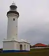 | 33° 16′ 53,8″ S, 151° 34′ 35″ O | 1903 | 1995 | aktiv | |
| Palm Beach | Barrenjoey Lighthouse | 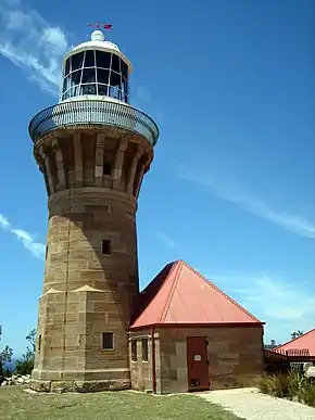 | 33° 34′ 48,4″ S, 151° 19′ 47,3″ O | 1855 | 1932 | aktiv | |
| Mosman | Parriwi Head Light | 33° 48′ 43,6″ S, 151° 14′ 46,7″ O | 1911 | aktiv | |||
| Point Perpendicular | Point-Perpendicular-Leuchtturm | 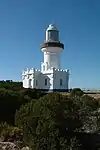 | 35° 5′ 38″ S, 150° 48′ 15,8″ O | 1899 | 1993 | wieder als durch Solarenergie betriebenen Turm aufgebaut[16] | |
| Point Stephens | Point Stephens Light | 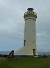 | 32° 44′ 49,2″ S, 152° 12′ 5″ O | 1862 | 1989 | aktiv | Solarbetrieb[17] |
| Shark Island | Shark Island Light | 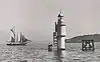 | 33° 51′ 23,4″ S, 151° 15′ 25,9″ O | 1913 | aktiv | ||
| Smoky Cape | Smoky Cape Lighthouse | 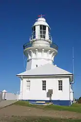 | 30° 55′ 22,8″ S, 153° 5′ 15,7″ O | 1891 | 1988 | aktiv | |
| Solitary Islands | North Solitary Island Light |  | 29° 55′ 28,6″ S, 153° 23′ 22,9″ O | 1975 | aktiv | Fiberglasstruktur, Solarbetrieb[18] | |
| Solitary Islands | South Solitary Island Light |  | 30° 12′ 24,1″ S, 153° 16′ 2,6″ O | 1880 | 1975 | aktiv | Solarbetrieb[19] |
| Seal Rocks | Sugarloaf Point Light | 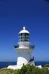 | 32° 26′ 27,2″ S, 152° 32′ 21,1″ O | 1875 | 1987 | aktiv | mit außen angelegter Treppe[20] |
| Sydney | CLS-4 Carpentaria | .jpg.webp) | 33° 52′ 11,9″ S, 151° 12′ 1″ O | 1918 | 1985 | Feuerschiff; befindet sich am Australian National Maritime Museum[21] | |
| Sydney Harbour | Eastern Channel Pile Light | 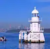 | 33° 50′ 30,5″ S, 151° 16′ 18,5″ O | 1924 | aktiv | ||
| Sydney Harbour | Western Channel Pile Light | 33° 50′ 16,4″ S, 151° 15′ 46,4″ O | 1924 | aktiv | |||
| Port Macquarie | Tacking Point Lighthouse | 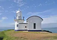 | 31° 28′ 31,4″ S, 152° 56′ 13,9″ O | 1879 | 1919 | aktiv | |
| Ulladulla | Warden Head Light |  | 35° 21′ 55,8″ S, 150° 29′ 27,2″ O | 1873 | 1920 | aktiv | Batteriebetrieb, wieder aufgebaut[22] |
| Vaucluse | Macquarie Lighthouse | .jpg.webp) | 33° 51′ 14″ S, 151° 17′ 6,4″ O | 1793 | 1976 | aktiv | Australiens erster Leuchtturm[4] |
| Vaucluse | Vaucluse Bay Range Front Light | 33° 50′ 58,2″ S, 151° 16′ 26″ O | 1884 | aktiv | |||
| Vaucluse | Vaucluse Bay Range Rear Light | 33° 51′ 29,5″ S, 151° 16′ 22,4″ O | 1884 | aktiv | |||
| Watsons Bay | Hornby Lighthouse | 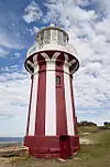 | 33° 50′ 0,6″ S, 151° 16′ 51,2″ O | 1858 | 1933 | aktiv | |
| Wollongong | Wollongong Breakwater Lighthouse |  | 34° 25′ 10,6″ S, 150° 54′ 24,1″ O | c.1870 | 1974 | [23] | |
| Wollongong | Wollongong Head Lighthouse |  | 34° 25′ 18,8″ S, 150° 54′ 34,9″ O | 1936 | 1936 | aktiv | |
| Yamba | Clarence River Light |  | 29° 25′ 56,6″ S, 153° 21′ 50″ O | 1866 | 1920 | aktiv | Batteriebetrieb[24] |
Northern Territory
Die meisten Leuchttürme im Northern Territory wurden vom Commonwealth Lighthouse Service während des "Golden Age of Australian Lighthouses" (deutsch: Goldene Zeit der australischen Leuchttürme), zwischen 1913 und 1920 gebaut. Dies sind das Cape Don Light, East Vernon Light, Emery Point Light, Cape Hotham Light und Cape Fourcroy.[25]
Von diesen fünf Leuchttürmen, können drei als "Geschwister" verstanden warden: Cape Hotham Light, Emery Point Light und Cape Fourcroy Light. Sie sind als weiße quadratisch geformte skelettierte Türme identifizierbar und sie haben die gleiche Lichtcharateristik, die alle 15 Sekunden einen Lichtblitz ausstrahlt. (Fl.(3) 15s).[26]
| Ort | Name | Bild | Koordinaten | Errichtet | Automatisiert | Deaktiviert | Bemerkungen |
|---|---|---|---|---|---|---|---|
| Cobourg Peninsula | Cape Don Light |  | 11° 18′ 28,3″ S, 131° 45′ 54,5″ O | 1917 | 1983 | aktiv | Solarbetrieb[27] |
| Cape Fourcroy | Cape Fourcroy Light | 11° 47′ 50,9″ S, 130° 1′ 27,6″ O | aktiv | ||||
| Clarence Strait | Cape Hotham Light |  | 12° 2′ 47,2″ S, 131° 17′ 22,1″ O | 1928 | aktiv | ||
| East Vernon Island | East Vernon Light | 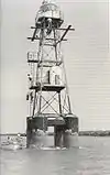 | 12° 4′ 38″ S, 131° 5′ 43,1″ O | 1928 | aktiv | ||
| Larrakeyah Barracks | Emery Point Light | 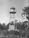 | 12° 27′ 13,8″ S, 130° 48′ 56″ O | 1900 | aktiv | ||
| Cox-Halbinsel | Point Charles Light | 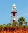 | 12° 23′ 21,4″ S, 130° 37′ 50,4″ O | 1893 | 1933 | aktiv | überstand den Cyclone Tracy;[28] Solarbetrieb[29] |
Queensland
Die meisten Leuchttürme in Queensland wurden in Kleinserien hergestellt:
- Zwei Leuchttürme sind, mit vorfabrizierten Segmenten aus Gusseisen mit Bolzen verbunden, aufgestellt worden: Sandy Cape Light und Bustard Head Light.[30]
- Acht Leuchttürme bestehen aus einem aus Hartholzrahmem, der mit Wellblech verkleidet ist: Little Sea Hill Light, Grassy Hill Light, Goods Island Light, Bay Rock Light, Old Caloundra Light, North Point Hummock Light (abgebaut), Gatcombe Head Light (abgebaut) und Bulwer Island Light.[31]
- Sieben Betontürme wurden zwischen 1964 und 1979 errichtet: Cape Capricorn Light, New Caloundra Light, Point Danger Light, New Burnett Heads Light, Fitzroy Island Light, Point Cartwright Light und Archer Point Light.[31]
| Ort | Name | Bild | Koordinaten | Errichtet | Automatisiert | Deaktiviert | Bemerkungen |
|---|---|---|---|---|---|---|---|
| Cooktown | Archer Point Light |  | 15° 35′ 37″ S, 145° 19′ 42,6″ O | 1883 | 1979 | aktiv | |
| Townsville | Bay Rock Light | 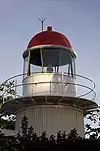 | 19° 7′ 0,5″ S, 146° 45′ 10,4″ O | 1886 | 1930 | c.1992 | [32][33] |
| Booby Island | Booby Island Light | 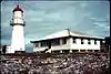 | 10° 36′ 15,1″ S, 141° 54′ 36″ O | 1890 | 1991 | aktiv | Generatorbetrieb[34] |
| Bulwer Island | Bulwer Island Light | 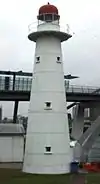 | 27° 28′ 53,4″ S, 153° 1′ 35,8″ O | 1912 | 1983 | nicht am Originalplatz aufgestellt[35] | |
| Burnett Heads | New Burnett Heads Light | 24° 45′ 29,5″ S, 152° 24′ 45,4″ O | 1971 | 1971 | aktiv | ||
| Burnett Heads | Old Burnett Heads Light | 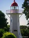 | 24° 45′ 49,3″ S, 152° 24′ 32,8″ O | 1873 | 1932 | 1971 | |
| Bustard Head | Bustard Head Light | 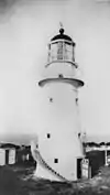 | 24° 1′ 20,3″ S, 151° 45′ 51,8″ O | 1869 | 1985 | aktiv | |
| Caloundra | New Caloundra Light |  | 26° 48′ 5,4″ S, 153° 8′ 14,6″ O | 1968 | 1969 | 1997 | |
| Caloundra | Old Caloundra Light |  | 26° 48′ 5,8″ S, 153° 8′ 14,6″ O | 1896 | 1942 | 1968 | |
| Cape Bowling Green | Cape Bowling Green Light | 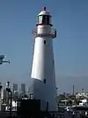 | 19° 19′ 34,3″ S, 147° 25′ 32,2″ O | 1874 | 1920 | aktiv | Original versetzt[36] |
| Cape Capricorn | Cape Capricorn Light | 23° 29′ 10,7″ S, 151° 14′ 10″ O | 1875 | aktiv | |||
| Cape Cleveland | Cape Cleveland Light | 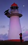 | 19° 10′ 58,4″ S, 147° 0′ 55,4″ O | 1879 | aktiv | ||
| Cape Moreton | Cape Moreton Light |  | 27° 1′ 54,8″ S, 153° 27′ 57,2″ O | 1857 | aktiv | ||
| Cleveland | New Cleveland Point Light |  | 27° 30′ 36,6″ S, 153° 17′ 20,7″ O | 1976 | aktiv | ||
| Cleveland | Old Cleveland Point Light |  | 27° 30′ 36,7″ S, 153° 17′ 20,4″ O | 1847 | 1976 | 1969 wurde mit Laserlicht experimentiert[37] | |
| Cooktown | Grassy Hill Light |  | 15° 27′ 38,2″ S, 145° 15′ 19,1″ O | 1886 | 1927 | aktiv | |
| Comboyuro Point | Comboyuro Point Light | 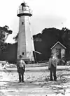 | 27° 3′ 41,9″ S, 153° 21′ 45,5″ O | 1874 | 1954 | 1960 | zusammengebrochen[38] |
| Cowan Cowan Point | Cowan Cowan Point Light | 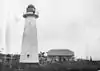 | 27° 8′ 11,6″ S, 153° 21′ 46,2″ O | 1873 | 1950[39] | Abgebaut[40] | |
| Creal Reef | Creal Reef Light |  | 20° 32′ 2,3″ S, 150° 22′ 49,8″ O | 1985[41] | aktiv | ||
| Curtis Island | Sea Hill Light | .jpg.webp) | 23° 29′ 27,4″ S, 150° 58′ 49,5″ O | 1876 | 2006 | erster Leuchtturm, der sich nun im Gladstone Maritime Museum befindet.[42] | |
| Dent Island | Dent Island Light |  | 20° 22′ 9,1″ S, 148° 55′ 44″ O | 1879 | 1987 | aktiv | |
| Double Island Point | Double Island Point Light |  | 25° 56′ 10,3″ S, 153° 11′ 26,5″ O | 1884 | 1992 | aktiv | |
| Eborac Island | Eborac Island Lighthouse |  | 10° 40′ 55,6″ S, 142° 32′ 1,1″ O | aktiv | |||
| Fitzroy Island | Fitzroy Island Light | 16° 55′ 34″ S, 146° 0′ 7,2″ O | 1943 | 1992 | |||
| Flat Top Island | Flat Top Island Light |  | 21° 9′ 41,4″ S, 149° 14′ 47″ O | 1879 | 1920 | 2007 | |
| Sandy Cape | Sandy Cape Light |  | 24° 43′ 47,6″ S, 153° 12′ 31″ O | 1870 | 1991 | aktiv | |
| Goods Island | Goods Island Light |  | 10° 33′ 55,4″ S, 142° 8′ 57,8″ O | 1886 | aktiv | ||
| Lady-Elliot-Insel | Lady Elliot Island Light | 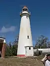 | 24° 6′ 52,6″ S, 152° 42′ 41,8″ O | 1873 | aktiv | ||
| Low Island | Low Isles Light |  | 16° 23′ 2,4″ S, 145° 33′ 35,3″ O | 1878 | 1993 | aktiv | |
| Moreton Bay | Moreton Bay Pile Light | 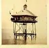 | 27° 18′ 39,2″ S, 153° 12′ 37,4″ O | 1884[43] | 1952[44] | 1966–1967[45] | Struktur wurde 1949 zerstört[45] |
| North Reef | North Reef Light |  | 23° 11′ 7,8″ S, 151° 54′ 13,3″ O | 1878 | 1978 | aktiv | |
| Pine Islet | Pine Islet Light | 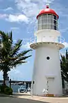 | 21° 39′ 27″ S, 150° 12′ 59,8″ O | 1885 | 1985 | wieder aufgestellt, es handelt sich um den letzten mit Kerosin betriebenen Leuchtturm der Welt[46] | |
| Mooloolaba | Point Cartwright Light | 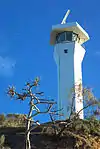 | 26° 40′ 46,9″ S, 153° 8′ 18,2″ O | 1978 | 1978 | aktiv | |
| Point Lookout | Point Lookout Light |  | 27° 25′ 53,8″ S, 153° 32′ 25,4″ O | 1932 | aktiv | ||
| Point Danger | Point Danger Light |  | 28° 9′ 54″ S, 153° 33′ 2,5″ O | 1971 | 1971 | aktiv | Experimente mit Laserlicht in 1971[47] |
| Townsville | Wharton Reef Light | 19° 15′ 35,6″ S, 146° 49′ 18,1″ O | 1915 | 1915 | 1990 | nicht am Ursprungsort[48] | |
| Wyborn Reef | Wyborn Reef Light |  | 10° 49′ 9,1″ S, 142° 46′ 29,7″ O | 1938[49] | aktiv | ||
South Australia
| Ort | Name | Bild | Koordinaten | Errichtet | Automatisiert | Deaktiviert | Bemerkungen |
|---|---|---|---|---|---|---|---|
| Althorpe Island | Althorpe Island Lighthouse | 35° 22′ 17,4″ S, 136° 51′ 37,1″ O | 1879 | 1991 | aktiv | Dieselbetrieb[50] | |
| Beachport | Cape Martin Lighthouse |  | 37° 29′ 22,2″ S, 140° 0′ 45″ O | 1960 | aktiv | ||
| Cape Banks | Cape Banks Lighthouse | 37° 53′ 52,8″ S, 140° 22′ 34,7″ O | 1883 | 1928 | aktiv | ||
| Cape Borda | Cape Borda Lighthouse |  | 35° 45′ 10,1″ S, 136° 35′ 37,3″ O | 1858 | 1989 | aktiv | |
| Cape Donnington | Cape Donnington Lighthouse | 34° 43′ 35,4″ S, 135° 59′ 38″ O | 1878 | aktiv | |||
| Cape du Couedic | Cape du Couedic Lighthouse |  | 36° 3′ 28,4″ S, 136° 42′ 17,6″ O | 1909 | 1957 | aktiv | |
| Cape Jaffa | Cape Jaffa Lighthouse |  | 36° 50′ 9,2″ S, 139° 50′ 46,3″ O | 1872 | 1973 | verschraubt; befindet sich nicht am Originalplatz[51] | |
| Cape Jervis | Cape Jervis Lighthouse | 35° 36′ 13,3″ S, 138° 5′ 40,2″ O | 1871 | 1972 | aktiv | ||
| Cape Spencer | Cape Spencer Lighthouse |  | 35° 17′ 55,7″ S, 136° 52′ 57,7″ O | 1950 | 1975 | aktiv | |
| Cape St Albans | Cape St Albans Lighthouse | 35° 48′ 13″ S, 138° 7′ 29,3″ O | 1908 | 1908 | aktiv | ||
| Cape Willoughby | Cape Willoughby Lighthouse |  | 35° 50′ 34,1″ S, 138° 7′ 57,7″ O | 1852 | 1974 | 2003 | erster Leuchtturm in South Australia[52] |
| Corny Point | Corny Point Lighthouse |  | 34° 53′ 47,4″ S, 137° 0′ 37,4″ O | 1882 | 1920 | aktiv | |
| Marino | Marino Rocks Navigational Aid | 1962 | 1962 | aktiv | |||
| Penguin Island | Penguin Island Lighthouse | 37° 29′ 52,4″ S, 140° 0′ 49″ O | 1878 | 1918 | 1960 | aufgegeben[53] | |
| Point Lowly | Point Lowly Lighthouse | 32° 59′ 58,6″ S, 137° 47′ 7,1″ O | 1883 | 1973 | 1993 | ||
| Point Malcolm | Point Malcolm Lighthouse | 35° 30′ 32″ S, 139° 11′ 27,2″ O | 1878 | 1931 | Australiens einziger Leuchtturm, der sich im Inland befindet; reaktiviert[3][54] | ||
| Port Adelaide | Port Adelaide Lighthouse |  | 34° 50′ 32,6″ S, 138° 30′ 15,1″ O | 1869 | 1901 | nicht am Ursprungsort, an Samstagen in Betrieb[54][55] | |
| Port Macdonnell | Cape Northumberland Lighthouse | _Lighthouses_-_SOUTH_AUSTRALIA%252C_CAPE_NORTHUMBERLAND.jpg.webp) | 38° 3′ 22,7″ S, 140° 40′ 2,6″ O | c. 1860 | 1990 | aktiv | |
| Port Macdonnell | Old Macdonnell Lighthouse | 38° 3′ 22,7″ S, 140° 40′ 2,6″ O | 1859 | 1881 | zerstört[56] | ||
| Robe | Robe Lighthouse |  | 37° 9′ 51,5″ S, 137° 0′ 37,4″ O | 1972 | 1972 | aktiv | |
| South Neptune Island | South Neptune Island Lighthouse | 35° 20′ 15″ S, 136° 7′ 3,7″ O | 1901 | c.1990 | aktiv | Neuer Turm[57] | |
| Tipara Reef | Tipara Reef Screw Pile | 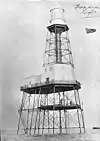 | 33° 55′ 46,9″ S, 137° 37′ 34,7″ O | 1877 | 1995 | nicht am Ursprungsort[58] | |
| Troubridge Hill | Troubridge Hill Lighthouse | 35° 9′ 58,7″ S, 137° 38′ 26,9″ O | 1980 | 1980 | aktiv | ||
| Troubridge Island | Troubridge Island Lighthouse |  | 35° 7′ 1,2″ S, 137° 49′ 39,4″ O | 1856 | 1981 | 2001 | vom Verfall bedroht[59] |
| West Cape | West Cape Lighthouse | 35° 14′ 39,1″ S, 136° 49′ 26,8″ O | 1980 | 1980 | aktiv | gebaut aus Edelstahl[60] | |
| Wonga Shoal | Wonga Shoal Lighthouse |  | 34° 49′ 23,9″ S, 138° 26′ 15,4″ O | 1901 | 1912 | zerstört[61] |
Tasmanien
| Ort | Name | Bild | Koordinaten | Errichtet | Automatisiert | Deaktiviert | Bemerkungen |
|---|---|---|---|---|---|---|---|
| Bluff Hill | 41° 0′ 32,4″ S, 144° 36′ 36,4″ O | 1982 | 1982 | aktiv | |||
| Cape Bruny | Cape Bruny Lighthouse | 43° 29′ 27,6″ S, 147° 8′ 32,6″ O | 1838 | 1996 | |||
| Cape Forrestier | Cape Forrestier Lighthouse | 42° 7′ 0,1″ S, 148° 21′ 32″ O | 1971 | demontiert[8] | |||
| Cape Sorell | Cape Sorell Lighthouse | 42° 11′ 52,1″ S, 145° 10′ 9,5″ O | 1899 | aktiv | |||
| Cape Tourville | Cape Tourville Lighthouse | 42° 7′ 21,4″ S, 148° 20′ 33,7″ O | 1971 | 1971 | aktiv | ||
| Cape Wickham | 39° 35′ 18,6″ S, 143° 56′ 34,4″ O | 1861 | 1918 | aktiv | |||
| Currie Harbour | Currie Lighthouse | 39° 55′ 45,5″ S, 143° 50′ 31,9″ O | 1880 | aktiv | deaktiviert von 1989 - 1995[62] | ||
| Deal Island | Deal Island Lighthouse |  | 39° 29′ 39,5″ S, 147° 19′ 21″ O | 1848 | 1921 | 1992 | Australiens höchster Leuchtturm[63] |
| Eddystone Point | 40° 59′ 35,2″ S, 148° 20′ 52,1″ O | 1889 | aktiv | ||||
| Goose Island | Goose Island Lighthouse | 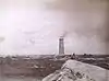 | 40° 18′ 41,8″ S, 147° 48′ 4,7″ O | 1846 | 1931 | aktiv | |
| Hells Gates | Bonnet Island Lighthouse | 42° 13′ 23,5″ S, 145° 13′ 18,8″ O | 1892 | 1910 | aktiv | ||
| Hells Gate | Entrance Island Lighthouse |  | 42° 12′ 38,9″ S, 145° 12′ 55,4″ O | 1892 | 1910 | aktiv | |
| Highland Bluff (neu) | 40° 44′ 19″ S, 145° 17′ 24,4″ O | aktiv | |||||
| Highland Bluff (alt) | 40° 45′ 58,7″ S, 145° 17′ 54,6″ O | 1924 | |||||
| Iron Pot | Iron Pot Lighthouse |  | 43° 3′ 31,3″ S, 147° 25′ 1,9″ O | 1832 | aktiv | Tasmaniens erster Leuchtturm[64] | |
| Low Head | Low Head Lighthouse | 41° 3′ 19,1″ S, 146° 47′ 20″ O | 1833 | 1995 | aktiv | Tasmanien zweiter Leuchtturm[65] | |
| Low Head | Middle Channel Lighthouse | 41° 4′ 46,9″ S, 146° 48′ 26,6″ O | 1882 | 1955 | aktiv | ||
| Low Head | She Oak Point Lighthouse | 41° 4′ 39,7″ S, 146° 48′ 14,4″ O | 1882 | 1955 | aktiv | ||
| Maatsuyker Island | Maatsuyker Island Lighthouse |  | 43° 39′ 25,2″ S, 146° 16′ 17″ O | 1891 | 1996 | Letzter bemannter Leuchtturm und Australiens südlichster[66][67] | |
| Mersey Bluff | 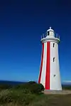 | 41° 9′ 31,3″ S, 146° 21′ 19,4″ O | 1889 | 1920 | aktiv | ||
| Point Home Lookout | Point Home Lookout Lighthouse | 42° 33′ 4,3″ S, 147° 57′ 13,3″ O | 1971 | 1971 | aktiv | ||
| Rocky Cape | 40° 51′ 16,2″ S, 145° 30′ 29,9″ O | 1968 | 1968 | aktiv | |||
| Round Hill Point | 41° 3′ 54″ S, 145° 57′ 42,5″ O | 1923 | 1980 | aktiv | |||
| Sandy Cape | 41° 25′ 18,1″ S, 144° 44′ 54,2″ O | 1953 | aktiv | ||||
| Swan Island | 40° 43′ 39,7″ S, 148° 7′ 32,2″ O | 1845 | 1985 | aktiv | |||
| Table Cape | Table Cape Lighthouse | 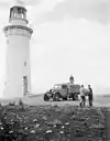 | 40° 56′ 47,4″ S, 145° 43′ 44,4″ O | 1888 | 1920 | aktiv | |
| Tasman Island | Tasman Island Lighthouse | 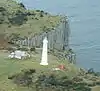 | 43° 14′ 22,2″ S, 148° 0′ 18,4″ O | 1906 | 1976 | aktiv | |
| West Point | 40° 56′ 34,1″ S, 144° 36′ 50″ O | 1916 | 1982 | Zerstört[68] |
Victoria
| Ort | Name | Bild | Koordinaten | Errichtet | Automatisiert | Deaktiviert | Bemerkungen |
|---|---|---|---|---|---|---|---|
| Aireys Inlet | Split Point Lighthouse | 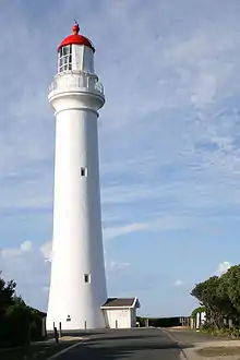 | 38° 28′ 4,8″ S, 144° 6′ 15,8″ O | 1891 | 1919 | aktiv | |
| Cape Liptrap | Cape Liptrap Lighthouse | 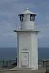 | 38° 54′ 7,6″ S, 145° 55′ 0,1″ O | 1913 | 1913 | aktiv | |
| Cape Nelson | Cape Nelson Lighthouse | 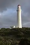 | 38° 25′ 51,6″ S, 141° 32′ 32,3″ O | 1884 | 1995 | aktiv | |
| Cape Otway | Cape Otway Lighthouse | 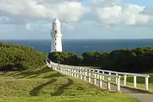 | 38° 51′ 24,5″ S, 143° 30′ 42,5″ O | 1848 | 1994 | Wieder aufgestellt mit einem Solarbetriebr[69] | |
| Cape Schanck | Cape Schanck Lighthouse |  | 38° 29′ 33,7″ S, 144° 53′ 10,3″ O | 1859 | aktiv | ||
| Citadel Island | Citadel Island Lighthouse | 39° 6′ 51,5″ S, 146° 14′ 12,1″ O | 1913 | 1982 | Solarbetrieb | ||
| Cliffy Island | Cliffy Island Lighthouse |  | 38° 57′ 2,2″ S, 146° 42′ 20,2″ O | 1884 | 1971 | aktiv | Solarbetrieb[70] |
| Gabo Island | Gabo Island Lighthouse | 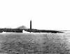 | 37° 34′ 7,3″ S, 149° 55′ 0,8″ O | 1853 | 1993 | aktiv | Solarbetrieb[71] |
| Gellibrand Shoal | Gellibrand Pile Light | 37° 52′ 42,6″ S, 144° 54′ 52,9″ O | 1906 | 1976 | Zerstört[72] | ||
| Griffiths Island | Griffiths Island Lighthouse | 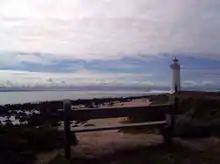 | 38° 23′ 27,2″ S, 142° 15′ 18,7″ O | 1853 | aktiv | mit Windenergie betrieben[73] | |
| Lady Bay Lower | Lady Bay Lower Lighthouse | 38° 23′ 26,5″ S, 142° 29′ 7,4″ O | 1854 | aktiv | |||
| Lady Bay Upper | Lady Bay Upper Lighthouse | 38° 23′ 25,1″ S, 142° 29′ 7,4″ O | 1859 | aktiv | nicht am Ursprungsort[74] | ||
| McCrae | Eastern Lighthouse | 38° 20′ 53,9″ S, 144° 55′ 40,4″ O | 1854 | 1994 | |||
| Point Hicks | Point Hicks Lighthouse |  | 37° 48′ 6,5″ S, 149° 16′ 31,1″ O | 1890 | aktiv | ||
| Point Lonsdale | Point Lonsdale Lighthouse | 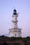 | 38° 17′ 30,8″ S, 144° 36′ 50″ O | 1863 | aktiv | ||
| Portland | Whaler's Bluff Lighthouse | 38° 20′ 14,3″ S, 141° 36′ 32,8″ O | 1889 | aktiv | |||
| Portland | Portland Bay Lighthouse | 38° 21′ 15,1″ S, 141° 37′ 11,3″ O | 1859 | 1889 | |||
| Port Melbourne | Port Melbourne Front Light | 37° 50′ 30,1″ S, 144° 55′ 45,5″ O | 1924 | ||||
| Port Melbourne | Port Melbourne Rear Light | 37° 50′ 13,6″ S, 144° 55′ 45,8″ O | 1924 | aktiv | |||
| Port Phillip | South Channel Pile Light |  | 38° 20′ 19″ S, 144° 49′ 7″ O | 1874 | 1985 | wieder aufgestellt und reaktiviert[75] | |
| Port Phillip | West Channel Pile Light | 38° 11′ 33,7″ S, 144° 45′ 22,7″ O | 1881 | aktiv | |||
| Queenscliff | Queenscliff High Light | 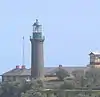 | 38° 16′ 17,4″ S, 144° 39′ 42,5″ O | 1843 | aktiv | Gebaut aus Bluestone[76] | |
| Queenscliff | Queenscliff Low Light | 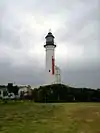 | 38° 16′ 25,3″ S, 144° 39′ 33,5″ O | 1854 | aktiv | nicht am Ursprungsort[77] | |
| Williamstown | Williamstown Lighthouse | 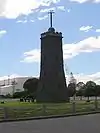 | 37° 52′ 0,5″ S, 144° 54′ 45,4″ O | 1840 | 1934 | 1987 | Befeuerung deaktiviert; Signalisierung aktiv[78] |
| Wilsons Promontory | Wilsons Promontory Lighthouse | 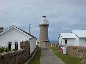 | 39° 7′ 47,6″ S, 146° 25′ 27,1″ O | 1859 | 1975 | aktiv | liegt am weitestens südlich des Hauptlandes[79] |
Western Australia
| Ort | Name | Bild | Koordinaten | Errichtet | Automatisiert | deaktiviert | Bemerkungen |
|---|---|---|---|---|---|---|---|
| Adele Island | 15° 30′ 36,4″ S, 123° 9′ 26,6″ O | 1951 | aktiv | ||||
| Arthur Head | Arthur Head Lighthouse | 32° 3′ 23,8″ S, 115° 44′ 24″ O | 1851 | 1902 | Abgebaut[80] | ||
| Bessieres Island Lighthouse | 21° 38′ 10,3″ S, 115° 6′ 42,5″ O | 1913 | aktiv | ||||
| Breaksea Island | Breaksea Island Lighthouse | 35° 3′ 51,1″ S, 118° 3′ 26,3″ O | 1858 | aktiv | |||
| Bunbury | Casuarina Point Lighthouse | 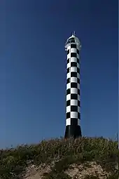 | 33° 19′ 8,8″ S, 115° 37′ 58,8″ O | 1870 | aktiv | ||
| Caffarelli Island | Caffarelli Island Lighthouse | 16° 2′ 46″ S, 123° 17′ 8,9″ O | 1967 | aktiv | |||
| Cape Bossut | Cape Bossut Lighthouse |  | 18° 42′ 49,3″ S, 121° 37′ 21,7″ O | 1913 | c.1980 | abgebaut | |
| Cape Leeuwin | Cape Leeuwin Lighthouse |  | 34° 22′ 30″ S, 115° 8′ 10,3″ O | 1896 | 1992 | aktiv | |
| Cape Leveque | Cape Leveque Lighthouse |  | 16° 23′ 41,6″ S, 122° 55′ 41,5″ O | 1911 | aktiv | ||
| Cape Naturaliste | Cape Naturaliste Lighthouse |  | 34° 22′ 30″ S, 115° 8′ 10,3″ O | 1873 | 1978 | aktiv | 1907 von einem Kugelblitz getroffen[81] |
| Carnarvon | Babbage Island Lighthouse | 24° 52′ 33,6″ S, 113° 37′ 51,2″ O | 1965 | aktiv | |||
| Cave Point | Cave Point Lighthouse | 35° 7′ 12,7″ S, 117° 53′ 56,4″ O | 1976 | 1994 | [82] | ||
| Dirk Hartog Island | Cape Inscription Lighthouse | 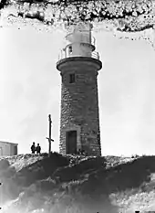 | 25° 28′ 54,5″ S, 112° 58′ 19,2″ O | 1910 | 1917 | aktiv | |
| East Island | East Island Lighthouse | 16° 54′ 8,6″ S, 122° 11′ 52,4″ O | 1968 | aktiv | |||
| Eclipse Island | Eclipse Island Lighthouse | 35° 10′ 55,6″ S, 117° 53′ 4,9″ O | 1926 | 1976 | aktiv | wiederaufgestellt mit Befeuerung[83] | |
| Escape Island | Escape Island Lighthouse | 30° 20′ 0,2″ S, 114° 59′ 11″ O | 1930 | aktiv | |||
| Fremantle | North Mole Lighthouse | 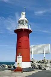 | 32° 3′ 13,7″ S, 115° 43′ 28,2″ O | 1906 | aktiv | ||
| Fremantle | South Mole Lighthouse |  | 32° 3′ 20,9″ S, 115° 43′ 57″ O | 1903 | aktiv | ||
| Gantheaume Point | Gantheaume Point Lighthouse | 17° 58′ 26,8″ S, 122° 10′ 39″ O | 1905 | 1922 | aktiv | ||
| Guilderton | Guilderton Lighthouse | 31° 20′ 21,8″ S, 115° 29′ 31,6″ O | 1983 | 1983 | aktiv | ||
| Hillarys |  | 31° 49′ 24,6″ S, 115° 44′ 1″ O | 1986 | aktiv | |||
| Jarman Island | Jarman Island Lighthouse | 20° 39′ 30,6″ S, 117° 13′ 2,6″ O | 1888 | 1917 | 1985 | [84] | |
| Legendre Island | Legendre Island Lighthouse | 20° 21′ 30,2″ S, 116° 50′ 33,7″ O | 1927 | 1989 | aktiv | ||
| Geraldton | Moore Point Lighthouse | 28° 46′ 57,7″ S, 114° 34′ 45,5″ O | 1878 | 1985 | aktiv | ||
| Mosman Park | Buckland Hill Lighthouse | 32° 1′ 1,5″ S, 115° 45′ 39,5″ O | c.1970 | aktiv | |||
| North West Cape | North West Cape Light | 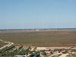 | 21° 48′ 56,2″ S, 114° 9′ 12,2″ O | 1967 | aktiv | ein Rundfunkturm[85] | |
| Pelsart Island | Pelsart Island Lighthouse | 28° 59′ 7,4″ S, 113° 57′ 44,3″ O | 1974 | aktiv | |||
| Point Cloates | Point Cloates Lighthouse | 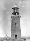 | 22° 42′ 32,4″ S, 113° 40′ 50,9″ O | 1910 | 1933 | 1936 | Ruine, denkmalgeschützt[86] |
| Point King | Point King Lighthouse |  | 35° 2′ 7,4″ S, 117° 55′ 8″ O | 1858 | 1911 | Ruine, denkmalgeschützt[87] | |
| Quobba Point | Quobba Point Light | 24° 28′ 46,9″ S, 113° 25′ 5,2″ O | 1950 | aktiv | |||
| Rottnest Island | Bathurst Lighthouse | 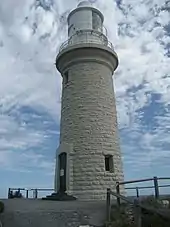 | 31° 59′ 21,5″ S, 115° 32′ 26,2″ O | 1900 | 1986 | aktiv | |
| Rottnest Island | Wadjemup Lighthouse |  | 32° 0′ 25,9″ S, 115° 30′ 14,8″ O | 1851 | 1986 | aktiv | Australiens erster Leuchtturm mit routierender Befeuerung[88] |
| Woodman Point | Woodman Light | 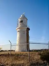 | 32° 7′ 51,2″ S, 115° 46′ 10,9″ O | 1902 | 1955 | aktiv |
Registrierung
Die Leuchttürme und Leuchtschiffe Australiens sind in der National Geospatial-Intelligence Agency (List of Lights publication 111)[89] und auch beim United Kingdom Hydrographic Office Admiralty List of Lights & Fog Signals (Volume K) registriert.[90] Die ARLHS World List of Lights versieht diese Leuchttürme mit der Kennzeichnung "AUS".[91]
Daneben gibt es weitere Registrierungen: Im The Lighthouse Directory sind die Leuchttürme entsprechend nach Gebieten registriert:
- Coral Sea Islands Territory[92]
- New South Wales, einschließlich Cape St George Lighthouse, das sich im Jervis Bay Territory befindet.[5]
- Northern Territory[6]
- Ostküste von Queensland, ab Townsville in südlicher Richtung[42]
- Entlegenes Queensland[93]
- South Australia[7]
- Tasmanien[8]
- Victoria[10]
- Western Australia[94]
Eine weitere Liste führt die Lighthouses of Australia Inc., die die Leuchttürme nach den australischen Bundesstaaten aufführt:[95]
- Western Australia[96]
- Northern Territory[97]
- South Australia[98]
- Queensland[99]
- New South Wales[100]
- Victoria[101]
- Tasmanien[102]
Darüber hinaus existiert eine Internetseite Australian Lighthouses, die die Leuchttürme nach Bundesstaat auflistet.[103]
Eine weitere Liste der Leuchttürme findet sich bei SeaSide Lights, die die Leuchttürme nach den australischen Bundesstaaten gliedert:[104]
- Western Australia[105]
- Northern Territory[106]
- South Australia[107]
- Queensland[108]
- New South Wales[109]
- Victoria[110]
- Tasmanien[111]
Ein aktiver australischer Leuchtturm muss in einem der Verzeichnisse The Lighthouse Directory, Lighthouses of Australia Inc. oder auf SeaSide Lights eingetragen sein. Andere Listen nehmen auch Stationen auf, die schwerlich als Leuchttürme bezeichnet werden können,[112] denn historische Leuchttürme werden manchmal registriert, wenn sie auch in anderen verfügbaren Listen genannt werden.
Weblinks
- Lighthouses Australia Inc. Eine Non-Profitorganisation, die weitergestellte Ziele in der Darstellung von australischen Leuchttürmen verfolgt
- West Australian Lighthouse Website
Einzelnachweise
- Australia. CIA World Factbook. Abgerufen am 26. August 2010.
- Australian lighthouses - Australia's Culture Portal. In: cultureandrecreation.gov.au. Archiviert vom Original am 20. September 2010. Info: Der Archivlink wurde automatisch eingesetzt und noch nicht geprüft. Bitte prüfe Original- und Archivlink gemäß Anleitung und entferne dann diesen Hinweis. Abgerufen am 26. August 2010.
- The Point Malcolm Lighthouse (en) In: South Australia Lighthouses. Lighthouses of Australia Inc. Abgerufen am 19. August 2010.
- Macquarie Lighthouse, Australiens erster Leuchtturm (en) In: New South Wales Lighthouses. Lighthouses of Australia Inc. Abgerufen am 6. Oktober 2011.
- Russ Rowlett: Lighthouses of Australia: New South Wales (Englisch) In: The Lighthouse Directory. University of North Carolina at Chapel Hill. Abgerufen am 6. Oktober 2011.
- Russ Rowlett: Lighthouses of Australia: Northern Territory (Englisch) In: The Lighthouse Directory. University of North Carolina at Chapel Hill. Abgerufen am 6. Oktober 2011.
- Russ Rowlett: Lighthouses of Australia: South Australia (Englisch) In: The Lighthouse Directory. University of North Carolina at Chapel Hill. Abgerufen am 6. Oktober 2011.
- Russ Rowlett: Lighthouses of Australia: Tasmania (Englisch) In: The Lighthouse Directory. University of North Carolina at Chapel Hill. Abgerufen am 6. Oktober 2011.
- Role of VRCA. In: regionalchannels.vic.gov.au. Abgerufen am 26. August 2010.
- Russ Rowlett: Lighthouses of Australia: Victoria (Englisch) In: The Lighthouse Directory. University of North Carolina at Chapel Hill. Abgerufen am 6. Oktober 2011.
- The Ill-Fated Cape St George Lighthouse (en) In: New South Wales Lighthouses. Lighthouses of Australia Inc. Abgerufen am 6. Oktober 2011. durch Zielübungen australischer Kriegsschiffe zerstört.
- Burrewarra Point Lighthouse bei der Batemans Bay (en) In: New South Wales Lighthouses. Lighthouses of Australia Inc. Abgerufen am 6. Oktober 2011.
- Crookhaven Heads Lighthouse (en) In: New South Wales Lighthouses. Lighthouses of Australia Inc. Abgerufen am 6. Oktober 2011.
- Steve Merson: Light the coast like a street with lamps Archiviert vom Original am 16. Mai 2008. Info: Der Archivlink wurde automatisch eingesetzt und noch nicht geprüft. Bitte prüfe Original- und Archivlink gemäß Anleitung und entferne dann diesen Hinweis. In: Lighthouses of Australia Inc Bulletin. Nr. 4. Abgerufen am 19. August 2010.
- Montague Island Lighthouse (en) In: New South Wales Lighthouses. Lighthouses of Australia Inc. Abgerufen am 6. Oktober 2011.
- Point Perpendicular Lighthouse an der Jervis Bay (en) In: New South Wales Lighthouses. Lighthouses of Australia Inc. Abgerufen am 6. Oktober 2011.
- Point Stephens Lighthouse (en) In: New South Wales Lighthouses. Lighthouses of Australia Inc. Abgerufen am 6. Oktober 2011.
- Ian Clifford: South & North Solitary Islands Trip Report Archiviert vom Original am 9. September 2010. Info: Der Archivlink wurde automatisch eingesetzt und noch nicht geprüft. Bitte prüfe Original- und Archivlink gemäß Anleitung und entferne dann diesen Hinweis. In: Lighthouses of Australia Inc Bulletin. Februar 2000. Abgerufen am 18. August 2010.
- South Solitary Lighthouse (en) In: New South Wales Lighthouses. Lighthouses of Australia Inc. Abgerufen am 6. Oktober 2011.
- Sugarloaf Point Lighthouse (en) In: New South Wales Lighthouses. Lighthouses of Australia Inc. Abgerufen am 6. Oktober 2011.
- Russ Rowlett: Lighthouses of Australia: Queensland’s East Coast (Englisch) In: The Lighthouse Directory. University of North Carolina at Chapel Hill. Abgerufen am 6. Oktober 2011. liegt vor dem Australian Maritime Museum, Sydney
- Warden Head Lighthouse bei Ulladulla (en) In: New South Wales Lighthouses. Lighthouses of Australia Inc. Abgerufen am 6. Oktober 2011.
- Wollongong Breakwater Lighthouse (en) In: New South Wales Lighthouses. Lighthouses of Australia Inc. Abgerufen am 6. Oktober 2011.
- Clarence River Lighthouse bei Yamba (en) In: New South Wales Lighthouses. Lighthouses of Australia Inc. Abgerufen am 6. Oktober 2011.
- Michael B. Komesaroff: The Golden Age of Australian Lighthouses. In: The Victorian Historical Journal. 48, Nr. 2, Mai 1977. reprinted in The Golden Age of Australian Lighthouses Archiviert vom Original am 3. November 2010. Info: Der Archivlink wurde automatisch eingesetzt und noch nicht geprüft. Bitte prüfe Original- und Archivlink gemäß Anleitung und entferne dann diesen Hinweis. In: Lighthouses of Australia Inc Bulletin. Nr. 5, September 2003. Abgerufen am 27. Oktober 2010.
- List of Lights, Pub. 111, The West Coasts of North and South America (Excluding Continental U.S.A. and Hawaii), Australia, Tasmania, New Zealand, and the Islands of the North and South Pacific Oceans (msi.nga.mil PDF; 2,7 MB). S. 187–188. Abgerufen am 18. September 2011.
- Cape Don Lighthouse (en) In: Northern Territory Lighthouses. Lighthouses of Australia Inc. Abgerufen am 26. August 2010.
- Mike Foley: Point Charles Lighthouse and the Military Occupation of the Cox Peninsula (PDF; 1,2 MB) Northern Territory Library Service. 1987. Abgerufen am 6. Oktober 2011.
- Point Charles Lighthouse (en) In: Northern Territory Lighthouses. Lighthouses of Australia Inc. Abgerufen am 26. August 2010.
- Australia Heritage Places Inventory: Sandy Cape Lightstation. In: Queensland Heritage Register. Department of Environment and Science, abgerufen am 2. März 2022 (englisch).
- Caloundra Lighthouses. In: Queensland Heritage Register. Department of Environment and Science, abgerufen am 2. März 2022 (englisch).
- Bay Rock Lighthouse (en) In: Queensland Lighthouses. Lighthouses of Australia Inc. Abgerufen am 6. Oktober 2011., das im Townsville Maritime Museum aufgestellt wurde.
- The Bay Rock Light House - Maritime Museum of Townsville. In: townsvillemaritimemuseum.org.au. Archiviert vom Original am 29. November 2010. Info: Der Archivlink wurde automatisch eingesetzt und noch nicht geprüft. Bitte prüfe Original- und Archivlink gemäß Anleitung und entferne dann diesen Hinweis. Abgerufen am 26. August 2010.
- Booby Island Lighthouse (en) In: Queensland Lighthouses. Lighthouses of Australia Inc. Abgerufen am 6. Oktober 2011. 240V
- LIGHTHOUSES. In: maritimemuseum.com.au. Archiviert vom Original am 18. Februar 2011. Info: Der Archivlink wurde automatisch eingesetzt und noch nicht geprüft. Bitte prüfe Original- und Archivlink gemäß Anleitung und entferne dann diesen Hinweis. Abgerufen am 26. August 2010.
- On the waterfront. In: anmm.gov.au. Archiviert vom Original am 28. Mai 2010. Info: Der Archivlink wurde automatisch eingesetzt und noch nicht geprüft. Bitte prüfe Original- und Archivlink gemäß Anleitung und entferne dann diesen Hinweis. Abgerufen am 26. August 2010.
- lighthouse.net.au möglicherweise der erste Leuchtturm, bei dem mit Lasern experimentiert wurde, allerdings wird das Point Danger Light seit 1971 offiziell als der erste Leuchtturm mit Laserlicht genannt
- Richard Walding: Moreton Island RAN7 Indicator Loop Station and Fort Cowan Cowan. In: indicatorloops.com. Abgerufen am 20. Februar 2011.
- Signal Station (former). In: Queensland Heritage Register. Department of Environment and Science, abgerufen am 2. März 2022 (englisch).
- Gelistet im Australia Heritage Places Inventory: Booby Island Lightstation. In: Queensland Heritage Register. Department of Environment and Science, abgerufen am 2. März 2022 (englisch).
- Creal Reef Light, QLD, AN424-01 (Seite nicht mehr abrufbar, Suche in Webarchiven) Info: Der Link wurde automatisch als defekt markiert. Bitte prüfe den Link gemäß Anleitung und entferne dann diesen Hinweis.
- Russ Rowlett: Lighthouses of Australia: Queensland’s East Coast (Englisch) In: The Lighthouse Directory. University of North Carolina at Chapel Hill. Abgerufen am 6. Oktober 2011.
- Annual Report on Harbours and Lighthouses. In: The Queenslander, 22. November 1884. Abgerufen am 6. Oktober 2011.
- Notice to Mariners No. 12 of 1952. In: The Courier-Mail, 10. Dezember 1952. Abgerufen am 6. Oktober 2011.
- The Moreton Bay Pile Light (en) In: Queensland Lighthouses. Lighthouses of Australia Inc. Abgerufen am 6. Oktober 2011.
- Pine Islet Lighthouse (en) In: Queensland Lighthouses. Lighthouses of Australia Inc. Abgerufen am 6. Oktober 2011. befindet sich in Mackay, wo es nicht als Leuchtturm verwendet wird.
- lighthouse.net.au
- Wharton Reef Lighthouse (en) In: Queensland Lighthouses. Lighthouses of Australia Inc. Abgerufen am 6. Oktober 2011.
- Wyborn Reef Light, QLD, AN299-01 (PDF) In: Aids to Navigation Schedule Issue 14. Australian Maritime Safety Authority. 14. Mai 2006. Archiviert vom Original am 28. September 2011. Abgerufen am 6. Oktober 2011.
- The Althorpe Island Lighthouse (en) In: South Australia Lighthouses. Lighthouses of Australia Inc. Abgerufen am 19. August 2010.
- The Cape Jaffa Lighthouse (en) In: South Australia Lighthouses. Lighthouses of Australia Inc. Abgerufen am 19. August 2010. mit Kerosin betrieben, allerdings nicht in Funktion
- Searle, Garry: Cape Willoughby SeaSide Lights. Abgerufen am 22. September 2011 (englisch)
- The old Penguin Island Lighthouse (en) In: South Australia Lighthouses. Lighthouses of Australia Inc. Abgerufen am 19. August 2010.
- unc.edu
- Searle, Garry: Port Adelaide SeaSide Lights. Abgerufen am 22. September 2011 (englisch) Dieser Leuchtturm stand ursprünglich an der Mündung des Port River in Port Adelaide. Er wurde 1901 nach South Neptune Island verbracht, anschließend erneut zurückgebracht, wo er bis 1985 stand. Der alte Turm wurde im South Australian Maritime Museum aufgestellt.
- The Cape Northumberland Lighthouse (en) In: South Australia Lighthouses. Lighthouses of Australia Inc. Abgerufen am 30. August 2010.
- The South Neptune Island Lighthouse (en) In: South Australia Lighthouses. Lighthouses of Australia Inc. Abgerufen am 19. August 2010. Der ursprüngliche Turm wurde nach Adelaide gebracht (vergleiche Hinweis zum Port Adelaide Lighthouse)
- Shipwrecks and sea rescue: Lighthouses. In: samemory.sa.gov.au. Abgerufen am 26. August 2010.
- Troubridge Island Lighthouse (en) In: South Australia Lighthouses. Lighthouses of Australia Inc. Abgerufen am 19. August 2010.
- Searle, Garry: West Cape. SeaSide Lights. Abgerufen am 22. September 2011. (englisch)
- Searle, Garry: Wonga Shoal. SeaSide Lights. Abgerufen am 22. September 2011. (englisch) wurde durch ein Segelschiff zerstört, wobei zwei Leuchtturmwärter ertranken.
- Currie Harbour Lighthouse (en) In: Tasmania Lighthouses. Lighthouses of Australia Inc. Abgerufen am 6. Oktober 2011.
- Deal Island Lighthouse in der Bass Strait (en) In: Tasmania Lighthouses. Lighthouses of Australia Inc. Abgerufen am 6. Oktober 2011. befindet sich auf einer Höhe von 305 Metern, 1992 deaktiviert.
- The Iron Pot Lighthouse (en) In: Tasmania Lighthouses. Lighthouses of Australia Inc. Abgerufen am 19. August 2010.
- Low Head Lighthouse (en) In: Tasmania Lighthouses. Lighthouses of Australia Inc. Abgerufen am 16. Januar 2011.
- The Maatsuyker Island Lighthouse (en) In: Tasmania Lighthouses. Lighthouses of Australia Inc. Abgerufen am 19. August 2010.
- Australian Lighthouses. In: lighthouses.net.au. Abgerufen am 26. August 2010. seit 1995 ohne Leuchtturmwärter.
- Deborah Taylor: Tasmanian Expedition Report: (Part 1 of 4) Archiviert vom Original am 10. März 2011. Info: Der Archivlink wurde automatisch eingesetzt und noch nicht geprüft. Bitte prüfe Original- und Archivlink gemäß Anleitung und entferne dann diesen Hinweis. In: Lighthouses of Australia Inc Bulletin. Mai 1999. Abgerufen am 18. März 2019. abgerufen am 19. August 2010
- The Cape Otway Lighthouse (en) In: Victoria Lighthouses. Lighthouses of Australia Inc. Abgerufen am 19. August 2010.
- Cliffy Island Lighthouse (en) In: Victoria Lighthouses. Lighthouses of Australia Inc. Abgerufen am 19. August 2010.
- The Gabo Island Lighthouse (en) In: Victoria Lighthouses. Lighthouses of Australia Inc. Abgerufen am 19. August 2010.
- Point Gellibrand Lightships & Pile Light (en) In: Victoria Lighthouses. Lighthouses of Australia Inc. Abgerufen am 19. August 2010. Durch ein Schiff zerstört
- The Griffiths Island Lighthouse (en) In: Victoria Lighthouses. Lighthouses of Australia Inc. Abgerufen am 19. August 2010.
- Lady Bay Upper Lighthouse (en) In: Victoria Lighthouses. Lighthouses of Australia Inc. Abgerufen am 19. August 2010.
- lighthouse.net.au
- Black Lighthouse at Fort Queenscliff (en) In: Victoria Lighthouses. Lighthouses of Australia Inc. Abgerufen am 19. August 2010.
- Parks Victoria: South Channel Pile Light page. In: parkweb.vic.gov.au. Archiviert vom Original am 21. Mai 2010. Info: Der Archivlink wurde automatisch eingesetzt und noch nicht geprüft. Bitte prüfe Original- und Archivlink gemäß Anleitung und entferne dann diesen Hinweis. Abgerufen am 26. August 2010.
- The Williamstown Lighthouse and Timeball Tower (en) In: Victoria Lighthouses. Lighthouses of Australia Inc. Abgerufen am 19. August 2010.
- The Wilsons Promontory Lighthouse (en) In: Victoria Lighthouses. Lighthouses of Australia Inc. Abgerufen am 19. August 2010. Südlichster Leuchtturm des Kontinents Australien.
- Lighthouses of Western Australia - Arthur Head. In: members.upnaway.com. Abgerufen am 29. August 2010. abgebaut 1905
- lighthouse.net.au
- Russ Rowlett: Lighthouses of Australia: Western Australia (Englisch) In: The Lighthouse Directory. University of North Carolina at Chapel Hill. Abgerufen am 6. Oktober 2011. inaktiv (?)
- The Eclipse Island Lighthouse (en) In: Western Australia Lighthouses. Lighthouses of Australia Inc. Abgerufen am 6. Oktober 2011. Laternenraum entfernt, Solarbetrieb
- Jarman Island Lighthouse/ {{{3}}} (en) In: Western Australia Lighthouses. Lighthouses of Australia Inc. Abgerufen am 6. Oktober 2011.
- North West Cape Light on Tower 11. In: members.upnaway.com. Abgerufen am 29. August 2010. mit Tower 11 der United States Naval Communication Station Harold E. Holt
- Das Point Cloates Lighthouse bei Ningaloo (en) In: Western Australia Lighthouses. Lighthouses of Australia Inc. Abgerufen am 6. Oktober 2011. 1936 aufgegeben
- Point King Lighthouse Albany WA Conservation Plan (PDF) Archiviert vom Original am 23. Februar 2011. Info: Der Archivlink wurde automatisch eingesetzt und noch nicht geprüft. Bitte prüfe Original- und Archivlink gemäß Anleitung und entferne dann diesen Hinweis. Abgerufen am 6. Oktober 2011.
- lighthouse.net.au
- List of Lights, Pub. 111, The West Coasts of North and South America (excluding continental USA and Hawaii), Australia, Tasmania, New Zealand, and the islands of the North and South Pacific Oceans (PDF; 2,7 MB). Abgerufen am 18. September 2011.
- Admiralty List Of Lights And Fog Signals vol. K Indian and Pacific Oceans, South of the Equator. United Kingdom Hydrographic Office, 2010/2011, ISBN 978-0-7077-1764-7.
- Australia. Amateur Radio Lighthouse Society. Abgerufen am 6. Oktober 2011.
- Russ Rowlett: Lighthouses of Australia: Coral Sea Islands Territory (Englisch) In: The Lighthouse Directory. University of North Carolina at Chapel Hill. Abgerufen am 6. Oktober 2011.
- Russ Rowlett: Lighthouses of Australia: Queensland’s Far North (Englisch) In: The Lighthouse Directory. University of North Carolina at Chapel Hill. Abgerufen am 6. Oktober 2011.
- Russ Rowlett: Lighthouses of Australia: Western Australia (Englisch) In: The Lighthouse Directory. University of North Carolina at Chapel Hill. Abgerufen am 6. Oktober 2011.
- Lighthouses of Australia
- Lighthouses of West Australia
- Lighthouses of Northern Territory
- Lighthouses of South Australia
- Lighthouses of Queensland
- Lighthouses of New South Wales
- Lighthouses of Victoria
- Lighthouses of Tasmania
- Australian Lighthouses listed by state. In: lighthouses.net.au. Abgerufen am 26. August 2010.
- Garry Searle: Lighthouses of Australia. SeaSide Lights, abgerufen am 22. September 2011 (englisch).
- Garry Searle: List of Lighthouses – Western Australia. In: Lighthouses of Australia. SeaSide Lights, abgerufen am 22. September 2011 (englisch).
- Garry Searle: List of Lighthouses – Northern Territory. In: Lighthouses of Australia. SeaSide Lights, abgerufen am 22. September 2011 (englisch).
- Garry Searle: List of Lighthouses – South Australia. In: Lighthouses of Australia. SeaSide Lights, abgerufen am 22. September 2011 (englisch).
- Garry Searle: List of Lighthouses – Queensland. In: Lighthouses of Australia. SeaSide Lights, abgerufen am 22. September 2011 (englisch).
- Garry Searle: List of Lighthouses – New South Wales. In: Lighthouses of Australia. SeaSide Lights, abgerufen am 22. September 2011 (englisch).
- Garry Searle: List of Lighthouses – Victoria. In: Lighthouses of Australia. SeaSide Lights, abgerufen am 22. September 2011 (englisch).
- Garry Searle: List of Lighthouses – Tasmania. In: Lighthouses of Australia. SeaSide Lights, abgerufen am 22. September 2011 (englisch).
- Ein Beispiel ist das Brush Island Light, eine kleine Hütte aus Beton mit einer automatisierten Lampe an ihrer Spitze, die nicht The Lighthouse Directory registriert ist, während sie die Lighthouses of Australia Inc. und SeaSide Lights es wie auch Australian Lighthouses, List of Lights, Admiralty List of Lights & Fog Signals und ARLHS World List of Lights gelistet ist.