Lal-lo
Lal-lo ist eine Stadtgemeinde in der philippinischen Provinz Cagayan. Im Jahre 2015 lebten in dem 702,8 km² großen Gebiet 44.506 Menschen, wodurch sich eine Bevölkerungsdichte von 63 Einwohnern pro km² ergibt. Lal-lo war im 19. Jahrhundert zeitweise die Provinzhauptstadt und wird vom Fluss Cagayan von Süd nach Nord durchquert. Die Ureinwohner von Lal-lo sind die Ibanag, die bereits vor der spanischen Eroberung des Landes in dem Gebiet lebten. Eine bedeutende Bildungseinrichtung in der Gemeinde ist die Cagayan State University.
| Municipality of Lal-lo | |||
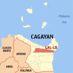
| Lage von Lal-lo in der Provinz Cagayan | |||
|---|---|---|---|
 | |||
| Basisdaten | |||
| Region: | Cagayan Valley | ||
| Provinz: | Cagayan | ||
| Barangays: | 35 | ||
| Distrikt: | 1. Distrikt von Cagayan | ||
| PSGC: | 021516000 | ||
| Einkommensklasse: | 2. Einkommensklasse | ||
| Haushalte: | 7443 Zensus 1. Mai 2000 | ||
| Einwohnerzahl: | 44.506 Zensus 1. August 2015 | ||
| Bevölkerungsdichte: | 63,3 Einwohner je km² | ||
| Fläche: | 702,8 km² | ||
| Koordinaten: | 18° 12′ N, 121° 40′ O | ||
| Postleitzahl: | 3509 | ||
| Vorwahl: | +63 78 | ||
| Geographische Lage auf den Philippinen | |||
| |||

Lal-lo ist in folgende 35 Baranggays aufgeteilt:
|
|
|
This article is issued from Wikipedia. The text is licensed under Creative Commons - Attribution - Sharealike. The authors of the article are listed here. Additional terms may apply for the media files, click on images to show image meta data.