Kent County (Rhode Island)
Kent County[1] ist ein County im Bundesstaat Rhode Island der Vereinigten Staaten. Im Jahr 2020 hatte das County 170.363 Einwohner und eine Bevölkerungsdichte von 386 Einwohner pro Quadratkilometer.[2] Der Verwaltungssitz (County Seat) ist East Greenwich.
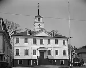 Kent County Courthouse | |
| Verwaltung | |
|---|---|
| US-Bundesstaat: | Rhode Island |
| Verwaltungssitz: | East Greenwich |
| Gründung: | 1750 |
| Gebildet aus: | Providence County |
| Demographie | |
| Einwohner: | 170.363 (2020) |
| Bevölkerungsdichte: | 386,31 Einwohner/km2 |
| Geographie | |
| Fläche gesamt: | 487 km² |
| Wasserfläche: | 46 km² |
| Karte | |
 Karte von Kent County innerhalb von Rhode Island | |
Geographie
Das County hat eine Fläche von 487 Quadratkilometern, wovon 46 Quadratkilometer Wasserfläche sind. Es grenzt im Uhrzeigersinn an folgende Countys: Providence County, Bristol County, Washington County, New London County und Windham County.
Geschichte
Kent County wurde am 11. Juni 1750 aus Teilen von Providence County gegründet und nach der englischen Grafschaft Kent benannt.[3]

Ein Ort im County hat den Status einer National Historic Landmark, die General Nathanael Greene Homestead.[4] 80 Bauwerke und Stätten des Countys sind im National Register of Historic Places (NRHP) eingetragen (Stand 25. Juli 2018).[5]
Bevölkerungsentwicklung
| 1980 | 1990 | 2000 | 2010 | 2020 |
|---|---|---|---|---|
| 154.163 | 161.135 | 167.090 | 166.158 | 170.363 |
Demographie
Laut der Volkszählung im Jahr 2000 lebten im Kent County 167.090 Einwohner in 67.320 Haushalten und 44.969 Familien. Die Bevölkerung setzte sich aus 95,54 Prozent Weißen, 0,93 Prozent Afroamerikanern und 1,34 Prozent Asiaten zusammen. 1,69 Prozent der Bevölkerung waren spanischer oder lateinamerikanischer Abstammung. Das Prokopfeinkommen betrug 23.833 US-Dollar; 4,8 Prozent der Familien sowie 6,6 Prozent der Bevölkerung lebten unter der Armutsgrenze.[6]
Städte und Gemeinden
Einzelnachweise
- Kent County im Geographic Names Information System des United States Geological Survey. Abgerufen am 22. Februar 2011
- Rhode Island (Bundesstaat, USA) - Einwohnerzahlen, Grafiken, Karte und Lage. Abgerufen am 31. August 2021.
- Charles Curry Aiken, Joseph Nathan Kane: The American Counties: Origins of County Names, Dates of Creation, Area, and Population Data, 1950–2010. 6. Auflage. Scarecrow Press, Lanham 2013, ISBN 978-0-8108-8762-6, S. 161.
- Listing of National Historic Landmarks by State: Rhode Island. National Park Service, abgerufen am 25. Juli 2018.
- Suchmaske Datenbank im National Register Information System. National Park Service, abgerufen am 25. Juli 2018.
- Kent County, Rhode Island, Datenblatt mit den Ergebnissen der Volkszählung im Jahre 2000 bei factfinder.census.gov.