Johannes-Paul-II.-Küste
| Johannes-Paul-II.-Küste Joannes Paulus II Coast Wybrzeże Jana Pawła II | ||
|---|---|---|
| ||
| Lage | King George Island, Südliche Shetlandinseln | |
| Gewässer | Drakestraße | |
| Südwesten | Fildes-Halbinsel 62° 10′ 0″ S, 58° 55′ 0″ W | |
| Nordosten | Pottinger Point 61° 56′ 1,3″ S, 58° 21′ 28,1″ W | |
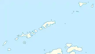
Als Johannes-Paul-II.-Küste (englisch Joannes Paulus II Coast, polnisch Wybrzeże Jana Pawła II) wird die schroffe, vergletscherte Nordwestküste von King George Island, der größten der Südlichen Shetlandinseln, bezeichnet. Sie erstreckt sich entlang der Drakestraße von der Fildes-Halbinsel im Südwesten bis zum Pottinger Point im Nordosten.
Die Küste wurde spätestens 1980 (während der Regierungszeit von Edward Gierek[1]) von polnischen Polarforschern nach dem 1978 gewählten Papst Johannes Paul II. benannt.[2][3]
Einzelnachweise
- K. Birkenmajer: New place names introduced to the area of Admiralty Bay, King George Island (South Shetland Islands, Antarctica). – Studia Geologica Polonica, vol. 64 (der erste von vier 1980 erschienenen Bänden), S. 67–87. Zitiert nach Cisak (1992): List of place-names …, S. 301.
- List of place-names in Antarctica introduced by Poland in 1978–1990. (Memento des Originals vom 29. März 2019 im Internet Archive) Info: Der Archivlink wurde automatisch eingesetzt und noch nicht geprüft. Bitte prüfe Original- und Archivlink gemäß Anleitung und entferne dann diesen Hinweis. Compiled by Jan Cisak. Polish Polar Research 3, 3–4, Warschau 1992, S. 273–302; hier S. 284. Abgerufen am 16. August 2017
- Joannes Paulus II Coast im SCAR Composite Gazetteer of Antarctica, abgerufen am 16. August 2017
This article is issued from Wikipedia. The text is licensed under Creative Commons - Attribution - Sharealike. The authors of the article are listed here. Additional terms may apply for the media files, click on images to show image meta data.
