Interstate 64
Die Interstate 64 (Abkürzung I-64) ist Teil des Interstate-Highway-Systems der USA. Ihr westliches Ende befindet sich in O’Fallon (Missouri) westlich der Ausfahrt zur Missouri Supplemental Route, ihr östliches Ende ist bei Bowers Hill in Chesapeake (Virginia) beim Autobahnkreuz mit der Interstate 264 und Interstate 664.
 Interstate 64 | |||||||||||||||||||||||||||||||||||||||||||||||||||||||||||||||||||||||||||||||||||||
| Basisdaten | |||||||||||||||||||||||||||||||||||||||||||||||||||||||||||||||||||||||||||||||||||||
|---|---|---|---|---|---|---|---|---|---|---|---|---|---|---|---|---|---|---|---|---|---|---|---|---|---|---|---|---|---|---|---|---|---|---|---|---|---|---|---|---|---|---|---|---|---|---|---|---|---|---|---|---|---|---|---|---|---|---|---|---|---|---|---|---|---|---|---|---|---|---|---|---|---|---|---|---|---|---|---|---|---|---|---|---|---|
| Länge: | 960 mi/1547 km | ||||||||||||||||||||||||||||||||||||||||||||||||||||||||||||||||||||||||||||||||||||
| Bundesstaaten: | Missouri Illinois Indiana Kentucky West Virginia Virginia | ||||||||||||||||||||||||||||||||||||||||||||||||||||||||||||||||||||||||||||||||||||
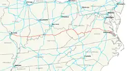
| Karte | |||||||||||||||||||||||||||||||||||||||||||||||||||||||||||||||||||||||||||||||||||||
 | |||||||||||||||||||||||||||||||||||||||||||||||||||||||||||||||||||||||||||||||||||||
|
Verlauf
| |||||||||||||||||||||||||||||||||||||||||||||||||||||||||||||||||||||||||||||||||||||
Wichtige Städte entlang der Route
Zubringer und Umgehungen
- Interstate 164 bei Evansville
- Interstate 264 bei Louisville
- Interstate 264 im Gebiet des Hampton Roads
- Interstate 464 im Gebiet des Hampton Roads
- Interstate 564 im Gebiet des Hampton Roads
- Interstate 664 im Gebiet des Hampton Roads
Galerie
 Übergang zu I-64 bei Lexington
 Zahlstelle auf der I-64
 Einfahrt West Virginia auf I-64
Literatur
- Rand McNally: The Road Atlas 2005. 2005.
Weblinks
- Artikel von American Byways zu Interstate 64
- Offizielle Webseite der West Virginia Turnpike
- Roads to the Future
- Missouri Verkehrsministerium zur Verlängerung von I-64
| Main Interstates |
2 • 4 • 5 • 8 • 10 • 11 • 12 • 14 • 15 • 16 • 17 • 19 • 20 • 22 • 24 • 25 • 26 • 27 • 29 • 30 • 35 • 37 • 39 • 40 • 41 • 43 • 44 • 45 • 49 • 55 • 57 • 59 • 64 • 65 • 66 • 68 • 69 • 70 • 71 • 72 • 73 • 74 • 75 • 76 (West) • 76 (Ost) • 77 • 78 • 79 • 80 • 81 • 82 • 83 • 84 (West) • 84 (Ost) • 85 • 86 (West) • 86 (Ost) • 87 (Nord) • 87 (Süd) • 88 (West) • 88 (Ost) • 89 • 90 • 91 • 93 • 94 • 95 • 96 • 97 • 99 • 238 |
 |
|---|---|---|
| Hawaii | ||
| Alaska |
A-1 • A-2 • A-3 • A-4 | |
| Puerto Rico |
PR-1 • PR-2 • PR-3 |