Hattiesburg
Hattiesburg ist eine Stadt (City) und Sitz der Countyverwaltung (County Seat) im Forrest County im US-Bundesstaat Mississippi. Mit knapp 50.000 Einwohnern ist sie die viertgrößte im Bundesstaat.
| Hattiesburg | |
|---|---|
| Spitzname: Hub City | |
.jpg.webp) | |
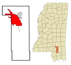
| Lage in Mississippi | |
 | |
| Basisdaten | |
| Gründung: | 1882 |
| Staat: | Vereinigte Staaten |
| Bundesstaat: | Mississippi |
| County: | Forrest County |
| Koordinaten: | 31° 19′ N, 89° 19′ W |
| Zeitzone: | Central (UTC−6/−5) |
| Einwohner: – Metropolregion: | 48.730 (Stand: 2020) 149.138 (Stand: 2016) |
| Fläche: | 128,6 km² (ca. 50 mi²) davon 127,6 km² (ca. 49 mi²) Land |
| Höhe: | 52 m |
| Postleitzahlen: | 39401-39404, 39406, 39407 |
| Vorwahl: | +1 601 |
| FIPS: | 28-31020 |
| GNIS-ID: | 0691565 |
| Website: | www.hattiesburgms.com |
| Bürgermeister: | Johnny DuPree |
 De Soto National Forest | |
Der Ort an der Kreuzung von Interstate 59 und U.S. Highway 49 beherbergt neben der University of Southern Mississippi das Luftfahrtmuseum Mississippi Armed Forces Museum.
Hattiesburg als Verwaltungssitz des nach dem Ku-Klux-Klan-Anführers Nathan Bedford Forrest benannten Countys war 1966 auch Schauplatz eines Anschlags der White Knights of the Ku Klux Klan.
Am 10. Februar 2013 wütete hier ein Tornado. Südlich der Stadt liegt der De Soto National Forest.
Persönlichkeiten
- Paul B. Johnson senior (1880–1943), Politiker
- Martin Sennett Conner (1891–1950), Politiker
- Vernon Dahmer (1908–1966), Bürgerrechtler
- Henry Winston (1911–1986), Politiker
- Jimmy Swan (1912–1994), Country-Musiker
- John Davis (1913–1985), Blues-Musiker
- Dorothy Dell (1915–1934), Schauspielerin und Sängerin
- Paul B. Johnson junior (1916–1985), Politiker
- Bobby Bryant (1934–1998), Trompeter
- Van Dyke Parks (* 1943), Schauspieler
- Barbara Ferrell (* 1947), Sprinterin
- Eddie Hodges (* 1947), Sänger
- Carolyn Haines (* 1953), Autorin
- Tim Floyd (* 1954), Basketballtrainer
- Webb Wilder (* 1954), Musiker
- Bob Dudley (* 1955), Wirtschaftsmanager
- Fred Armisen (* 1966), Komiker
- Shelby Cannon (* 1966), Tennisspieler
- Danny Manning (* 1966), Basketballer
- Miles Doleac (* 1975), Schauspieler, Drehbuchautor, Filmproduzent und Filmregisseur
- Todd Grisham (* 1976), Sportjournalist
- Taylor Spreitler (* 1993), Schauspielerin
Literatur
- William Sturkey: Hattiesburg: An American City in Black and White. Harvard University Press, Cambridge 2019, ISBN 978-0-674-97635-1.
This article is issued from Wikipedia. The text is licensed under Creative Commons - Attribution - Sharealike. The authors of the article are listed here. Additional terms may apply for the media files, click on images to show image meta data.