Distrikt Kotido
Kotido ist ein Distrikt in Norduganda. Die Hauptstadt des Distrikts ist Kotido.
| Karte | |
|---|---|
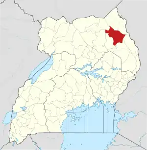 Lage von Kotido | |
| Basisdaten | |
| Hauptstadt | Kotido |
| Geographisches Zentrum | 3° 31′ N, 34° 7′ O |
| Fläche | 1.071 km² |
| Einwohnerzahl | 206.500 (Stand 2020) |
| Bevölkerungsdichte | 192,8 Einwohner/km² |
| Zeitzone | UTC +3 |
Lage
Der Distrikt Kotido grenzt im Norden an den Distrikt Kaabong, im Osten an den Distrikt Moroto, im Süden an den Distrikt Napak und im Westen an den Distrikt Abim. Der Distrikt Agago und der Distrikt Kitgum liegen nordwestlich des Bezirks Kotido.
Demografie
Die Bevölkerungszahl wird für 2020 auf 206.500 geschätzt. Davon lebten im selben Jahr 36,7 Prozent in städtischen Regionen und 63,3 Prozent in ländlichen Regionen.[1]
| Zensusjahr | Einwohnerzahl[1] |
|---|---|
| 1991 | 57.198 |
| 2002 | 122.541 |
| 2014 | 181.050 |
Wirtschaft
Nomadischer Pastoralismus ist die wichtigste wirtschaftliche Aktivität im Distrikt. In einigen Gebieten wird bäuerliche Landwirtschaft betrieben. Der Distrikt gehört zu den ärmsten und unterentwickeltesten in Uganda.[2]
Einzelnachweise
- Kole (Bezirk, Uganda) - Einwohnerzahlen, Grafiken, Karte und Lage. Abgerufen am 4. Juli 2020.
- Justine Nannyonjo: Conflicts, poverty and human development in Northern Uganda. In: The Round Table. Band 94, Nr. 381, 1. September 2005, ISSN 0035-8533, S. 473–488, doi:10.1080/00358530500243609.
Zentrale Distrikte:
Buikwe |
Bukomansimbi |
Butambala |
Buvuma |
Gomba |
Kalangala |
Kalungu |
Kampala |
Kasanda |
Kayunga |
Kiboga |
Kyankwanzi |
Kyotera |
Luweero |
Lwengo |
Lyantonde |
Masaka |
Mityana |
Mpigi |
Mubende |
Mukono |
Nakaseke |
Nakasongola |
Rakai |
Sembabule |
Wakiso
Östliche Distrikte:
Amuria |
Budaka |
Bududa |
Bugiri |
Bugweri |
Bukedea |
Bukwo |
Bulambuli |
Busia |
Butaleja |
Butebo |
Buyende |
Iganga |
Jinja |
Kaberamaido |
Kalaki |
Kaliro |
Kamuli |
Kapchorwa |
Kapelebyong |
Katakwi |
Kibuku |
Kumi |
Kween |
Luuka |
Manafwa |
Mayuge |
Mbale |
Namayingo |
Namisindwa |
Namutumba |
Ngora |
Pallisa |
Serere |
Sironko |
Soroti |
Tororo
Nördliche Distrikte:
Abim |
Adjumani |
Agago |
Alebtong |
Amolatar |
Amudat |
Amuru |
Apac |
Arua |
Dokolo |
Gulu |
Kaabong |
Karenga |
Kitgum |
Koboko |
Kole |
Kotido |
Kwania |
Lamwo |
Lira |
Lusot |
Madi Okollo |
Maracha |
Moroto |
Moyo |
Nabilatuk |
Nakapiripirit |
Napak |
Nebbi |
Nwoya |
Obongi |
Omoro |
Otuke |
Oyam |
Pader |
Pakwach |
Terego |
Yumbe |
Zombo
Westliche Distrikte:
Buhweju |
Buliisa |
Bundibugyo |
Bunyangabu |
Bushenyi |
Hoima |
Ibanda |
Isingiro |
Kabale |
Kabarole |
Kagadi |
Kakumiro |
Kamwenge |
Kanungu |
Kasese |
Kazo |
Kibaale |
Kikuube |
Kiruhura |
Kiryandongo |
Kisoro |
Kitagwenda |
Kyegegwa |
Kyenjojo |
Masindi |
Mbarara |
Mitooma |
Ntoroko |
Ntungamo |
Rubanda |
Rubirizi |
Rukiga |
Rukungiri |
Rwampara |
Sheema