Cantagalo (Distrikt)
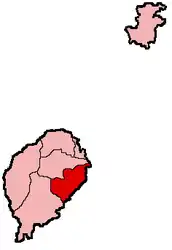
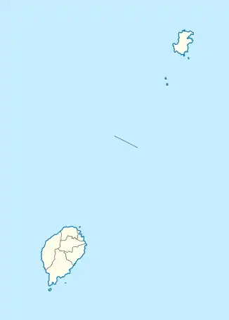
Cantagalo ist einer der sieben Distrikte von São Tomé und Príncipe und liegt auf der Insel São Tomé.
| Cantagalo | |||
|---|---|---|---|
| |||
| Koordinaten | 0° 11′ N, 6° 39′ O | ||
 | |||
| Basisdaten | |||
| Staat | São Tomé und Príncipe | ||
| Cantagalo | |||
| Höhe | 5 m | ||
| Fläche | 119 km² | ||
| Einwohner | 17.191 (2012) | ||
| Dichte | 144,5 Ew./km² | ||
| Website | República Democrática de São Tomé e Principe (portugiesisch) | ||
| Kultur | |||
| Partnerstädte | |||
 | |||
Geographie
Cantagalo grenzt im Norden an Mé-Zóchi und im Osten an Caué und hat eine Fläche von 119 km². 2012 lebten in Cantagolo 17.161 Menschen[1]. Die Hauptstadt ist Santana an der Ostküste von São Tomé mit 7.798 Einwohnern (2005).
Bevölkerungsentwicklung
| Jahr | Einwohner | Anteil an der Gesamtbevölkerung |
|---|---|---|
| 1940 | 7.854 | 12,9 % |
| 1950 | 8.568 | 14,2 % |
| 1960 | 9.758 | 15,2 % |
| 1970 | 9.697 | 13,1 % |
| 1981 | 10.435 | 10,8 % |
| 1991 | 11.433 | 9,7 % |
| 2001 | 13.258 | 9,6 % |
| 2012 | 17.161 | 9,6 % |
Einzelnachweise
- Instituto Nacional de Estatística: Projecção a nível distrital 2012 - 2020. (pdf) 8. März 2018, abgerufen am 7. September 2019 (portugiesisch, französisch).
This article is issued from Wikipedia. The text is licensed under Creative Commons - Attribution - Sharealike. The authors of the article are listed here. Additional terms may apply for the media files, click on images to show image meta data.