Biri (Northern Samar)
Biri ist eine philippinische Stadtgemeinde in der Provinz Northern Samar. Sie hat 11.767 Einwohner (Zensus 1. August 2015). Die Gemeinde liegt im Naturschutzgebiet Biri Larosa Protected Landscape/Seascape.
| Municipality of Biri | |||
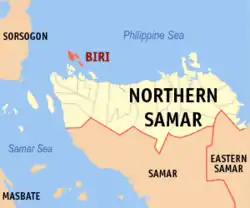
| Lage von Biri in der Provinz Northern Samar | |||
|---|---|---|---|
 | |||
| Basisdaten | |||
| Region: | Eastern Visayas | ||
| Provinz: | Northern Samar | ||
| Barangays: | 8 | ||
| Distrikt: | 1. Distrikt von Northern Samar | ||
| PSGC: | 084802000 | ||
| Einkommensklasse: | unbekannt (1-6) | ||
| Haushalte: | 1661 Zensus 1. Mai 2000 | ||
| Einwohnerzahl: | 11.767 Zensus 1. August 2015 | ||
| Koordinaten: | 12° 41′ N, 124° 22′ O | ||
| Postleitzahl: | 6410 | ||
| Bürgermeister: | Jaime Serrona Garcia Sr. | ||
| Geographische Lage auf den Philippinen | |||
| |||

Baranggays
Biri ist politisch unterteilt in acht Baranggays.
- Poblacion (Biri)
- MacArthur
- Kauswagan (Basud)
- Pio Del Pilar
- Progress or Talisay
- San Antonio
- San Pedro
- Santo Niño
Weblinks
- elgu.ncc.gov.ph - Biri (Memento vom 10. Januar 2008 im Internet Archive)
This article is issued from Wikipedia. The text is licensed under Creative Commons - Attribution - Sharealike. The authors of the article are listed here. Additional terms may apply for the media files, click on images to show image meta data.