Bedeque
Bedeque and Area ist eine Gemeinde mit Community Status in der kanadischen Provinz Prince Edward Island.[2] Sie wurde erst im November 2014 in der heutigen Form geschaffen. Davor war das Gebiet auf zwei Gemeinden, Bedeque.
| Bedeque and Area | |||
|---|---|---|---|
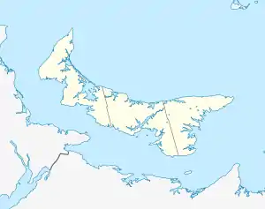
| Lage in Prince Edward Island | |||
| |||
| Staat: | |||
| Provinz: | Prince Edward Island | ||
| County: | Prince County | ||
| Koordinaten: | 46° 20′ N, 63° 43′ W | ||
| Höhe: | 15 m | ||
| Fläche: | 2,53 km² | ||
| Einwohner: | 302 (Stand: 2016[1]) | ||
| Bevölkerungsdichte: | 119,4 Einw./km² | ||
| Zeitzone: | Atlantic Time (UTC−4) | ||
| Postleitzahl: | C0B | ||
Geographie
Die Community liegt nördlich von Borden-Carleton im Lot 26, Prince County. Hauptwirtschaftszweig ist Landwirtschaft bzw. Jagd.
Central Bedeque liegt am Südlichen Ufer der Insel. Sie hat Zugang zur Northumberland Strait am Dunk River.
Geschichte
Der Name, Central Bedeque, wurde 1925 erstmals verwendet und 1944 amtlich bestätigt. Den Titel Dorf bekam Central Bedeque 1966. Davor waren Namen wie "Strong's Corner", "Weatherbie's Corner" gebräuchlich.
Der Name "Bedeque" könnte eine Verballhornung eines Mi'kmaq-Begriffes sein mit Bedeutungen wie "sonniger Lagerplatz" oder "der heiße Ort". Der Begriff kommt in mehreren Ortsbezeichnungen in der Umgebung vor: Bedeque, North Bedeque und Lower Bedeque.
Persönlichkeiten
- George Uglow Pope (1820–1908), englischer Missionar und Tamil-Forscher
- William Henry Pope (1825–1879), kanadischer Politiker
- Benjamin Rogers (1837–1923), kanadischer Politiker
Siehe auch
Einzelnachweise
- Statistics Canada: Census Profile, 2016 Census – Bedeque and Area, Community (Census subdivision), Prince Edward Island and Prince Edward Island (Province), abgerufen am 18. Juni 2021
- EC2014-524: Municipalities Act, Community of Central Bedeque and Community of Bedeque Amalgamation. Government of Prince Edward Island: Executive Council. 9. September 2014. Abgerufen am 8. Februar 2015.