Bay County (Michigan)
Das Bay County[1] ist ein County (Kreis) im US-Bundesstaat Michigan in den Vereinigten Staaten. Der Verwaltungssitz ist Bay City.
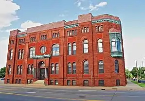 Masonic Temple | |
| Verwaltung | |
|---|---|
| US-Bundesstaat: | Michigan |
| Verwaltungssitz: | Bay City |
| Gründung: | 1857 |
| Demographie | |
| Einwohner: | 107.771 (2010) |
| Bevölkerungsdichte: | 93,63 Einwohner/km2 |
| Geographie | |
| Fläche gesamt: | 1634 km² |
| Wasserfläche: | 483 km² |
| Karte | |
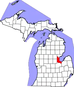 Karte von Bay County innerhalb von Michigan | |
| Website: www.co.bay.mi.us | |
Bay County liegt an der Saginaw-Bucht am südwestlichen Teil des Huronsees.
Geschichte
Eine Konstruktion im County hat den Status einer National Historic Landmark, der Zerstörer USS Edson.[2] 16 Bauwerke und Stätten des Countys sind insgesamt im National Register of Historic Places eingetragen (Stand 17. November 2017).[3]
Bevölkerungsentwicklung
| Bevölkerungswachstum | |||
|---|---|---|---|
| Census | Einwohner | ± in % | |
| 1860 | 3164 | — | |
| 1870 | 15.900 | 402,5 % | |
| 1880 | 38.081 | 139,5 % | |
| 1890 | 56.412 | 48,1 % | |
| 1900 | 62.378 | 10,6 % | |
| 1910 | 68.238 | 9,4 % | |
| 1920 | 69.548 | 1,9 % | |
| 1930 | 69.474 | −0,1 % | |
| 1940 | 74.981 | 7,9 % | |
| 1950 | 88.461 | 18 % | |
| 1960 | 107.042 | 21 % | |
| 1970 | 117.339 | 9,6 % | |
| 1980 | 119.881 | 2,2 % | |
| 1990 | 111.723 | −6,8 % | |
| 2000 | 110.157 | −1,4 % | |
| 2010 | 107.771 | −2,2 % | |
| Vor 1900[4] | |||
Orte im County
- Aplin Beach
- Auburn
- Bay City
- Beaver
- Bentley
- Brissette Beach
- Crump
- Donahue Beach
- Duel
- Essexville
- Fisherville
- Kawkawlin
- Killarney Beach
- Lagoon Beach
- Linwood
- Linwood Beach
- Little Killarney Beach
- Loehme
- Meyers Beach
- Midland
- Mount Forest
- Munger
- Nine Mile
- North Williams
- Pinconning
- Seidlers
- Three Churches Corner
- Tobico Beach
- Willard
- Woodville
- Frankenlust Township
- Fraser Township
- Garfield Charter Township
- Gibson Township
- Hampton Charter Township
- Kawkawlin Township
- Merritt Township
- Monitor Charter Township
- Mount Forest Township
- Pinconning Township
- Portsmouth Charter Township
- Williams Charter Township
Weblinks
Einzelnachweise
- GNIS-ID: 1622951. Abgerufen am 22. Februar 2011 (englisch).
- Listing of National Historic Landmarks by State: Michigan. National Park Service, abgerufen am 17. November 2017.
- Suchmaske Datenbank im National Register Information System. National Park Service, abgerufen am 17. November 2017.
- U.S. Census Bureau - Census of Population and Housing. Abgerufen am 15. März 2011
- Auszug aus Census.gov. Abgerufen am 18. Februar 2011
- Auszug aus census.gov (2000+2010) Abgerufen am 4. April 2012
Liste der Countys in Michigan
Alcona |
Alger |
Allegan |
Alpena |
Antrim |
Arenac |
Baraga |
Barry |
Bay |
Benzie |
Berrien |
Branch |
Calhoun |
Cass |
Charlevoix |
Cheboygan |
Chippewa |
Clare |
Clinton |
Crawford |
Delta |
Dickinson |
Eaton |
Emmet |
Genesee |
Gladwin |
Gogebic |
Grand Traverse |
Gratiot |
Hillsdale |
Houghton |
Huron |
Ingham |
Ionia |
Iosco |
Iron |
Isabella |
Jackson |
Kalamazoo |
Kalkaska |
Kent |
Keweenaw |
Lake |
Lapeer |
Leelanau |
Lenawee |
Livingston |
Luce |
Mackinac |
Macomb |
Manistee |
Marquette |
Mason |
Mecosta |
Menominee |
Midland |
Missaukee |
Monroe |
Montcalm |
Montmorency |
Muskegon |
Newaygo |
Oakland |
Oceana |
Ogemaw |
Ontonagon |
Osceola |
Oscoda |
Otsego |
Ottawa |
Presque Isle |
Roscommon |
Saginaw |
Sanilac |
Schoolcraft |
Shiawassee |
St. Clair |
St. Joseph |
Tuscola |
Van Buren |
Washtenaw |
Wayne |
Wexford