Bageshwar (Distrikt)
Der Distrikt Bageshwar (Hindi बागेश्वर जिला) ist ein Distrikt des indischen Bundesstaats Uttarakhand. Sitz der Distriktverwaltung ist Bageshwar.
| Distrikt Bageshwar बागेश्वर जिला | |
| Staat: | |
| Bundesstaat: | Uttarakhand |
| Koordinaten: | 29° 54′ N, 79° 51′ O |
| Fläche: | 2 241 km² |
| Einwohner: | 259.898 (2011) |
| Bevölkerungsdichte: | 116 Einwohner je km² |
| Religionen: (2011) | 99,1 % Hindus 0.9 % übrige und k. A. |
| Soziale Daten (Zensus 2011)[1][2] | |
| Alphabetisierungsrate: | 80,0 % (M: 92,3 %, F: 69,0 %) |
| Geschlechterverhältnis: | 0,917 (M:F) |
| Urbanisierungsgrad: | 3,5 % |
| Scheduled Castes: | 27,7 % |
| Scheduled Tribes: | 0,8 % |
| Website: | |
.svg.png.webp) | |
Geografie

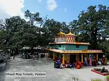
Vijaypur-Tempel
Der Distrikt Bageshwar liegt in der Division Kumaon im Osten von Uttarakhand im Kumaon-Himalaya. Bageshwar grenzt im Westen an Chamoli, im Osten an Pithoragarh und im Süden an Almora. Die Fläche des Distrikts Bageshwar beträgt 2241 km². Das Gebiet des Distrikts Bageshwar befindet sich im Einzugsgebiet von Pindar und Sarju. Der Distrikt erstreckt sich im Norden bis zum Nanda Kot.
Bevölkerung
Nach der Volkszählung 2011 hatte der Distrikt Bageshwar 259.898 Einwohner.[3]
Weblinks
Commons: Distrikt Bageshwar – Sammlung von Bildern, Videos und Audiodateien
Einzelnachweise
- District Census 2011. Census of India, abgerufen im Jahr 2021 (englisch).
- Population Enumeration Data (Final Population): A Series Including Primary Census Abstract Data (Final Population) > Primary Census Abstract Data Tables (India & States/UTs - District Level) (Excel Format). (XLS) Office of the Registrar General & Census Commissioner, India, abgerufen im Jahr 2021 (englisch).
- Census of India 2011: Primary Census Abstract - Uttarakhand. (PDF; 471 kB)
This article is issued from Wikipedia. The text is licensed under Creative Commons - Attribution - Sharealike. The authors of the article are listed here. Additional terms may apply for the media files, click on images to show image meta data.
