Baganga
Baganga ist eine Großraumgemeinde in der Provinz Davao Oriental und liegt an der Ostküste der Insel Mindanao auf den Philippinen. Sie hat 56.241 Einwohner (Zensus 1. August 2015), die in 18 Barangays leben.
| Municipality of Baganga | |||
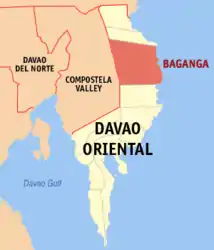
| Lage von Baganga in der Provinz Davao Oriental | |||
|---|---|---|---|
 | |||
| Basisdaten | |||
| Region: | Davao | ||
| Provinz: | Davao Oriental | ||
| Barangays: | 18 | ||
| PSGC: | 112501000 | ||
| Einkommensklasse: | 1. Einkommensklasse | ||
| Haushalte: | 8221 Zensus 1. Mai 2000 | ||
| Einwohnerzahl: | 56.241 Zensus 1. August 2015 | ||
| Bevölkerungsdichte: | 59,5 Einwohner je km² | ||
| Fläche: | 945,50 km² | ||
| Koordinaten: | 7° 34′ N, 126° 34′ O | ||
| Postleitzahl: | 8204 | ||
| Bürgermeister: | REMEGIO G. NAZARENO | ||
| Website: | http://www.baganga.gov.ph/ | ||
| Geographische Lage auf den Philippinen | |||
| |||

Geographie
Die Gemeinde Baganga liegt etwa 294 km entfernt vom internationalen Flughafen Davao City und ist über Mati City, entlang die Küstenstraße zu erreichen. Die Gemeinde belegt eine Fläche von 945,50 km² entlang der Ostküste der Insel Mindanao. Innerhalb des Gemeindegebietes liegt das Natur- und Meeresschutzgebiet Baganga Bay Protected Landscape and Seascape.
Barangays
Die Großraumgemeinde ist in 18 Barangays unterteilt.
|
|
Söhne und Töchter
- Nolly Buco (* 1963), römisch-katholischer Geistlicher, Weihbischof in Antipolo
This article is issued from Wikipedia. The text is licensed under Creative Commons - Attribution - Sharealike. The authors of the article are listed here. Additional terms may apply for the media files, click on images to show image meta data.