Bécancour (regionale Grafschaftsgemeinde)
Bécancour ist eine regionale Grafschaftsgemeinde (französisch municipalité régionale de comté, MRC) in der kanadischen Provinz Québec.
| Municipalité régionale de comté Bécancour | |
|---|---|
| Staat | Kanada |
| Provinz | Québec |
| Verwaltungsregion | Centre-du-Québec |
| Hauptort | Bécancour |
| Einwohner | 20.404 (2016)[1] |
| Fläche | 1.144,67 km² |
| Bevölkerungsdichte | 17,8 Einw./km² |
| Gründung | 1. Januar 1982 |
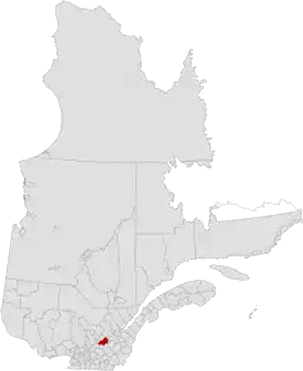 | |
Sie liegt in der Verwaltungsregion Centre-du-Québec und besteht aus zwölf untergeordneten Verwaltungseinheiten (eine Stadt, acht Gemeinden und drei Sprengel). Die MRC wurde am 1. Januar 1982 gegründet.[2] Der Hauptort ist Bécancour. Die Einwohnerzahl beträgt 20.404 (Stand: 2016) und die Fläche 1.144,67 km², was einer Bevölkerungsdichte von 17,8 Einwohnern je km² entspricht.
Gliederung
Stadt (ville)
Gemeinde (municipalité)
- Deschaillons-sur-Saint-Laurent
- Fortierville
- Lemieux
- Manseau
- Sainte-Françoise
- Sainte-Marie-de-Blandford
- Saint-Pierre-les-Becquets
- Saint-Sylvère
Sprengel (municipalité de paroisse)
- Parisville
- Sainte-Cécile-de-Lévrard
- Sainte-Sophie-de-Lévrard
Auf dem Gebiet der MRC Bécancour liegt auch das Indianerreservat Wôlinak, das jedoch autonom verwaltet wird und eine Enklave bildet.
Angrenzende MRC und vergleichbare Gebiete
Weblinks
Commons: Bécancour (regionale Grafschaftsgemeinde) – Sammlung von Bildern, Videos und Audiodateien
Einzelnachweise
- Statistics Canada: Census Profile, 2016 Census – Bécancour, Municipalité régionale de comté (Census division), Quebec and Quebec (Province), abgerufen am 8. Juni 2021
- Bécancour. Commission de toponymie du Québec
This article is issued from Wikipedia. The text is licensed under Creative Commons - Attribution - Sharealike. The authors of the article are listed here. Additional terms may apply for the media files, click on images to show image meta data.