Aramengo
Aramengo ist eine Gemeinde mit 567 (Stand 31. Dezember 2019) Einwohnern in der italienischen Provinz Asti (AT) der Region Piemont.
| Aramengo | ||
|---|---|---|
 |
| |
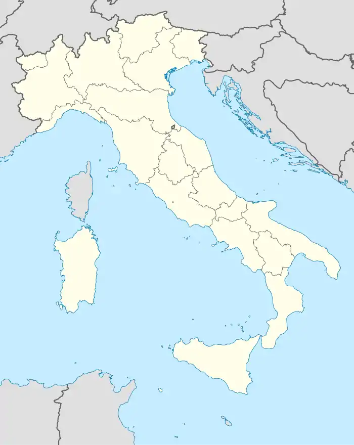
| Staat | Italien | |
| Region | Piemont | |
| Provinz | Asti (AT) | |
| Koordinaten | 45° 6′ N, 8° 0′ O | |
| Höhe | 357 m s.l.m. | |
| Fläche | 11,42 km² | |
| Einwohner | 567 (31. Dez. 2019)[1] | |
| Postleitzahl | 14020 | |
| Vorwahl | 0141 | |
| ISTAT-Nummer | 005004 | |
| Volksbezeichnung | aramenghesi | |
| Schutzpatron | Sant'Anna | |
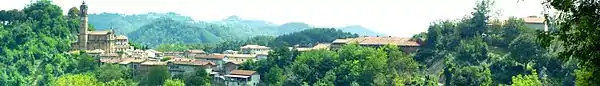
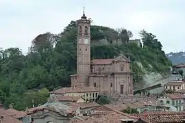 Die Kirche von Aramengo | ||
Die Nachbargemeinden sind Albugnano, Berzano di San Pietro, Casalborgone, Cocconato, Passerano Marmorito und Tonengo.
Geographie
Der Ort liegt auf einer Höhe von 369 m über dem Meeresspiegel. Das Gemeindegebiet umfasst eine Fläche von 11 km².
Kulinarische Spezialitäten
In Aramengo werden Reben der Sorte Barbera für den Barbera d’Asti, einen Rotwein mit DOCG Status angebaut.
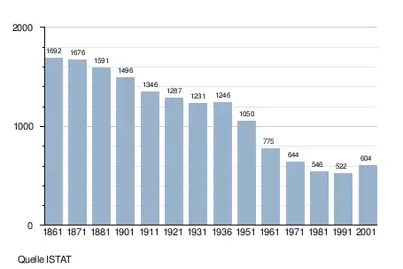
Bevölkerungsentwicklung
Einzelnachweise
- Statistiche demografiche ISTAT. Monatliche Bevölkerungsstatistiken des Istituto Nazionale di Statistica, Stand 31. Dezember 2019.
Weblinks

Agliano Terme | Albugnano | Antignano | Aramengo | Asti | Azzano d’Asti | Baldichieri d’Asti | Belveglio | Berzano di San Pietro | Bruno | Bubbio | Buttigliera d’Asti | Calamandrana | Calliano | Calosso | Camerano Casasco | Canelli | Cantarana | Capriglio | Casorzo | Cassinasco | Castagnole Monferrato | Castagnole delle Lanze | Castel Boglione | Castel Rocchero | Castell’Alfero | Castellero | Castelletto Molina | Castello di Annone | Castelnuovo Belbo | Castelnuovo Calcea | Castelnuovo Don Bosco | Cellarengo | Celle Enomondo | Cerreto d’Asti | Cerro Tanaro | Cessole | Chiusano d’Asti | Cinaglio | Cisterna d’Asti | Coazzolo | Cocconato | Corsione | Cortandone | Cortanze | Cortazzone | Cortiglione | Cossombrato | Costigliole d’Asti | Cunico | Dusino San Michele | Ferrere | Fontanile | Frinco | Grana | Grazzano Badoglio | Incisa Scapaccino | Isola d’Asti | Loazzolo | Maranzana | Maretto | Moasca | Mombaldone | Mombaruzzo | Mombercelli | Monale | Monastero Bormida | Moncalvo | Moncucco Torinese | Mongardino | Montabone | Montafia | Montaldo Scarampi | Montechiaro d’Asti | Montegrosso d’Asti | Montemagno | Montiglio Monferrato | Moransengo | Nizza Monferrato | Olmo Gentile | Passerano Marmorito | Penango | Piea | Pino d’Asti | Piovà Massaia | Portacomaro | Quaranti | Refrancore | Revigliasco d’Asti | Roatto | Robella | Rocca d’Arazzo | Roccaverano | Rocchetta Palafea | Rocchetta Tanaro | San Damiano d’Asti | San Giorgio Scarampi | San Martino Alfieri | San Marzano Oliveto | San Paolo Solbrito | Scurzolengo | Serole | Sessame | Settime | Soglio | Tigliole | Tonco | Tonengo | Vaglio Serra | Valfenera | Vesime | Viale | Viarigi | Vigliano d’Asti | Villa San Secondo | Villafranca d’Asti | Villanova d’Asti | Vinchio