Amandi (Villaviciosa)
Amandi ist eines von 41 Parroquias in der Gemeinde Villaviciosa der autonomen Region Asturien in Spanien.
Die 519 Einwohner (2011) leben in 25 Dörfern auf einer Fläche von 5,06 km². Der Rio Profundo durchquert das Parroquia.
| Gemeinde Villaviciosa: Parroquia Amandi | |||
|---|---|---|---|
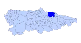
| Wappen | Karte von Spanien | ||
| ? Hilfe zu Wappen |
| ||
| Basisdaten | |||
| Autonome Gemeinschaft: | |||
| Comarca: | Gijón (Comarca) | ||
| Koordinaten | 43° 28′ N, 5° 27′ W | ||
| Höhe: | 171 msnm | ||
| Fläche: | 5,06 km² | ||
| Einwohner: | 519 (1. Januar 2011)INE | ||
| Bevölkerungsdichte: | 102,57 Einw./km² | ||
| Postleitzahl: | 33311 | ||
| Ortskennzahl: | 33076010000 | ||
| Nächster Flughafen: | Flughafen Asturias | ||
| Lage der Gemeinde | |||
 | |||


Am Jakobsweg
Die Kirche Juan el Bautista in Algara ist eine Station am Jakobsweg, dem Camino de la Costa.
Sehenswürdigkeiten
- Pfarrkirche San Salvador von 1134
- romanische Kirche Juan el Bautista in Algara
- Alte Wassermühlen im Tal des Rio Profundo
Dörfer und Weiler der Parroquia
- Algara: 3 Einwohner 2011
- Les Baragañes: 7 Einwohner 2011
- Bozames: 56 Einwohner 2011 43° 27′ 41″ N, 5° 27′ 12″ W
- Los Campos: 17 Einwohner 2011 43° 27′ 56″ N, 5° 26′ 21″ W
- Casquita: 4 Einwohner 2011
- Conciella: 7 Einwohner 2011
- La Ferrería: 1 Einwohner 2011
- Gordinayo: 1 Einwohner 2011
- La Gotera: 6 Einwohner 2011
- Llavares: 98 Einwohner 2011 43° 27′ 31″ N, 5° 26′ 41″ W
- El Lugarín: 7 Einwohner 2011 43° 28′ 2″ N, 5° 26′ 24″ W
- La Mesada: 3 Einwohner 2011
- Obaya: 15 Einwohner 2011
- El Palaciu – 142 Einwohner 2011
- La Parra: 35 Einwohner 2011
- Poladura: 9 Einwohner 2011
- Pumarín: 2 Einwohner 2011
- La Quinta – 1 Einwohner 2011
- La Roza: 4 Einwohner 2011
- San Juan: 54 Einwohner 2011 43° 28′ 19″ N, 5° 26′ 9″ W
- Sur: 17 Einwohner 2011
- Valbúcar: 11 Einwohner 2011 43° 27′ 49″ N, 5° 26′ 34″ W
- La Vega: unbewohnt 2011
- Vitienes: 15 Einwohner 2011 43° 27′ 48″ N, 5° 26′ 5″ W
- Ximague: 4 Einwohner 2011
Quellen
- Bevölkerungszahlen siehe INE
- Postleitzahlen siehe Codigos postales de España Buscador
- Koordinaten und Höhenangaben siehe Google Earth
Weblinks
- Infoseite im Tourismusportal vivirasturias
- Karte von Asturien (PDF; 12,52 MB)
Amandi | Ambás | Argüero | Arnín | Arroes | Bedriñana | Breceña | Camoca | Candanal | Carda | Careñes | Castiello | Cazanes | Celada | Coro | El Busto | Fuentes | Grases | La Llera | La Magdalena | Lugás | Mar | Miravalles | Niévares | Oles | Peón | Priesca | Puelles | Quintes | Quintueles | Rales | Rozadas | San Justo | Santa Eugenia | Selorio | Tazones | Tornón | Valdebárzana | Vallés | Villaverde La Marina | Villaviciosa
This article is issued from Wikipedia. The text is licensed under Creative Commons - Attribution - Sharealike. The authors of the article are listed here. Additional terms may apply for the media files, click on images to show image meta data.