Westlich Berus
Das Naturschutzgebiet Westlich Berus liegt auf dem Gebiet der Gemeinde Überherrn im Landkreis Saarlouis im Saarland.
Westlich Berus
| ||
| Lage | Saarland, Deutschland | |
| Fläche | 143 ha | |
| Kennung | NSG-N-6706-302 | |
| WDPA-ID | 555632877 | |
| Geographische Lage | 49° 16′ N, 6° 40′ O | |
| ||
| Einrichtungsdatum | 26. Mai 2016, 2016 | |
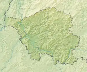
Das Gebiet erstreckt sich westlich von Berus, einem Ortsteil der Gemeinde Überherrn. Am westlichen Rand des Gebietes verläuft die Staatsgrenze zu Frankreich.
Bedeutung
Das 143 ha große Gebiet ist seit dem 26. Mai 2016 unter der Kennung NSG-N-6706-302 als Naturschutzgebiet ausgewiesen.
Weblinks
- Westlich Berus in der World Database on Protected Areas (englisch)
- Verordnung über das Naturschutzgebiet „Westlich Berus“ (N 6706-302). Vom 9. Mai 2016 auf recht.saarland.de, abgerufen am 11. Juli 2020

Bei der Knorscheider Mühle | Breitborner Floss | Ellbachtal | Eulenmühle / Eulenmühle-Welschwies | Großer Lückner nordöstlich Oppen | Hoxfels | Kuhnenwald-Huhngrund | Neuforweiler Weiherbachtal | Nied | Nonnenwies/Distelwies | Prims | Saaraue nordwestlich Wadgassen | Taffingstal | Warndt | Westlich Berus | Wiesenlandschaft bei Überroth
This article is issued from Wikipedia. The text is licensed under Creative Commons - Attribution - Sharealike. The authors of the article are listed here. Additional terms may apply for the media files, click on images to show image meta data.