Ward (South Dakota)
Ward ist der nördlichste Ort im Moody County im US-Bundesstaat South Dakota. Der Ort hatte 41 Einwohner (Stand: 2000) auf einer Fläche von 0,7 km².
| Dieser Artikel wurde aufgrund von inhaltlichen Mängeln auf der Qualitätssicherungsseite des Projektes USA eingetragen. Hilf mit, die Qualität dieses Artikels auf ein akzeptables Niveau zu bringen, und beteilige dich an der Diskussion! Eine nähere Beschreibung der zu behebenden Mängel fehlt. | .svg.png.webp) |
| Ward | |||
|---|---|---|---|
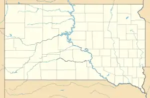
Lage in South Dakota | |||
| Basisdaten | |||
| Staat: | Vereinigte Staaten | ||
| Bundesstaat: | South Dakota | ||
| County: | Moody County | ||
| Koordinaten: | 44° 9′ N, 96° 28′ W | ||
| Zeitzone: | Central (UTC−6/−5) | ||
| Einwohner: | 41 (Stand: 2000) | ||
| Fläche: | 0,7 km² (ca. 0 mi²) davon 0,7 km² (ca. 0 mi²) Land | ||
| Höhe: | 535 m | ||
| Vorwahl: | +1 605 | ||
| FIPS: | 46-68660 | ||
| GNIS-ID: | 1258820 | ||
Lage
Ward liegt direkt an der Staatsgrenze zum Pipestone County in Minnesota. Nächstgrößere Städte sind das 25 km entfernte Brookings im Nordwesten und Flandreau 20 km im Südwesten. Pipestone in Minnesota im Südosten ist ebenfalls 20 km Luftlinie entfernt.
Name
Ward wurde nach dem Förderer der Eisenbahnlinie durch das Staatsgebiet von Dakota zwischen 1887 und 1889 James A. Ward benannt.
Weblinks
This article is issued from Wikipedia. The text is licensed under Creative Commons - Attribution - Sharealike. The authors of the article are listed here. Additional terms may apply for the media files, click on images to show image meta data.