Wallingford (Connecticut)
Wallingford ist eine Stadt im New Haven County im Süden des US-Bundesstaats Connecticut, Vereinigte Staaten, mit 45.000 Einwohnern (Stand: 2010). Sie liegt am Quinnipiac River. Die geographischen Koordinaten sind: 41,45° Nord, 72,82° West. Das Stadtgebiet hat eine Größe von 103,3 km².
| Wallingford | |||
|---|---|---|---|
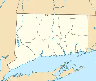
Lage in Connecticut | |||
| Basisdaten | |||
| Gründung: | 1667 | ||
| Staat: | Vereinigte Staaten | ||
| Bundesstaat: | Connecticut | ||
| County: | New Haven County | ||
| Koordinaten: | 41° 27′ N, 72° 48′ W | ||
| Zeitzone: | Eastern (UTC−5/−4) | ||
| Einwohner: | 44.396 (Stand: 2020) | ||
| Fläche: | 103,3 km² (ca. 40 mi²) davon 101,1 km² (ca. 39 mi²) Land | ||
| Höhe: | 46 m | ||
| Postleitzahl: | 06492 | ||
| Vorwahl: | +1 203 | ||
| FIPS: | 09-78740 | ||
| GNIS-ID: | 0213522 | ||
| Website: | www.town.wallingford.ct.us | ||
| Bürgermeister: | William W. Dickinson, Jr. | ||
Am Ort ansässig ist das Eliteinternat Choate Rosemary Hall. Das Gebäude des U.S. Post Office in Delmar ist in das National Register of Historic Places eingetragen.
Geschichte
Die Stadt entstand seit 1638, hieß ursprünglich East River, wurde 1670 inkorporiert und in Wallingford umbenannt. 1697 fand hier der letzte Hexenprozess in Neuengland statt; Winifred Benham wurde dreimal wegen Hexerei angeklagt und stets freigesprochen.[1] Seit 1835 gab es in Wallingford eine Produktion von Silberwaren.
Am 2. September 1913 ereignete sich bei der Stadt ein schwerer Eisenbahnunfall, bei dem 26 Menschen starben.
Söhne und Töchter der Stadt
- Jovan Alexandre (* 1988), Jazzmusiker
- Stephen R. Bradley (1754–1830), US-Senator für Connecticut
- Samuel Wittlesey Dana (1760–1830), US-Senator für Connecticut
- Robert Gober (* 1954), Künstler
- Lyman Hall (1724–1790), einer der Gründerväter der USA
- Jared Potter Kirtland (1793–1877), Arzt, Politiker und Naturforscher
- George Schaefer (1920–1997), Regisseur
Weblinks
- Offizieller Internetauftritt der Stadt Wallingford
Einzelnachweise
- John Putnam Demos: Entertaining Satan: Witchcraft and the Culture of Early New England, Oxford Press, 2004, S. 409.