Thel
| Thel | ||
|---|---|---|
.svg.png.webp)
|
| |
| Gemeinde | Cours | |
| Region | Auvergne-Rhône-Alpes | |
| Département | Rhône | |
| Arrondissement | Villefranche-sur-Saône | |
| Koordinaten | 46° 7′ N, 4° 23′ O | |
| Postleitzahl | 69470 | |
| Ehemaliger INSEE-Code | 69247 | |
| Eingemeindung | 1. Januar 2016 | |
| Status | Commune déléguée | |
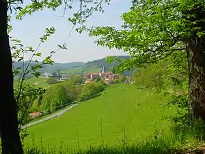 Blick auf Thel | ||

Thel ist eine Commune déléguée in der französischen Gemeinde Cours mit 339 Einwohnern (Stand: 1. Januar 2019) im Département Rhône in der Region Auvergne-Rhône-Alpes.
Zum 1. Januar 2016 wurden Thel, Cours-la-Ville und Pont-Trambouze zur Commune nouvelle Cours zusammengeschlossen. Sie hat seither den Status einer Commune déléguée. Die Gemeinde Thel gehörte zum Arrondissement Villefranche-sur-Saône und zum Kanton Thizy-les-Bourgs (bis 2015: Kanton Lamure-sur-Azergues).
Lage
Thel liegt 52 Kilometer nordnordwestlich von Lyon, etwa 25 Kilometer ostnordöstlich von Roanne und rund 29 Kilometer nordwestlich von Villefranche-sur-Saône.
Bevölkerungsentwicklung
| Jahr | 1962 | 1968 | 1975 | 1982 | 1990 | 1999 | 2006 | 2013 |
| Einwohner | 287 | 265 | 272 | 278 | 302 | 293 | 293 | 326 |
| Quelle: Cassini und INSEE | ||||||||
Sehenswürdigkeiten
- Kirche
Weblinks
Commons: Thel – Sammlung von Bildern, Videos und Audiodateien
This article is issued from Wikipedia. The text is licensed under Creative Commons - Attribution - Sharealike. The authors of the article are listed here. Additional terms may apply for the media files, click on images to show image meta data.