Tenarunga
Tenarunga (alter Name: Minto Island) ist ein unbewohntes Atoll des Tuamotu-Archipels in Französisch-Polynesien. Es gehört geographisch zu den Actéon-Inseln und administrativ zur Gemeinde Gambier. Das Atoll liegt 15 km nordwestlich von Matureivavao und 6 km östlich von Vahanga. Die 5 km große Lagune der Insel hat keinen Zugang zum Meer.
| Tenarunga | ||
|---|---|---|
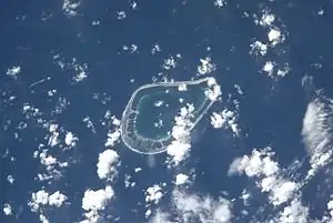 NASA-Bild von Tenarunga | ||
| Gewässer | Pazifischer Ozean | |
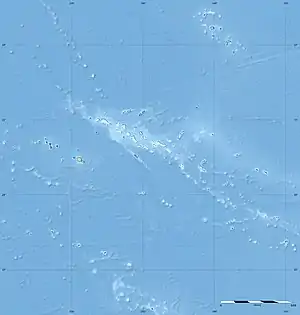
| Archipel | Tuamotu-Archipel | |
| Geographische Lage | 21° 21′ S, 136° 32′ W | |
| ||
| Anzahl der Inseln | – | |
| Landfläche | 2,3 km² | |
| Lagunenfläche | 5 km² | |
| Einwohner | unbewohnt | |
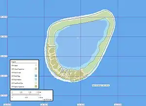 Karte | ||
Tenarunga wurde am 5. Februar 1605 vom portugiesischen Seefahrer Pedro Fernández de Quirós entdeckt.
Literatur
- Sailing Directions, Pub 126, "Pacific Islands" NIMA 2002; page-12
Weblinks
- Bild und Kurzbeschreibung (englisch) (Memento vom 23. Dezember 2010 im Internet Archive)
- Volgewelt des Atolls (englisch)
- Fauna und Flora des Atolls (PDF, englisch)
Ahe | Ahunui | Akiaki | Amanu | Anaa | Anuanuraro | Anuanurunga | Apataki | Aratika | Arutua | Faaite | Fakahina | Fakarava | Fangatau | Fangataufa | Hao | Haraiki | Héréhérétué | Hikueru | Hiti | Katiu | Kauehi | Kaukura | Makatea | Makemo | Manihi | Manuhangi | Maria Est | Marokau | Marutea Nord | Marutea Sud | Mataiva | Matureivavao | Morane | Motutunga | Mururoa | Napuka | Nengonengo | Niau | Nihiru | Nukutavake | Nukutepipi | Paraoa | Pinaki | Puka-Puka | Puka Rua | Rangiroa | Raraka | Raroia | Ravahere | Reao | Reitoru | Rekareka | Taenga | Tahanea | Taiaro | Takapoto | Takaroa | Takume | Tatakoto | Tauere | Tekokota | Tematangi | Temoe | Tenararo | Tenarunga | Tepoto Nord | Tepoto Sud | Tikehau | Tikei | Toau | Tuanake | Tureia | Vahanga | Vahitahi | Vairaatea | Vanavana