Staudach (Gemeinde Leonding)
Staudach ist der südwestlichste Stadtteil von Leonding. Mit 45 Einwohnern (Stand 1. Jänner 2021)[1] ist Staudach einer der bevölkerungsärmsten Stadtteile Leondings.
| Staudach (Dorf) Ortschaft | |||
|---|---|---|---|
| |||
| Basisdaten | |||
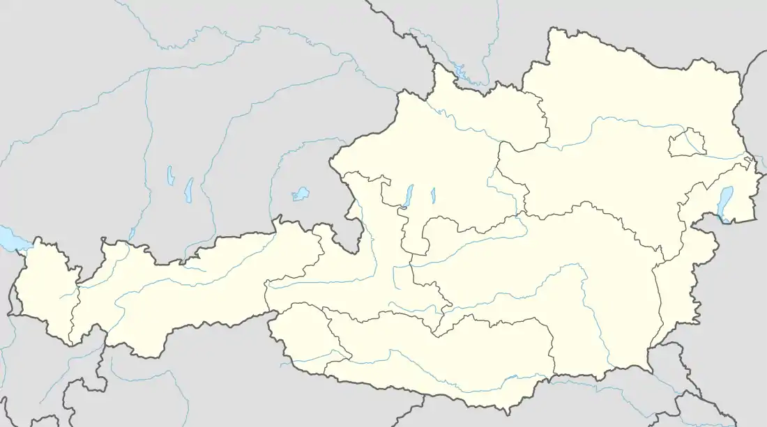
| Pol. Bezirk, Bundesland | Linz-Land (LL), Oberösterreich | ||
| Gerichtsbezirk | Traun | ||
| Pol. Gemeinde | Leonding (KG Rufling) | ||
| Koordinaten | 48° 15′ 17″ N, 14° 13′ 52″ O | ||
| Höhe | 285 m ü. A. | ||
| Einwohner der Ortschaft | 45 (1. Jän. 2021) | ||
| Postleitzahl | 4060 Leonding | ||
| Statistische Kennzeichnung | |||
| Ortschaftskennziffer | 09904 | ||
| Zählsprengel/ -bezirk | Leonding-Land (41012 060) | ||
| Quelle: STAT: Ortsverzeichnis; BEV: GEONAM; DORIS | |||
Staudachrunde
Die Strecke folgt auf einer Länge von 7,75 km den Spuren des 10-Meilen-Laufes durch Felder und Ortsteile mit dörflichem Charakter. Ausgangspunkt ist das Schulzentrum Hart, vorbei am Eislaufplatz über Reith, Jetzing, Staudach, Felling zurück nach Reith zum Ausgangspunkt.[2]
Einzelnachweise
- Statistik Austria: Bevölkerung am 1.1.2021 nach Ortschaften (Gebietsstand 1.1.2021), (xlsx)
- Laufen, Walken & Wandern - Stadt Leonding. Abgerufen am 7. Februar 2022.
Katastralgemeinden: Holzheim | Leonding | Ruefling
Ortschaften: Aichberg | Alharting | Berg | Bergham | Buchberg | Doppl | Enzenwinkl | Felling | Friesenegg | Gaumberg | Haag | Hart | Holzheim | Imberg | Jetzing | Kinderdorf Sankt Isidor | Leonding | Reith | Rufling | Staudach | Untergaumberg | Zaubertal
Stadt: Leonding Stadtteile: Alharting • Berg • Bergham • Buchberg • Gaumberg • Haag • Imberg • Leonding • Untergaumberg Dörfer: Enzenwinkl • Friesenegg • Holzheim • Kinderdorf Sankt Isidor • Reith • Rufling • Staudach Siedlungen: Doppl • Hart • Zaubertal Weiler: Felling • Jetzing Rotten: Aichberg
Zählsprengel: Leonding-Zentralbereich: Alt-Leonding | Neu-Leonding-Ost | Neu-Leonding-West Gaumberg-Buchberg: Gaumberg-N-Buchberg | Gaumberg-S-Untergaumberg Kinderdorf St.Isidor: Kinderdorf St.Isidor Haag: Haag-Nord | Haag-Süd | Haag-Ost Hart: Hart-Ost | Hart-West | Hart-Nord | Hart-Nord-Giwog-Teil 1 | Hart-Nord-Giwog-Teil 2 Doppl: Doppl-Ost | Doppl-West Ländl.Bereich im Westen: Leonding-Land | Rufling Alharting-Holzheim u.Umg.: Holzheim und Umgebung | Alharting und Umgebung