St. Ignace Island
St. Ignace Island (französisch Île Saint-Ignace) ist eine 274 km² große unbewohnte Insel im Oberen See.
| St. Ignace Island | ||
|---|---|---|
| Gewässer | Oberer See | |
| Geographische Lage | 48° 48′ N, 87° 56′ W | |
| ||
| Fläche | 274 km² | |
| Höchste Erhebung | Mount St. Ignace 569 m | |
| Einwohner | unbewohnt | |
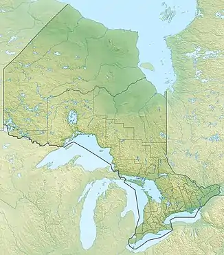
Sie liegt im Thunder Bay District der kanadischen Provinz Ontario. Die Insel befindet sich vor der Nordküste des Oberen See, zwischen der Nipigon Bay und dem Hauptsee.
Die Insel wurde von Missionaren des Jesuitenordens zu Ehren ihres Ordensgründers Ignatius von Loyola benannt.
Die Nipigon Strait trennt St. Ignace Island von der westlich gelegenen Black Bay-Halbinsel. Östlich von St. Ignace Island befindet sich die Simpson Island.
Die Insel ist etwa 20 km von der nächsten Gemeinde, Red Rock, entfernt. Der 569 m hohe Mount St. Ignace ist die höchste Erhebung der Insel.
This article is issued from Wikipedia. The text is licensed under Creative Commons - Attribution - Sharealike. The authors of the article are listed here. Additional terms may apply for the media files, click on images to show image meta data.