Shawnee (Kansas)
Shawnee ist eine schnell wachsende Stadt mit 62.209 Einwohnern (2010) im Johnson County im US-Bundesstaat Kansas.
| Shawnee | |||
|---|---|---|---|
| Spitzname: Gum Springs | |||
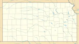
Lage in Kansas | |||
| Basisdaten | |||
| Staat: | Vereinigte Staaten | ||
| Bundesstaat: | Kansas | ||
| County: | Johnson County | ||
| Koordinaten: | 39° 1′ N, 94° 46′ W | ||
| Zeitzone: | Central (UTC−6/−5) | ||
| Einwohner: – Metropolregion: | 67.311 (Stand: 2020) 2.067.585 (Stand: 2009) | ||
| Fläche: | 110,2 km² (ca. 43 mi²) davon 108,1 km² (ca. 42 mi²) Land | ||
| Höhe: | 325 m | ||
| Postleitzahlen: | 66200-66299 | ||
| Vorwahl: | +1 913 | ||
| FIPS: | 20-64500 | ||
| GNIS-ID: | 0478925 | ||
| Website: | www.cityofshawnee.org | ||
| Bürgermeister: | Michelle Distler | ||
Shawnee ist Bestandteil der Metropolregion Kansas City.
Geografie
Shawnee befindet sich im Nordwesten Johnson Countys und zählt damit zu den Vorstädten Kansas Citys.
Bevölkerungsentwicklung
| Jahr | Bevölkerung |
|---|---|
| 1930 | 553 |
| 1940 | 597 |
| 1950 | 845 |
| 1960 | 9.072 |
| 1970 | 20.946 |
| 1980 | 29.653 |
| 1990 | 37.993 |
| 2000 | 47.996 |
| 2010 | 62.209 |
Geschichte
Der Ort wurde nach einem indianischen Stamm, den Shawnee benannt, die um 1820 in dieses Gebiet umgesiedelt wurden.
This article is issued from Wikipedia. The text is licensed under Creative Commons - Attribution - Sharealike. The authors of the article are listed here. Additional terms may apply for the media files, click on images to show image meta data.
