Plumpudding Island
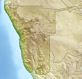
Plumpudding Island ist eine nahezu rautenförmige kleine Felseninsel im Südatlantik, rund 590 Meter vor der Diamantenküste Namibias. Die Insel liegt in der Baker Bay, 2400 Meter nördlich von Sinclair Island.
| Plumpudding Island | ||
|---|---|---|
| Gewässer | Baker Bay, Südatlantik | |
| Inselgruppe | Penguin Islands | |
| Geographische Lage | 27° 38′ 30″ S, 15° 30′ 50″ O | |
| ||
| Länge | 150 m | |
| Breite | 100 m | |
| Fläche | 1,5 ha | |
| Höchste Erhebung | 20 m | |
| Einwohner | unbewohnt | |
| Hauptort | - | |
Plumpudding Island gehört zu den Penguin Islands und ist bekannt als Guanoinsel, da hier noch bis 1949 Guano abgebaut wurde. Eine Station auf der Ostseite der Insel zeugt noch von dieser Vergangenheit. Die Insel ist Teil des Meob-Chamais Meeresschutzgebietes, wobei in der näheren Umgebung intensiver Bergbau betrieben wird.
740 Meter südlich der Insel liegt das Felseneiland Black Sophie Rock.
Weblinks
- Foto von Plumpudding Island aus der Namibia-Photo Sammlung von Klaus Dierks
- Forschungsbericht der Universität Kapstadt zu Seevögeln auf Plumpudding Island (englisch)
This article is issued from Wikipedia. The text is licensed under Creative Commons - Attribution - Sharealike. The authors of the article are listed here. Additional terms may apply for the media files, click on images to show image meta data.
