Orroroo Carrieton District Council
Der District Council of Orroroo Carrieton ist ein lokales Verwaltungsgebiet (LGA) im australischen Bundesstaat South Australia. Das Gebiet ist 3300 km² groß und hat etwa 900 Einwohner (2016).
| District Council of Orroroo Carrieton | |
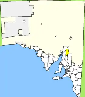 Lage des Orroroo Carrieton District Council in South Australia | |
| Gliederung | |
| Staat: | |
| Bundesstaat: | |
| Verwaltungssitz: | Orroroo |
| Daten und Zahlen | |
| Fläche: | 3.300 km² |
| Einwohner: | 895 (2016) [1] |
| Bevölkerungsdichte: | 0,3 Einwohner je km² |
Orroroo Carrieton liegt in der Northern Region etwa 240 Kilometer nördlich der Metropole Adelaide. Das Gebiet beinhaltet 20 Ortsteile und Ortschaften: Belton, Bendelby, Black Rock, Carrieton, Erskine, West Erskine, Eurelia, Johnburgh, Morchard, Oladdie, Orroroo, Orroroo East, Pamatta, Pekina, Uroonda, Walloway, Wepowie, Yalpara, Yanyarrie und Yatina. Der Verwaltungssitz des Councils befindet sich in Orroroo im Süden der LGA.
Verwaltung
Der Council von Orroroo Carrieton hat neun Mitglieder, die acht Councillor und der Vorsitzende (Chairman) des Councils werden von den Bewohnern der LGA gewählt. Der Orroroo Carrieton District Council ist nicht in Bezirke untergliedert.
Weblinks
- Website des Orroroo Carrieton Council (englisch)
Quellen
- Australian Bureau of Statistics: Orroroo/Carrieton (DC) (Local Government Area) (Englisch) In: 2016 Census QuickStats. 27. Juni 2017. Abgerufen am 20. April 2020.