Murias (Candamo)
Murias ist eines von elf Parroquias in der Gemeinde Candamo der autonomen Region Asturien in Spanien.
| Gemeinde Candamo: Parroquia Murias | |||
|---|---|---|---|
| Wappen | Karte von Spanien | ||
| ? Hilfe zu Wappen |
| ||
| Basisdaten | |||
| Autonome Gemeinschaft: | |||
| Comarca: | Avilés | ||
| Koordinaten | 43° 26′ N, 6° 3′ W | ||
| Höhe: | 35 msnm | ||
| Fläche: | 8,9 km² | ||
| Einwohner: | 287 (1. Januar 2011)INE | ||
| Bevölkerungsdichte: | 32,25 Einw./km² | ||
| Postleitzahl: | 33828 | ||
| Ortskennzahl: | 33010060000 | ||
| Nächster Flughafen: | Flughafen Asturias 24 km | ||
| Verwaltung | |||
| Adresse der Gemeindeverwaltung: | Carretera General, s/n 33829 GRULLOS | ||
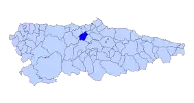
| Lage der Gemeinde | |||
 | |||


Sehenswürdigkeiten
- Kirche Santa María in Murias
Feste und Feiern
- 28. August „Fiesta de San Agustín“ in Murias
- 9. September „Fiesta de Nuestra Señora“ in Agüera
Dörfer und Weiler in der Parroquia
- Agüera – 39 Einwohner 2011 - 43° 25′ 5″ N, 6° 3′ 24″ W
- Bohles – 29 Einwohner 2011
- El Caleyo – 23 Einwohner 2011
- Figaredo – 21 Einwohner 2011
- Murias – 66 Einwohner 2011 - 43° 25′ 49″ N, 6° 3′ 2″ W
- Sandiche – 60 Einwohner 2011 - 43° 25′ 37″ N, 6° 3′ 40″ W
- Villamarin – 14 Einwohner 2011 - 43° 24′ 55″ N, 6° 3′ 56″ W
- Villar – 35 Einwohner 2011 - 43° 25′ 50″ N, 6° 2′ 9″ W
Quellen
- Bevölkerungszahlen siehe INE
- Postleitzahlen siehe
- Koordinaten und Höhenangaben siehe Google Earth
Weblinks
This article is issued from Wikipedia. The text is licensed under Creative Commons - Attribution - Sharealike. The authors of the article are listed here. Additional terms may apply for the media files, click on images to show image meta data.