Mansfield (Connecticut)
Mansfield ist eine Stadt im Tolland County im US-Bundesstaat Connecticut, Vereinigte Staaten, mit 24.300 Einwohnern (Stand: 2004). Die geographischen Koordinaten sind: 41,76° Nord, 72,24° West. Das Stadtgebiet hat eine Größe von 117,8 km².
| Mansfield | |
|---|---|
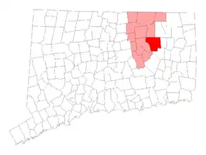 Lage in Connecticut | |
| Basisdaten | |
| Staat: | Vereinigte Staaten |
| Bundesstaat: | Connecticut |
| County: | Tolland County |
| Koordinaten: | 41° 47′ N, 72° 14′ W |
| Zeitzone: | Eastern (UTC−5/−4) |
| Einwohner: | 25.892 (Stand: 2020) |
| Fläche: | 117,8 km² (ca. 45 mi²) davon 115,2 km² (ca. 44 mi²) Land |
| Höhe: | 195 m |
| Postleitzahlen: | 06235, 06250, 06268 |
| Vorwahl: | +1 860 |
| FIPS: | 09-44910 |
| GNIS-ID: | 0213456 |
| Website: | www.mansfieldct.org |
| Bürgermeister: | Elizabeth C. Paterson |
Im Stadtteil Storrs befindet sich der Campus der University of Connecticut.
Schulen
- University of Connecticut
- Mansfield Middle School
- Goodwin School
- Southeast School
- Vinton School
Weblinks
Commons: Mansfield (Connecticut) – Sammlung von Bildern, Videos und Audiodateien
This article is issued from Wikipedia. The text is licensed under Creative Commons - Attribution - Sharealike. The authors of the article are listed here. Additional terms may apply for the media files, click on images to show image meta data.