M54 motorway
Der zwischen 1975 und 1983 für den Verkehr freigegebene M54 motorway (englisch für Autobahn M54), auch bekannt als Telford dual carriageway, ist eine 37,0 km lange Autobahn in England. Er verbindet den Raum um Wolverhampton mit Telford und bildet damit einen Teil der Verkehrsachse von London nach Dublin in Irland (via Holyhead).
| M54 motorway im Vereinigten Königreich | |||||||||||||||||||||||||
| Karte | |||||||||||||||||||||||||
_map.svg.png.webp) Verlauf der M 54 | |||||||||||||||||||||||||
| Basisdaten | |||||||||||||||||||||||||
| Betreiber: | Highways Agency | ||||||||||||||||||||||||
| Straßenbeginn: | M6 motorway, Ausfahrt (junction) 10A, bei Essington | ||||||||||||||||||||||||
| Straßenende: | Wellington (Shropshire) | ||||||||||||||||||||||||
| Gesamtlänge: | 37,0 km (23 mi) | ||||||||||||||||||||||||
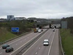 | |||||||||||||||||||||||||
| Der M54 bei Junction 5 (Aufnahme 2008) | |||||||||||||||||||||||||
Straßenverlauf
| |||||||||||||||||||||||||
Weblinks
This article is issued from Wikipedia. The text is licensed under Creative Commons - Attribution - Sharealike. The authors of the article are listed here. Additional terms may apply for the media files, click on images to show image meta data.