M32 motorway
Der zwischen 1966 und 1975 eröffnete M32 motorway (englisch für Autobahn M32) ist eine 7,1 km lange Autobahn in England. Er verbindet den M4 motorway mit dem Zentrum der Stadt Bristol.
| M32 motorway im Vereinigten Königreich | |||||||||||||
| Karte | |||||||||||||
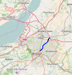 Verlauf der M 32 | |||||||||||||
| Basisdaten | |||||||||||||
| Betreiber: | Highways Agency | ||||||||||||
| Straßenbeginn: | M4 motorway, Ausfahrt (junction) 19, Hambrook | ||||||||||||
| Straßenende: | St Pauls, Bristol | ||||||||||||
| Gesamtlänge: | 7.1 km (4.4 mi) | ||||||||||||
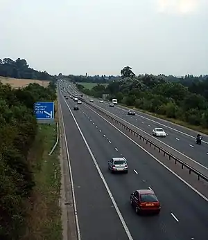 | |||||||||||||
| Der M32 zwischen Junction 1 und Junction 2 (Aufnahme 2004) | |||||||||||||
Straßenverlauf
| |||||||||||||
Weblinks
This article is issued from Wikipedia. The text is licensed under Creative Commons - Attribution - Sharealike. The authors of the article are listed here. Additional terms may apply for the media files, click on images to show image meta data.