Loch of Yarrows
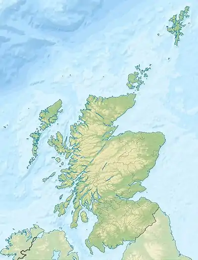
Loch of Yarrows ist ein schottischer Süßwassersee. Er liegt in der traditionellen Grafschaft Caithness in der Council Area Highland etwa acht Kilometer südöstlich von Wick.
| Loch of Yarrows | ||
|---|---|---|
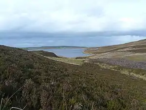 | ||
| Loch of Yarrows von Süden fotografiert. | ||
| Geographische Lage | Highland, Schottland | |
| Zuflüsse | Black Loch | |
| Abfluss | Burn of Thrumster | |
| Daten | ||
| Koordinaten | 58° 22′ 39″ N, 3° 10′ 57″ W | |
| ||
| Höhe über Meeresspiegel | 93 m | |
| Fläche | 0,45 km² | |
| Länge | 1,1 km | |
| Breite | 500 m | |
Loch of Yarrows ist circa 1100 m lang und im Mittel etwa 500 m breit. Die Ufer des Sees sind unbewohnt und zeigen sich vollständig als Grasland. Am Westufer befinden sich die Überreste eines Brochs – eines fensterlosen eisenzeitlichen Turms, dessen Funktion bis heute nicht abschließend geklärt ist.
Der Loch of Yarrows ist ein Angelgebiet, in dem vor allem Forellen gefangen werden können.
Weblinks
- Beschreibung des Brochs (englisch)
- Informationen für Wanderer (englisch)
- Informationen für Angler (englisch)
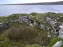
Das Broch am Loch of Yarrows
This article is issued from Wikipedia. The text is licensed under Creative Commons - Attribution - Sharealike. The authors of the article are listed here. Additional terms may apply for the media files, click on images to show image meta data.