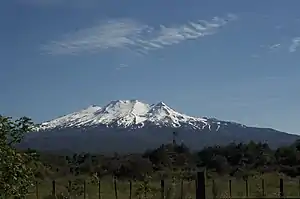
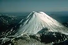
Liste von Vulkanen in Neuseeland

Dies i​st eine Liste v​on Vulkanen i​n Neuseeland, d​ie während d​es Quartärs mindestens einmal a​ktiv waren.

Bild Name Insel Inselgruppe/Region Vulkantyp Letzte Eruption Höhe [m] Geokoordinaten
Antipoden-Inseln Aschenkegel[1] unbekannt 402[1] !450.3166675678.766667549° 41′ 00″ S, 178° 46′ 00″ O[1]
Auckland Volcanic Field Nordinsel, Rangitoto Auckland (Region) Vulkanfeld ca. 1350 260 !463.1000005674.866667536° 54′ 00″ S, 174° 52′ 00″ O
Brothers Kermadecinseln Submariner Vulkan unbekannt -1350 !465.1252785679.075278534° 52′ 29″ S, 179° 04′ 31″ O
Clark Kermadecinseln Submariner Vulkan unbekannt -860 !463.5536115677.838889536° 26′ 47″ S, 177° 50′ 20″ O
Curtis Island Kermadecinseln Submariner Vulkan unbekannt 137 !469.4577785321.439167530° 32′ 32″ S, 178° 33′ 39″ W
Giggenbach Kermadecinseln Submariner Vulkan unbekannt -65 !469.9641675321.287500530° 02′ 09″ S, 178° 42′ 45″ W
Healy Kermadecinseln Submariner Vulkan 1360 ± 75 Jahre -980 !464.9963895678.972500535° 00′ 13″ S, 178° 58′ 21″ O
Kaikohe-Bay of Islands-Vulkanfeld Nordinsel Northland Vulkanfeld 400 n. Chr. ± 300 Jahre 388 !464.7000005673.900000535° 18′ 00″ S, 173° 54′ 00″ O
Macauley Island Kermadecinseln Caldera 4360 v. Chr. ± 200 Jahre 238 !469.8000005321.533333530° 12′ 00″ S, 178° 28′ 00″ W
Maroa Nordinsel Waikato (Region) Calderen ca. 180 n. Chr. 1156 !461.5833335676.083333538° 25′ 00″ S, 176° 05′ 00″ O
Mayor Island (Tuhua) Bay of Plenty (Region) Schildvulkan 5060 v. Chr. ± 200 Jahre 355 !462.7166675676.250000537° 17′ 00″ S, 176° 15′ 00″ O
Monowai Kermadecinseln Submariner Vulkan 2008 -132 !474.1125005322.811944525° 53′ 15″ S, 177° 11′ 17″ W
Okataina Nordinsel Bay of Plenty (Region) Vulkanfeld 1981 1111 !461.8833335676.500000538° 07′ 00″ S, 176° 30′ 00″ O
Raoul Island Kermadecinseln Schichtvulkan 2006 516 !470.7333335322.083333529° 16′ 00″ S, 177° 55′ 00″ W
Reporoa-Caldera Nordinsel Bay of Plenty (Region) Caldera ca. 1180 592 !461.5833335676.333333538° 25′ 00″ S, 176° 20′ 00″ O
Rotorua Nordinsel Bay of Plenty (Region) Caldera <25000 BP 757 !461.9166675676.266667538° 05′ 00″ S, 176° 16′ 00″ O
Ruapehu Nordinsel Manawatu-Wanganui Schichtvulkan 2007 2797 !460.7166675675.566667539° 17′ 00″ S, 175° 34′ 00″ O
Rumble II West Kermadecinseln Submariner Vulkan unbekannt -1200 !464.6466675678.526667535° 21′ 12″ S, 178° 31′ 36″ O
Rumble III Kermadecinseln Submariner Vulkan 2008 ± 1 Jahr -220 !464.2550005678.478333535° 44′ 42″ S, 178° 28′ 42″ O
Rumble IV Kermadecinseln Submariner Vulkan unbekannt -500 !463.8666675678.050000536° 08′ 00″ S, 178° 03′ 00″ O
Rumble V Kermadecinseln Submariner Vulkan unbekannt -400 !463.8583335678.195833536° 08′ 30″ S, 178° 11′ 45″ O
Tangaroa Kermadecinseln Submariner Vulkan unbekannt -600 !463.6791675678.028333536° 19′ 15″ S, 178° 01′ 42″ O
Mount Taranaki (Mount Egmont) Nordinsel Taranaki Schichtvulkan 1854 2518 !460.7000005674.066667539° 18′ 00″ S, 174° 04′ 00″ O
Taupo Nordinsel Waikato (Region) Caldera ca. 260 n. Chr. 760 !461.1833335676.000000538° 49′ 00″ S, 176° 00′ 00″ O
Tongariro, Ngauruhoe Nordinsel Manawatu-Wanganui Schichtvulkane 1977 2291 !460.8416675675.633333539° 09′ 30″ S, 175° 38′ 00″ O
Volcano W Kermadecinseln Submarine Vulkane unbekannt -900 !468.1500005320.816667531° 51′ 00″ S, 179° 11′ 00″ W
Moutohora Island (Whale Island) Bay of Plenty (Region) >9000 BP 354 !462.1416675676.983333537° 51′ 30″ S, 176° 59′ 00″ O
Whangarei-Vulkanfeld Nordinsel Northland Vulkanfeld unbekannt 397 !464.2500005674.266667535° 45′ 00″ S, 174° 16′ 00″ O
Whakaari / White Island Bay of Plenty (Region) Schichtvulkane 2019 321 !462.4833335677.183333537° 31′ 00″ S, 177° 11′ 00″ O

Siehe auch

Einzelnachweise

  1. Antipodes Island. Global Volcanism Program, Smithsonian Institution.
This article is issued from Wikipedia. The text is licensed under Creative Commons - Attribution - Sharealike. The authors of the article are listed here. Additional terms may apply for the media files, click on images to show image meta data.