Liste der Ramsar-Gebiete in Australien
Die Ramsar-Gebiete in Australien sind nach der 1971 beschlossenen Ramsar-Konvention besondere Schutzzonen für ein natürliches Feuchtgebiet auf dem Territorium des Landes. Ramsar-Gebiete besitzen gemäß dem Anliegen dieses völkerrechtlichen Vertrags eine hohe Bedeutung und dienen insbesondere dem Erhalt der Lebensräume von Wasser- und Watvögeln. In Australien gibt es insgesamt 66 Ramsar-Gebiete mit einer Gesamtfläche von 8.307.694 Hektar.
Liste
| Name des Ramsar-Gebiets | Bild | Region | Karte | Lage | Ramsar-Nr. | Fläche [ha] | Ausweisungsdatum | Anmerkungen | ||
|---|---|---|---|---|---|---|---|---|---|---|
| Apsley Marshes | Tasmania |
|
41° 58′ 59″ S, 148° 12′ 0″ O | 255 | 880 | 16. Nov. 1982 | An der Mündung des Apsley Rivers gelegenes Marschland | |||
| Ashmore Reef Commonwealth Marine Reserve |  |
External Territory of Ashmore and Cartier Islands |
|
12° 13′ 59″ S, 123° 7′ 0″ O | 1220 | 58.300 | 21. Okt. 2002 | |||
| Banrock Station Wetland Complex | South Australia |
|
34° 10′ 59″ S, 140° 19′ 59″ O | 1221 | 1375 | 21. Okt. 2002 | ||||
| Barmah Forest | 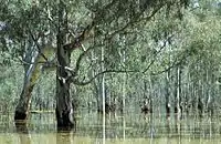 |
South Australia |
|
35° 55′ 0″ S, 145° 7′ 59″ O | 262 | 28.515 | 15. Dez. 1982 | |||
| Becher Point Wetlands | 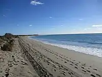 |
Western Australia |
|
32° 22′ 0″ S, 115° 43′ 59″ O | 1048 | 708 | 5. Jan. 2001 | |||
| Blue Lake |  |
New South Wales |
|
36° 24′ 0″ S, 148° 19′ 0″ O | 800 | 338 | 17. März 1996 | |||
| Bool and Hacks Lagoons | 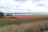 |
South Australia |
|
37° 7′ 59″ S, 140° 40′ 59″ O | 322 | 3.200 | 1. Nov. 1985 | |||
| Bowling Green Bay | Queensland |
|
19° 27′ 0″ S, 147° 15′ 0″ O | 632 | 35.500 | 22. Okt. 1993 | ||||
| Cape Barren Island,east coast lagoons | Tasmania |
|
40° 22′ 42″ S, 148° 24′ 5″ O | 256 | 4.473 | 16. Nov. 1982 | ||||
| Cobourg Peninsula | 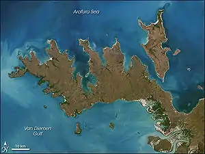 |
Northern Territory |
|
11° 25′ 0″ S, 132° 15′ 0″ O | 1 | 220.700 | 8. Mai 1974 | |||
| Coongie Lakes | 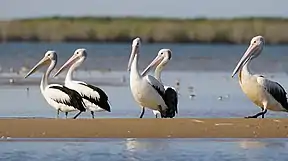 |
South Australia |
|
27° 34′ 33″ S, 139° 56′ 26″ O | 376 | 2.178.952 | 15. Juni 1987 | |||
| Coral Sea Reserves | Coral Sea Islands Territory |
|
16° 52′ 13″ S, 149° 49′ 14″ O | 1222 | 1.728.920 | 21. Okt. 2002 | ||||
| Corner Inlet | 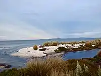 |
Victoria |
|
38° 45′ 0″ S, 146° 31′ 59″ O | 261 | 67.186 | 15. Dez. 1982 | |||
| Currawinya Lakes | 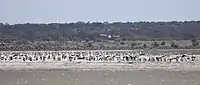 |
Queensland |
|
28° 47′ 35″ S, 144° 33′ 9″ O | 791 | 151.300 | 11. März 1996 | |||
| Edithvale-Seaford Wetlands | 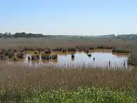 |
Victoria |
|
38° 4′ 0″ S, 145° 7′ 0″ O | 1096 | 261 | 29. Aug. 2001 | |||
| Eighty Mile Beach | 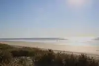 |
Western Australia |
|
19° 28′ 59″ S, 120° 34′ 59″ O | 480 | 125.000 | 7. Juni 1990 | |||
| Elizabeth and Middleton Reefs Marine National Nature Reserve | Australia’s East Marine Region |
|
29° 27′ 0″ S, 159° 7′ 0″ O | 1223 | 187.726 | 21. Okt. 2002 | ||||
| Fivebough and Tuckerbil Swamps | .jpg.webp) |
New South Wales |
|
34° 30′ 0″ S, 146° 22′ 59″ O | 1224 | 689 | 21. Okt. 2002 | |||
| Flood Plain Lower Ringarooma River | Tasmania |
|
40° 54′ 0″ S, 147° 55′ 59″ O | 257 | 3519 | 16. Nov. 1982 | ||||
| Forrestdale and Thomsons Lakes | Western Australia |
|
32° 9′ 0″ S, 115° 52′ 0″ O | 481 | 754 | 7. Juni 1990 | ||||
| Ginini Flats Subalpine Bog Complex | Australian Capital Territory |
|
35° 31′ 29″ S, 148° 46′ 53″ O | 793 | 350 | 1. März 1996 | ||||
| Gippsland Lakes | 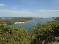 |
Victoria |
|
38° 0′ 0″ S, 147° 36′ 0″ O | 269 | 60.015 | 15. Dez. 1982 | |||
| Glenelg Estuary and Discovery Bay Ramsar Site | Shire of Glenelg, Victoria |
|
38° 0′ 0″ S, 147° 36′ 0″ O | 2.344 | 22.289 | 28. Feb. 2018 | ||||
| Great Sandy Strait | 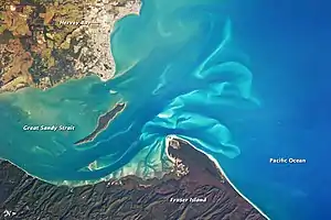 |
Queensland |
|
25° 28′ 0″ S, 152° 54′ 0″ O | 992 | 93.160 | 14. Juni 1999 | |||
| Gunbower Forest | 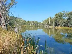 |
Victoria |
|
35° 49′ 0″ S, 144° 19′ 0″ O | 263 | 19.931 | 15. Dez. 1982 | |||
| Gwydir Wetlands Gingham and Lower Gwydir Watercourses | 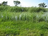 |
New South Wales |
|
29° 18′ 0″ S, 149° 13′ 59″ O | 993 | 823 | 14. Juni 1999 | |||
| Hattah-Kulkyne Lakes | 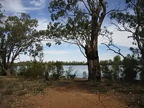 |
Victoria |
|
34° 40′ 59″ S, 142° 25′ 59″ O | 264 | 955 | 15. Dez. 1982 | |||
| Hosnie's Spring | Christmas Island |
|
10° 28′ 0″ S, 105° 40′ 59″ O | 512 | 202 | 11. Dez. 1990 | ||||
| Hunter Estuary Wetlands | 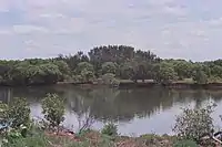 |
New South Wales |
|
32° 51′ 0″ S, 151° 46′ 0″ O | 287 | 3.388 | 21. Feb. 1984 | |||
| Interlaken Lakeside Reserve | Tasmania |
|
42° 9′ 0″ S, 147° 10′ 0″ O | 259 | 517 | 16. Nov. 1982 | ||||
| Jocks Lagoon | Tasmania |
|
41° 20′ 41″ S, 148° 18′ 29″ O | 258 | 19 | 16. Nov. 1982 | ||||
| Kakadu National Park | 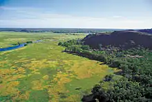 |
Northern Territory |
|
12° 40′ 0″ S, 132° 45′ 0″ O | 204 | 1.979.766 | 6. Dez. 1980 | |||
| Kerang Wetlands |  |
Victoria |
|
35° 39′ 39″ S, 143° 52′ 16″ O | 265 | 9.784 | 15. Dez. 1982 | |||
| Lake Albacutya | .jpg.webp) |
Victoria |
|
35° 46′ 0″ S, 141° 58′ 0″ O | 270 | 5.731 | 15. Dez. 1982 | |||
| Lake Gore | Western Australia |
|
33° 46′ 59″ S, 121° 28′ 59″ O | 1.049 | 4.017 | 5. Jan. 2001 | ||||
| Lake Pinaroo |  |
New South Wales |
|
29° 6′ 0″ S, 141° 13′ 0″ O | 799 | 719 | 17. März 1996 | |||
| Lakes Argyle and Kununurra | .jpg.webp) |
Western Australia |
|
16° 19′ 59″ S, 128° 39′ 0″ O | 478 | 150.000 | 7. Juni 1990 | |||
| Lake Warden system | Western Australia |
|
33° 48′ 0″ S, 121° 55′ 59″ O | 485 | 2.300 | 7. Juni 1990 | ||||
| Lavinia Nature Reserve | Tasmania |
|
39° 45′ 0″ S, 144° 4′ 59″ O | 253 | 7.034 | 16. Nov. 1982 | ||||
| Little Llangothlin Nature Reserve | New South Wales |
|
30° 5′ 11″ S, 151° 46′ 54″ O | 798 | 257,6 | 17. März 1996 | ||||
| Little Waterhouse Lake | Tasmania |
|
40° 52′ 30″ S, 147° 36′ 39″ O | 260 | 56 | 16. Nov. 1982 | ||||
| Logan Lagoon | Tasmania |
|
40° 10′ 0″ S, 148° 16′ 59″ O | 252 | 2.257 | 16. Nov. 1982 | ||||
| Macquarie Marshes |  |
New South Wales |
|
30° 45′ 0″ S, 147° 33′ 0″ O | 337 | 19.850 | 1. Aug. 1986 | |||
| Moreton Bay |  |
Queensland |
|
27° 19′ 59″ S, 153° 10′ 0″ O | 631 | 113.314 | 22. Okt. 1993 | |||
| Moulting Lagoon | Tasmania |
|
42° 1′ 59″ S, 148° 10′ 59″ O | 251 | 4.507 | 16. Nov. 1982 | ||||
| Muir-Byenup System | 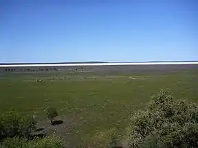 |
Western Australia |
|
34° 28′ 59″ S, 116° 43′ 0″ O | 1.050 | 10.631 | 5. Jan. 2001 | |||
| Myall Lakes | 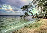 |
New South Wales |
|
32° 30′ 0″ S, 152° 16′ 59″ O | 994 | 44.612 | 14. Juni 1999 | |||
| Narran Lake Nature Reserve | New South Wales |
|
29° 43′ 0″ S, 147° 25′ 59″ O | 995 | 8.447 | 14. Juni 1999 | ||||
| NSW Central Murray State Forests | New South Wales |
|
35° 39′ 0″ S, 144° 39′ 0″ O | 1.291 | 83.992 | 20. Mai 2003 | ||||
| Ord River Floodplain | Western Australia |
|
15° 31′ 13″ S, 128° 19′ 48″ O | 477 | 140.766 | 7. Juni 1990 | ||||
| Paroo River Wetlands |  |
New South Wales |
|
30° 19′ 59″ S, 143° 51′ 0″ O | 1.716 | 138.304 | 13. Sep. 2007 | |||
| Peel-Yalgorup system | 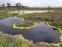 |
Western Australia |
|
32° 49′ 0″ S, 115° 42′ 0″ O | 482 | 26.530 | 7. Juni 1990 | |||
| Piccaninnie Ponds Karst Wetlands | South Australia |
|
38° 3′ 0″ S, 140° 55′ 59″ O | 2.136 | 862 | 21. Dez. 2012 | ||||
| Pittwater-Orielton Lagoon | Tasmania |
|
42° 46′ 59″ S, 147° 30′ 0″ O | 254 | 3.334 | 16. Nov. 1982 | ||||
| Port Phillip Bay & Bellarine Peninsula | 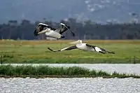 |
Victoria |
|
38° 4′ 0″ S, 144° 36′ 0″ O | 266 | 22.897 | 15. Dez. 1982 | |||
| Pulu Keeling National Park | Cocos (Keeling) Islands |
|
11° 49′ 0″ S, 96° 49′ 0″ O | 797 | 2.603 | 17. März 1996 | ||||
| Riverland | 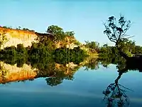 |
South Australia |
|
34° 1′ 59″ S, 140° 51′ 0″ O | 377 | 30.640 | 23. Sep. 1987 | |||
| Roebuck Bay | 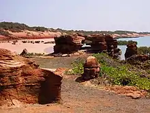 |
Western Australia |
|
18° 7′ 0″ S, 122° 16′ 0″ O | 479 | 55.000 | 7. Juni 1990 | |||
| Shoalwater and Corio Bays Area | 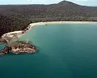 |
Livingston Shire, Queensland |
|
22° 33′ 56″ S, 150° 29′ 41″ O | 792 | 202.023 | 1. März 1996 | |||
| The Coorong, Lake Alexandrina & Albert Wetland | 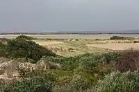 |
South Australia |
|
35° 18′ 0″ S, 138° 43′ 59″ O | 321 | 142.530 | 11. Jan. 1985 | |||
| The Dales, Christmas Island | Christmas Island Territory |
|
10° 28′ 59″ S, 105° 34′ 0″ O | 1.225 | 580 | 21. Okt. 2002 | ||||
| Toolibin Lake | Western Australia |
|
32° 55′ 0″ S, 117° 36′ 29″ O | 483 | 497 | 7. Juni 1990 | ||||
| Towra Point |  |
New South Wales |
|
34° 0′ 0″ S, 151° 10′ 0″ O | 286 | 604 | 21. Feb. 1984 | |||
| Vasse-Wonnerup System | .jpg.webp) |
Western Australia |
|
33° 38′ 6″ S, 115° 25′ 1″ O | 484 | 1.109 | 7. Juni 1990 | |||
| Western District Lakes | Victoria |
|
38° 10′ 0″ S, 143° 31′ 0″ O | 268 | 32.898 | 15. Dez. 1982 | ||||
| Western Port |  |
Victoria |
|
38° 22′ 0″ S, 145° 16′ 59″ O | 267 | 59.297 | 15. Dez. 1982 | |||

Weblinks
- Annotated List of Wetlands of International Importance. Australia. (PDF; 174 KB) ramsar.org (englisch).
- Ramsar Country Profile Australia. ramsar.org (englisch).
Australien |
Fidschi |
Cookinseln |
Kiribati |
Marshallinseln |
Föderierte Staaten von Mikronesien |
Nauru |
Neuseeland |
Palau |
Papua-Neuguinea |
Salomonen |
Samoa |
Tonga |
Tuvalu |
Vanuatu
durchgestrichen … nicht ratifiziert
Ramsar-Gebiete in: Afrika | Asien | Amerika | Europa | Ozeanien/Australien