Liste der Kategorie-A-Bauwerke in Dumfries and Galloway
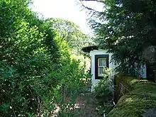
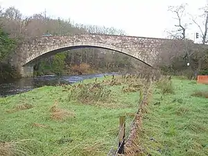
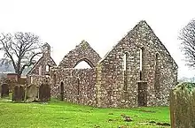
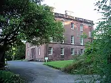
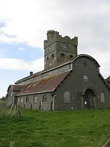
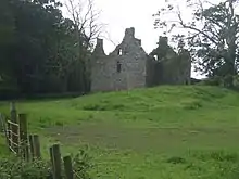
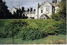
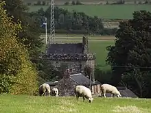
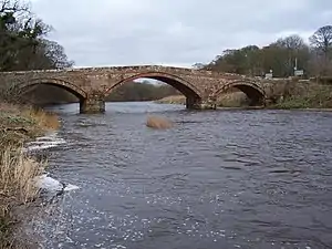
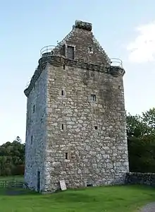
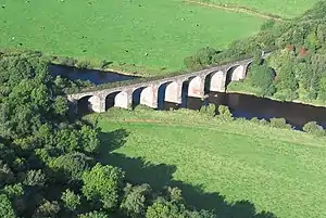
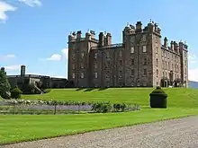
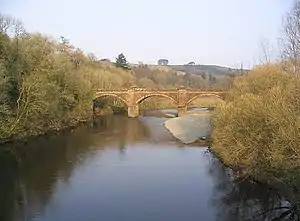
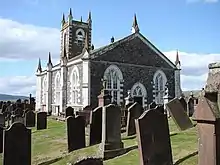
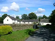
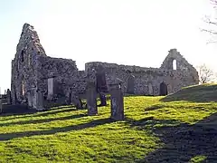
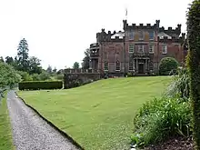
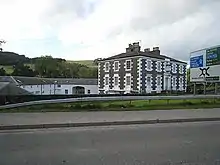
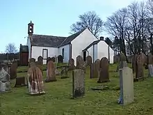
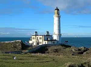
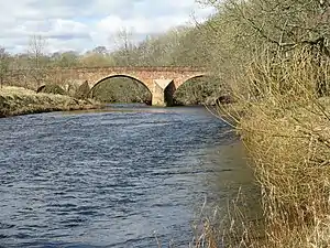
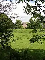
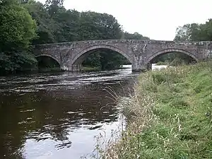
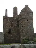
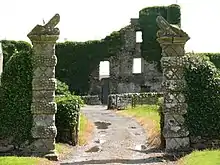
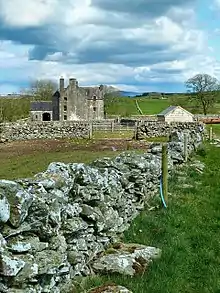
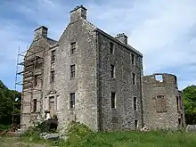
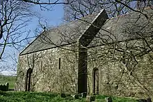
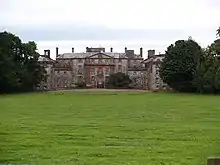
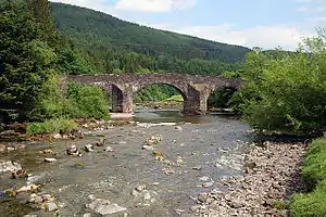
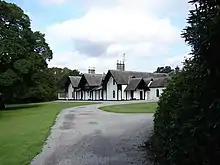
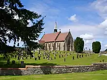
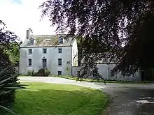
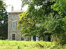
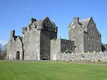
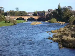
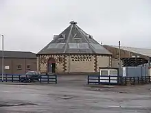
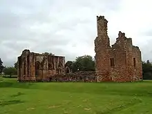
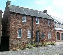
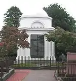
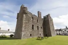
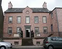
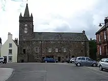
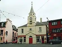
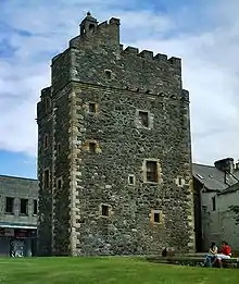
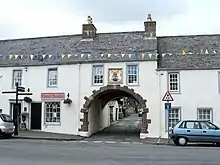
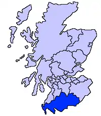
Die Liste d​er Kategorie-A-Gebäude i​n Dumfries a​nd Galloway umfasst sämtliche i​n der Kategorie A eingetragenen Baudenkmäler i​n der schottischen Council Area Dumfries a​nd Galloway. Die Einstufung w​ird anhand d​er Kriterien v​on Historic Scotland vorgenommen, w​obei in d​ie höchste Kategorie A Bauwerke v​on nationaler o​der internationaler Bedeutung einsortiert sind. In Dumfries a​nd Galloway s​ind derzeit 213 Bauwerke i​n der Kategorie A gelistet.

NameLageTypEintragBild
Rusco Tower nahe Gatehouse of Fleet
54° 55′ 6,1″ N,  12′ 37,7″ W
Tower House 3299
Ardwall House nahe Gatehouse of Fleet
54° 52′ 2″ N,  12′ 43,5″ W
Villa 3302
Friedhof der Anwoth Old Church nahe Gatehouse of Fleet
54° 52′ 49,7″ N,  12′ 38,2″ W
Friedhof 3309
Barscobe Castle nahe Balmaclellan
55° 6′ 7,3″ N,  6′ 7,7″ W
Wohngebäude 3310
Ironmacannie Mill nahe Balmaclellan
55° 3′ 16,3″ N,  5′ 16,5″ W
Mühle 3315
Ken Bridge nahe New Galloway
55° 4′ 51,4″ N,  7′ 51,9″ W
Brücke 3316
Millhouse Bridge Millhousebridge
55° 9′ 21,3″ N,  24′ 23,5″ W
Brücke 3324
Old Tollbar Cottage nahe Johnstonebridge
55° 11′ 51″ N,  24′ 31,2″ W
Zollhaus 3327
Stallungen von Jardine Hall nahe Templand
55° 10′ 36,1″ N,  24′ 49,4″ W
Stallungen 3340
Gärten von Jardine Hall nahe Templand
55° 10′ 36,6″ N,  24′ 56,4″ W
Gärten 3341
Buittle Bridge nahe Dalbeattie
54° 55′ 36″ N,  50′ 20″ W
Brücke 3364
Buittle Old Church nahe Dalbeattie
54° 55′ 8,2″ N,  51′ 41,6″ W
Kirchenruine 3365
Rammerscales House nahe Hightae
55° 5′ 5,1″ N,  26′ 22,8″ W
Herrenhaus 3378
Corseyard Farm nahe Borgue
54° 48′ 43,6″ N,  11′ 38,3″ W
Bauernhof 3381
Borgue Old House Borgue
54° 48′ 36,1″ N,  7′ 40,2″ W
Wohngebäude 3393
Hensol House nahe Crossmichael
55° 0′ 19,2″ N,  4′ 20,4″ W
Villa 3415
Sonnenuhr von Hensol House nahe Crossmichael
55° 0′ 18,5″ N,  4′ 18,8″ W
Sonnenuhr 3416
Shillahill Bridge nahe Lockerbie
55° 6′ 45,4″ N,  24′ 9,9″ W
Brücke 3453
Friedhof der Dalton Old Parish Church Dalton
55° 3′ 8,6″ N,  23′ 16,8″ W
Friedhof 3455
Denbie House nahe Dalton
55° 2′ 35,2″ N,  23′ 33,8″ W
Villa 3469
Taubenturm von Denbie House nahe Dalton
55° 2′ 38,6″ N,  23′ 45,4″ W
Taubenturm 3470
Bonshaw Tower Kirtlebridge
55° 2′ 14,4″ N,  11′ 12″ W
Tower House 3489
Brydekirk Bridge Brydekirk
55° 1′ 21,7″ N,  16′ 26,5″ W
Brücke 3494
Gilnockie Bridge nahe Canonbie
55° 5′ 39″ N,  57′ 49,7″ W
Brücke 3504
Byreburnfoot Bridge nahe Canonbie
55° 5′ 32,6″ N,  57′ 25″ W
Brücke 3520
Gilnockie Tower nahe Canonbie
55° 5′ 51,9″ N,  58′ 10,6″ W
Tower House 3527
Scheune der Priorslynn Farm Canonbie
55° 4′ 23,8″ N,  57′ 4,2″ W
Scheune 3531
Riddings Junction Viaduct nahe Canonbie
55° 4′ 16,6″ N,  55′ 27,6″ W
Brücke 3533
Tarrasfoot Tile Works nahe Langholm
55° 7′ 8,7″ N,  58′ 22,6″ W
Ziegelei 3535
Hoddom Castle nahe Brydekirk
55° 2′ 39,6″ N,  19′ 22,2″ W
Burg 3558
Repentance Tower nahe Brydekirk
55° 2′ 15″ N,  19′ 25,4″ W
Tower House 3570
Kinmount House nahe Cummertrees
55° 0′ 19,2″ N,  20′ 44,5″ W
Herrenhaus 3582
Earlstoun Castle nahe St John’s Town of Dalry
55° 7′ 52,2″ N,  10′ 39,3″ W
Tower House 3624
Grennan Mill nahe St John’s Town of Dalry
55° 5′ 55,5″ N,  7′ 39,5″ W
Mühle 3625
Crossmichael Parish Church Crossmichael
54° 58′ 52,2″ N,  59′ 11″ W
Kirche 3698
Gordon Memorial Crossmichael
54° 58′ 52,2″ N,  59′ 10,1″ W
Denkmal 3699
Glenlochar Bridge Glenlochar
54° 57′ 32,7″ N,  58′ 54″ W
Brücke 3706
Greenlaw House nahe Castle Douglas
54° 57′ 31,6″ N,  56′ 50,7″ W
Villa 3708
Southwick Home Farm nahe Southerness
54° 53′ 42,9″ N,  39′ 33,6″ W
Bauernhof 3723
Stapleton Tower nahe Annan
55° 0′ 30,5″ N,  11′ 53,1″ W
Tower House 3782
Dornock House Dornock
54° 58′ 58,9″ N,  12′ 7″ W
Bauernhof 3792
Crichton Royal Hospital Dumfries
55° 3′ 12,2″ N,  35′ 47,1″ W
Krankenhaus 3839
Durisdeer Parish Church Durisdeer
55° 18′ 56″ N,  44′ 39,5″ W
Kirche 3856
Drumlanrig Castle nahe Thornhill
55° 16′ 25,1″ N,  48′ 32,1″ W
Schloss 3886
Wallacehall Academy Closeburn
55° 12′ 49,3″ N,  43′ 35,8″ W
Schule 3953
Auldgirth Bridge Auldgirth
55° 9′ 34,2″ N,  42′ 35,3″ W
Brücke 3966
Dalgonar Bridge nahe Dunscore
55° 8′ 16,4″ N,  47′ 21,7″ W
Brücke 4227
Dunscore Parish Church Dunscore
55° 8′ 25,3″ N,  46′ 46,2″ W
Kirche 4230
Ellisland Farm nahe Auldgirth
55° 8′ 14,6″ N,  40′ 48,6″ W
Bauernhof 4232
Crichton Farm Dumfries
55° 2′ 52,1″ N,  35′ 33,4″ W
Bauernhof 6693
Crichton Memorial Church Dumfries
55° 3′ 3,5″ N,  35′ 37,7″ W
Kirche 6695
Hills Tower nahe Lochfoot
55° 2′ 11,5″ N,  42′ 13,3″ W
Tower House 9715
Duchess Bridge Langholm
55° 9′ 26,1″ N,  0′ 44,6″ W
Brücke 9734
Scheune von Knocknalling House nahe St John’s Town of Dalry
55° 8′ 17″ N,  12′ 11,9″ W
Scheune 9746
Milnholm Farmhouse nahe Langholm
55° 10′ 32,3″ N,  0′ 50,6″ W
Bauernhaus 9763
Skipper’s Bridge nahe Langholm
55° 8′ 27,3″ N,  59′ 19,5″ W
Brücke 9764
Mossknowe House nahe Kirkpatrick-Fleming
55° 1′ 1,7″ N,  7′ 33″ W
Herrenhaus 9799
Springkell House nahe Eaglesfield
55° 3′ 55,8″ N,  10′ 4,8″ W
Herrenhaus 9805
Stallungen von Wyseby House Kirtlebridge
55° 2′ 27,7″ N,  11′ 21,5″ W
Stallungen 9808
Grabstätte der Grahams of Mossknowe Kirkpatrick-Fleming
55° 1′ 12,3″ N,  7′ 59,9″ W
Grabstätte 9813
Douglas Mausoleum nahe Castle Douglas
54° 55′ 20,4″ N,  56′ 17,7″ W
Mausoleum 9835
Gelston Castle nahe Gelston
54° 54′ 17,1″ N,  54′ 31,3″ W
Herrenhaus 9836
Old Bridge of Dee Bridge of Dee
54° 55′ 5,7″ N,  58′ 34,5″ W
Brücke 9838
Craigielands House Beattock
55° 17′ 58,4″ N,  27′ 22,9″ W
Villa 9842
Cally Palace Hotel nahe Gatehouse of Fleet
54° 52′ 10,5″ N,  10′ 59,9″ W
Hotel 9854
Friedhof der Girthon Old Kirk Girthon
54° 51′ 20,6″ N,  10′ 25,5″ W
Friedhof 9859
Raehills House nahe Johnstonebridge
55° 14′ 3,5″ N,  28′ 25,5″ W
Herrenhaus 9898
The Old Brig Inn Beattock
55° 18′ 39,3″ N,  27′ 17,5″ W
Hotel 9908
Hutton and Corrie Parish Church Boreland
55° 12′ 17,3″ N,  18′ 18″ W
Kirche 9911
Corsewall Lighthouse Corsewall Point
55° 0′ 25,5″ N,  9′ 33,9″ W
Leuchtturm 9923
Kinnel Bridge nahe Templand
55° 9′ 3,7″ N,  25′ 49,4″ W
Brücke 9950
Spedlins Tower nahe Templand
55° 10′ 26,3″ N,  25′ 5,6″ W
Tower House 9965
Elshieshields Tower nahe Templand
55° 9′ 3″ N,  27′ 45,4″ W
Tower House 9970
Stallungen von Halleaths nahe Lochmaben
55° 7′ 37,3″ N,  25′ 1,4″ W
Stallungen 9971
Hoddom Bridge nahe Brydekirk
55° 2′ 30,6″ N,  18′ 37,7″ W
Brücke 10026
Windmühle von Shortrigg nahe Ecclefechan
55° 3′ 24,1″ N,  18′ 51,5″ W
Windmühle 10041
Geburtshaus von Thomas Carlyle Ecclefechan
55° 3′ 32,9″ N,  15′ 51,3″ W
Wohngebäude 10065
Kirkcowan Parish Church Kirkcowan
54° 54′ 55″ N,  36′ 39,1″ W
Kirche 10066
Craichlaw House nahe Kirkcowan
54° 54′ 56,6″ N,  38′ 38,6″ W
Herrenhaus 10076
Barholm Castle nahe Carsluith
54° 50′ 58,2″ N,  18′ 19,7″ W
Tower House 10093
Carsluith Castle nahe Carsluith
54° 51′ 33,9″ N,  20′ 48″ W
Tower House 10104
Torzufahrt zu Baldoon Castle nahe Bladnoch
54° 51′ 9,3″ N,  27′ 13,1″ W
Tor 10109
Old Place of Monreith nahe Port William
54° 45′ 21,2″ N,  31′ 1,5″ W
Tower House 10123
Ravenstone Castle nahe Sorbie
54° 46′ 2,3″ N,  28′ 26,8″ W
Tower House 10133
Glasserton Parish Church nahe Whithorn
54° 42′ 46,5″ N,  27′ 8,3″ W
Kirche 10137
Craigcaffie Tower nahe Stranraer
54° 56′ 6,5″ N,  59′ 6,4″ W
Tower House 10164
Lochryan House Cairnryan
54° 58′ 33,2″ N,  1′ 35,5″ W
Herrenhaus 10168
Lochinch Castle nahe Castle Kennedy
54° 54′ 52,9″ N,  57′ 22″ W
Herrenhaus 10179
Old Bridge of Urr Mill Old Bridge of Urr
54° 59′ 19,8″ N,  54′ 49,5″ W
Mühle 10191
Fourmerkland Tower nahe Dumfries
55° 6′ 32,9″ N,  42′ 44,7″ W
Tower House 10204
West Galloberry Farm nahe Kirkton
55° 7′ 37,7″ N,  37′ 34,1″ W
Bauernhof 10218
Stallungen von Blackwood House nahe Auldgirth
55° 9′ 54,9″ N,  43′ 3,3″ W
Stallungen 10244
Capenoch House nahe Penpont
55° 13′ 30,4″ N,  49′ 11,2″ W
Herrenhaus 10247
Kilneiss House Moniaive
55° 11′ 53,4″ N,  55′ 41,8″ W
Villa 10298
Carnsalloch House nahe Kirkton
55° 6′ 22,8″ N,  36′ 52,5″ W
Herrenhaus 10300
Carnsalloch Chapel at the Mount nahe Kirkton
55° 6′ 44,4″ N,  36′ 31,9″ W
Kirche 10301
Stallungen von Carnsalloch House nahe Kirkton
55° 6′ 26,1″ N,  36′ 39,9″ W
Stallungen 10303
Glenluiart House nahe Moniaive
55° 11′ 47,5″ N,  56′ 34,7″ W
Villa 10307
Glencairn Parish Church nahe Moniaive
55° 11′ 38,8″ N,  52′ 20,7″ W
Kirche 10312
Craigdarroch House nahe Moniaive
55° 11′ 46,4″ N,  58′ 43,3″ W
Herrenhaus 10340
Ross Mains nahe Templand
55° 11′ 0,3″ N,  28′ 1,7″ W
Bauernhaus 10353
John Paul Jones’ Cottage nahe Southerness
54° 53′ 55,6″ N,  34′ 48,7″ W
Wohngebäude 10397
Arbigland House nahe Southerness
54° 54′ 4,8″ N,  34′ 37″ W
Herrenhaus 10398
Southerness Lighthouse Southerness
54° 52′ 22,2″ N,  35′ 42″ W
Leuchtturm 10415
Shennanton House nahe Kirkcowan
54° 56′ 44,6″ N,  35′ 34,6″ W
Villa 13106
Kirkdale Bridge nahe Carsluith
54° 51′ 2,4″ N,  18′ 39,4″ W
Brücke 13137
Kirkdale House nahe Carsluith
54° 51′ 8,2″ N,  18′ 53,5″ W
Villa 13138
Kirkdale Kirk nahe Carsluith
54° 51′ 32,7″ N,  19′ 10,1″ W
Kirchenruine 13139
Stallungen von Kirkdale House nahe Carsluith
54° 51′ 17,9″ N,  19′ 4,6″ W
Stallungen 13140
Lochnaw Castle nahe Leswalt
54° 55′ 10,8″ N,  8′ 8,7″ W
Herrenhaus 13498
Gärten von Lochnaw Castle nahe Leswalt
54° 55′ 17,8″ N,  8′ 26,8″ W
Gärten 13505
Logan House nahe Port Logan
54° 44′ 39,4″ N,  57′ 31,7″ W
Herrenhaus 13564
Logan Windmill nahe Ardwell
54° 45′ 12,9″ N,  55′ 49,1″ W
Windmühle 13570
Mull of Galloway Lighthouse Mull of Galloway
54° 38′ 5,9″ N,  51′ 26,6″ W
Leuchtturm 13578
Old Parish Church of Kirkmaiden nahe Drummore
54° 41′ 32,4″ N,  54′ 40,8″ W
Kirche 13581
Kirkmadrine Church nahe Sandhead
54° 47′ 36,8″ N,  59′ 15,9″ W
Kirche 16739
Portpatrick Old Parish Church Portpatrick
54° 50′ 33,7″ N,  6′ 59,7″ W
Kirchenruine 16743
Isle Castle Isle of Whithorn
54° 42′ 4,8″ N,  21′ 56,7″ W
Tower House 16751
Castle of Park nahe Glenluce
54° 52′ 33,5″ N,  49′ 31,9″ W
Tower House 16761
Haugh Bridge Haugh of Urr
54° 58′ 26,5″ N,  52′ 4,2″ W
Brücke 16807
Scheune der Archbank Farm nahe Moffat
55° 20′ 49,5″ N,  26′ 7,3″ W
Scheune 16847
Granton House nahe Moffat
55° 22′ 28,1″ N,  27′ 43,2″ W
Villa 16858
Heatheryhaugh Moffat
55° 20′ 30,8″ N,  25′ 56,8″ W
Villa 16861
Cruggleton Church nahe Garlieston
54° 45′ 25,6″ N,  22′ 0,1″ W
Kirche 16875
Galloway House nahe Garlieston
54° 46′ 45,4″ N,  22′ 1,9″ W
Herrenhaus 16876
Castlemilk nahe Kettleholm
55° 5′ 3,6″ N,  20′ 2,7″ W
Herrenhaus 16888
Brücke von Castlemilk nahe Kettleholm
55° 4′ 57,1″ N,  19′ 56,4″ W
Brücke 16890
Johnstone Mausoleum Bentpath
55° 12′ 9,4″ N,  4′ 52,3″ W
Mausoleum 16921
Bentpath Bridge Bentpath
55° 12′ 6,1″ N,  4′ 59,3″ W
Brücke 16939
Barwhinnock House nahe Twynholm
54° 52′ 17,6″ N,  5′ 40,6″ W
Villa 16989
Cumstoun House nahe Kirkcudbright
54° 51′ 26″ N,  3′ 10,2″ W
Herrenhaus 16993
Cumloden House nahe Minnigaff
54° 58′ 43,2″ N,  28′ 27,5″ W
Villa 17052
Dundrennan Abbey Dundrennan
54° 48′ 24,5″ N,  56′ 50″ W
Klosterruine 17072
Tor von Corsock House nahe Corsock
55° 3′ 39,8″ N,  56′ 24,8″ W
Tor 17094
Argrennan House nahe Tongland
54° 54′ 3″ N,  0′ 22″ W
Herrenhaus 17114
Old Tongland Bridge Tongland
54° 51′ 38,5″ N,  1′ 53,7″ W
Brücke 17123
Tongland Bridge Tongland
54° 51′ 28,1″ N,  2′ 20,8″ W
Brücke 17125
Wasserkraftwerk Tongland Tongland
54° 51′ 35″ N,  2′ 3,6″ W
Kraftwerk 17126
Torthorwald Cruck Cottage Torthorwald
55° 5′ 28,6″ N,  31′ 1,4″ W
Wohngebäude 17157
Miners’ Library Wanlockhead
55° 23′ 52,4″ N,  46′ 46,9″ W
Bücherei 17192
Goldielea Viaduct nahe Cargenbridge
55° 2′ 43,3″ N,  40′ 32,6″ W
Brücke 17201
Kirkconnel House nahe New Abbey
54° 59′ 47″ N,  35′ 46″ W
Herrenhaus 17204
Stallungen von Terregles House Terregles
55° 4′ 54,3″ N,  40′ 31,2″ W
Stallungen 17208
Tynron Parish Church Tynron
55° 13′ 0,5″ N,  52′ 42,1″ W
Kirche 17222
Amisfield Tower nahe Amisfield
55° 8′ 17,8″ N,  34′ 57,5″ W
Tower House 17233
Tinwald House nahe Tinwald
55° 6′ 26,2″ N,  32′ 30,2″ W
Herrenhaus 17238
Cottages von Tinwald House nahe Tinwald
55° 6′ 24,3″ N,  32′ 29,4″ W
Wohngebäude 17239
Gutshof von Tinwald House nahe Tinwald
55° 6′ 27,3″ N,  32′ 33,5″ W
Stallungen 17240
Comlongon Castle nahe Clarencefield
55° 0′ 23,4″ N,  26′ 26,8″ W
Tower House 17245
Ruthwell Museum Ruthwell
54° 59′ 34,6″ N,  24′ 19,2″ W
Museum 17249
Nith Bridge nahe Thornhill
55° 14′ 26,1″ N,  46′ 38,7″ W
Brücke 17286
Gärtnerhaus von Drumlanrig Castle nahe Thornhill
55° 15′ 53,1″ N,  47′ 57,4″ W
Wohngebäude 17297
Sweetheart Abbey New Abbey
54° 58′ 48,9″ N,  37′ 7,8″ W
Klosterruine 17304
New Abbey Mill New Abbey
54° 58′ 48″ N,  37′ 23,2″ W
Mühle 17323
Thornhill Cross Thornhill
55° 14′ 26,6″ N,  45′ 53,7″ W
Marktkreuz 17337
The Old House New Abbey
54° 58′ 47,1″ N,  37′ 25,1″ W
Wohngebäude 17346
Henry Duncan Monument Mouswald
55° 1′ 47,3″ N,  27′ 12,6″ W
Denkmal 17388
Sorbie Tower nahe Sorbie
54° 47′ 38,8″ N,  24′ 39,6″ W
Tower House 19181
All Saints Episcopal Church nahe Newton Stewart
54° 58′ 32,7″ N,  31′ 28,4″ W
Kirche 19190
Tonderghie House nahe Isle of Whithorn
54° 41′ 31,1″ N,  25′ 0,4″ W
Villa 19248
Gutshof von Tonderghie House nahe Isle of Whithorn
54° 41′ 21,4″ N,  25′ 6,4″ W
Bauernhof 19249
Heron Monument Minnigaff
54° 58′ 6,1″ N,  29′ 7,8″ W
Grabstätte 19313
Monreith House nahe Port William
54° 45′ 13,3″ N,  33′ 22,9″ W
Herrenhaus 19561
Old Place of Mochrum nahe Kirkcowan
54° 51′ 10,5″ N,  38′ 13,8″ W
Tower House 19570
Annan Bridge Annan
54° 59′ 14,2″ N,  15′ 56,9″ W
Brücke 21061
27–29 Bank Street Annan
54° 59′ 10,2″ N,  15′ 43,6″ W
Wohn- und Geschäftsgebäude 21066
5–9 High Street Annan
54° 59′ 12,6″ N,  15′ 53,6″ W
Wohngebäude 21086
Annan Old Parish Church Annan
54° 59′ 15,1″ N,  15′ 29,8″ W
Kirche 21106
Viehmarkthalle von Castle Douglas Castle Douglas
54° 56′ 32,8″ N,  55′ 28,6″ W
Markthalle 22976
Lincluden Collegiate Church Dumfries
55° 5′ 6″ N,  37′ 14,7″ W
Kirchenruine 26075
5–11 Bank Street Dumfries
55° 4′ 4,2″ N,  36′ 44,7″ W
Wohn- und Geschäftsgebäude 26083
Alte Methodistische Kirche Dumfries
55° 4′ 13,2″ N,  36′ 48,5″ W
Kirche 26102
Robert Burns’ House Dumfries
55° 3′ 57,9″ N,  36′ 29,1″ W
Wohngebäude 26115
25–37 Castle Street Dumfries
55° 4′ 14″ N,  36′ 49,5″ W
Wohngebäude 26118
41–47 Castle Street Dumfries
55° 4′ 16,6″ N,  36′ 53″ W
Wohngebäude 26120
14–24 Castle Street Dumfries
55° 4′ 14,2″ N,  36′ 47,5″ W
Wohngebäude 26122
26–30 Castle Street Dumfries
55° 4′ 17″ N,  36′ 51,4″ W
Wohngebäude 26123
Greyfriars Church Dumfries
55° 4′ 13,5″ N,  36′ 45,4″ W
Kirche 26126
Dumfries Museum Dumfries
55° 3′ 55,1″ N,  36′ 52,8″ W
Museum 26135
Queensberry Column Dumfries
55° 4′ 8,9″ N,  36′ 39″ W
Denkmal 26173
Midsteeple Dumfries
55° 4′ 7,7″ N,  36′ 38,8″ W
Rathaus 26215
The Globe Inn Dumfries
55° 4′ 3,2″ N,  36′ 34,6″ W
Gasthaus 26230
Trades Hall Dumfries
55° 4′ 8,4″ N,  36′ 38,1″ W
Versammlungsgebäude 26234
29 Irish Street Dumfries
55° 3′ 58,8″ N,  36′ 38,8″ W
Villa 26240
24 Nith Place Dumfries
55° 3′ 59,5″ N,  36′ 33,5″ W
Villa 26305
St Michael’s Church Dumfries
55° 3′ 54,4″ N,  36′ 22,6″ W
Kirche 26335
Friedhof der St Michael’s Church Dumfries
55° 3′ 54,4″ N,  36′ 20,5″ W
Friedhof 26336
Burns’ Mausoleum Dumfries
55° 3′ 54,3″ N,  36′ 17,7″ W
Mausoleum 26337
Devorgilla Bridge Dumfries
55° 4′ 5,4″ N,  36′ 58,4″ W
Brücke 26354
MacLellan’s Castle Kirkcudbright
54° 50′ 13,4″ N,  3′ 11,3″ W
Tower House 36484
Blair House Kirkcudbright
54° 50′ 13,3″ N,  3′ 15,2″ W
Villa 36529
Broughton House Kirkcudbright
54° 50′ 12,6″ N,  3′ 15,7″ W
Villa 36530
Tolbooth von Kirkcudbright Kirkcudbright
54° 50′ 7,6″ N,  3′ 20,5″ W
Rathaus 36542
66–70 High Street Kirkcudbright
54° 50′ 7,3″ N,  3′ 19,4″ W
Wohngebäude 36545
74 High Street Kirkcudbright
54° 50′ 7″ N,  3′ 18,4″ W
Wohngebäude 36546
Langholm Parish Church Langholm
55° 9′ 1,1″ N,  0′ 12,1″ W
Kirche 37137
Lochmaben Parish Church Lochmaben
55° 7′ 34,9″ N,  26′ 19,1″ W
Kirche 37539
Tolbooth von Lochmaben Lochmaben
55° 7′ 44,5″ N,  26′ 29,2″ W
Rathaus 37541
Rathaus von Lockerbie Lockerbie
55° 7′ 17,9″ N,  21′ 17″ W
Rathaus 37579
St Andrew’s Parish Church Moffat
55° 19′ 53,9″ N,  26′ 40,7″ W
Kirche 37881
Moffat House Hotel Moffat
55° 20′ 1,9″ N,  26′ 45,5″ W
Hotel 37928
Sidmount Cottage Moffat
55° 20′ 8″ N,  26′ 11,6″ W
Villa 37935
Penninghame Parish Church Newton Stewart
54° 57′ 28,5″ N,  29′ 6,7″ W
Kirche 38663
Cree Bridge Newton Stewart
54° 57′ 36,6″ N,  28′ 56,4″ W
Brücke 38667
Douglas House Newton Stewart
54° 58′ 0,4″ N,  29′ 14,4″ W
Villa 38672
Tolbooth von Sanquhar Sanquhar
55° 22′ 4,7″ N,  55′ 30,2″ W
Rathaus 40540
Stranraer Museum Stranraer
54° 54′ 16″ N,  1′ 41,8″ W
Museum 41745
Stranraer Castle Stranraer
54° 54′ 15,8″ N,  1′ 33,6″ W
Tower House 41765
Torweg zu Whithorn Priory Whithorn
54° 43′ 59,3″ N,  24′ 56,9″ W
Wohngebäude 42195
55–57 George Street Whithorn
54° 43′ 58,8″ N,  24′ 57,2″ W
Wohngebäude 42196
Whithorn Priory Whithorn
54° 44′ 1,1″ N,  25′ 0,8″ W
Klosterruine 42266
18–20 King Street Stranraer
54° 54′ 17,9″ N,  1′ 49,3″ W
Wohn- und Geschäftsgebäude 45230
Lage von Dumfries and Galloway in Schottland
Commons: Kategorie-A-Bauwerke in Dumfries and Galloway – Sammlung von Bildern, Videos und Audiodateien
This article is issued from Wikipedia. The text is licensed under Creative Commons - Attribution - Sharealike. The authors of the article are listed here. Additional terms may apply for the media files, click on images to show image meta data.