Liste der Einträge im National Register of Historic Places in Milton (Massachusetts)
Die Liste der Einträge im National Register of Historic Places in Milton in Massachusetts führt alle Bauwerke, National Historic Landmarks und Historic Districts in Milton auf, die in das National Register of Historic Places aufgenommen wurden.

Die vorliegende Liste wurde aufgrund der Vielzahl an Einträgen in Milton ausgelagert und ist integraler Bestandteil der Liste der Einträge im National Register of Historic Places im Norfolk County.[1]
Legende
| NRHP | Historic Place |
|---|---|
| NHL | Historic Landmark |
| HD | Historic District |
Aktuelle Einträge
| [2] | Name[3] | Bild | Eintragsdatum | Lage | Ort | Beschreibung |
|---|---|---|---|---|---|---|
| 1 | Belcher-Rowe House | 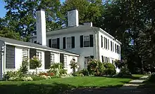 Belcher-Rowe House |
1. Apr. 1982 ID-Nr. 82002748 |
26 Governor Belcher Lane 42° 15′ 34″ N, 71° 2′ 58″ W |
Milton | |
| 2 | G.H. Bent Company Factory | 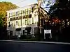 G.H. Bent Company Factory |
10. Feb. 2000 ID-Nr. 00000075 |
7 Pleasant St. 42° 14′ 42″ N, 71° 4′ 10″ W |
Milton | |
| 3 | Blue Hills Headquarters |  Blue Hills Headquarters |
25. Sep. 1980 ID-Nr. 80000654 |
Hillside St. 42° 12′ 53,4″ N, 71° 5′ 35,2″ W |
Milton | |
| 4 | Blue Hills Reservation Parkways | 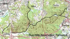 Blue Hills Reservation Parkways |
11. Aug. 2003 ID-Nr. 03000746 |
42° 13′ 34″ N, 71° 4′ 20″ W |
Milton | |
| 5 | Blue Hills Parkway |  Blue Hills Parkway |
23. Juni 2003 ID-Nr. 03000574 |
42° 15′ 21″ N, 71° 5′ 38″ W |
Milton | |
| 6 | Brookwood Farm |  Brookwood Farm |
25. Sep. 1980 ID-Nr. 80000655 |
Hillside Street 42° 12′ 34″ N, 71° 6′ 41″ W |
Milton | Erstreckt sich bis nach Canton. |
| 7 | Brush Hill Historic District | 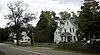 Brush Hill Historic District |
20. Aug. 1998 ID-Nr. 98001081 |
42° 14′ 45″ N, 71° 6′ 35″ W |
Milton | |
| 8 | Comfort Station |  Comfort Station |
25. Sep. 1980 ID-Nr. 80000658 |
Blue Hill Ave. 42° 13′ 9″ N, 71° 7′ 6″ W |
Milton | |
| 9 | Davenport Estate Historic District | 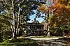 Davenport Estate Historic District |
17. Mai 2018 ID-Nr. 100002421 |
1465, 1485 und 1493 Brush Hill Rd. 42° 13′ 25,2″ N, 71° 7′ 19,7″ W |
Milton | |
| 10 | Dorchester-Milton Lower Mills Industrial District | 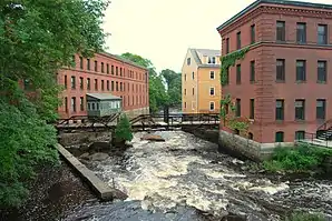 Dorchester-Milton Lower Mills Industrial District |
2. Apr. 1980 ID-Nr. 80000675 |
42° 16′ 16″ N, 71° 4′ 8″ W |
Milton | Erstreckt sich bis nach Boston. |
| 11 | Eliot Memorial Bridge |  Eliot Memorial Bridge |
25. Sep. 1980 ID-Nr. 80000662 |
42° 12′ 42″ N, 71° 6′ 49″ W |
Milton | |
| 12 | Eustis Estate Historic District |  Eustis Estate Historic District |
22. März 2016 ID-Nr. 16000099 |
1400, 1421, 1424, 1426 und 1452 Canton Ave. 42° 13′ 53,6″ N, 71° 6′ 26,6″ W |
Milton | |
| 13 | Capt. Robert B. Forbes House |  Capt. Robert B. Forbes House weitere Bilder |
13. Nov. 1966 ID-Nr. 66000651 |
215 Adams St. 42° 15′ 47″ N, 71° 3′ 49″ W |
Milton | |
| 14 | Great Blue Hill Observation Tower |  Great Blue Hill Observation Tower |
25. Sep. 1980 ID-Nr. 80000661 |
42° 12′ 43″ N, 71° 6′ 49″ W |
Milton | |
| 15 | Great Blue Hill Weather Observatory | 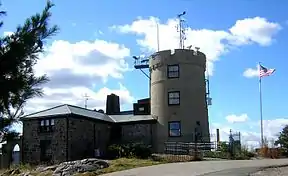 Great Blue Hill Weather Observatory |
25. Sep. 1980 ID-Nr. 80000665 |
42° 12′ 42″ N, 71° 6′ 55″ W |
Milton | |
| 16 | Dr. Amos Holbrook House |  Dr. Amos Holbrook House |
13. Feb. 1975 ID-Nr. 75000289 |
203 Adams St. 42° 15′ 55″ N, 71° 3′ 59″ W |
Milton | |
| 17 | Gov. Thomas Hutchinson’s Ha-ha | 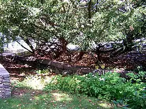 Gov. Thomas Hutchinson’s Ha-ha |
13. Feb. 1975 ID-Nr. 75000290 |
100 und 122 Randolph Ave. 42° 15′ 55″ N, 71° 4′ 6″ W |
Milton | |
| 18 | Massachusetts Hornfels-Braintree Slate Quarry | 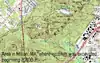 Massachusetts Hornfels-Braintree Slate Quarry |
25. Sep. 1980 ID-Nr. 80000653 |
Adresse wird nicht veröffentlicht. |
Milton | Erstreckt sich bis nach Quincy. |
| 19 | Metropolitan District Commission Stable |  Metropolitan District Commission Stable |
25. Sep. 1980 ID-Nr. 80000663 |
Hillside St. 42° 12′ 56″ N, 71° 5′ 33″ W |
Milton | |
| 20 | Milton Cemetery |  Milton Cemetery |
2. Juni 2004 ID-Nr. 04000537 |
211 Centre St. 42° 15′ 23,6″ N, 71° 3′ 55,3″ W |
Milton | |
| 21 | Milton Centre Historic District |  Milton Centre Historic District |
28. Apr. 1988 ID-Nr. 88000428 |
42° 15′ 12″ N, 71° 4′ 47″ W |
Milton | |
| 22 | Milton Hill Historic District |  Milton Hill Historic District |
9. Juni 1995 ID-Nr. 95000698 |
42° 15′ 52″ N, 71° 3′ 59″ W |
Milton | |
| 23 | Neponset Valley Parkway |  Neponset Valley Parkway |
24. Jan. 2005 ID-Nr. 04001573 |
Neponset Valley Parkway 42° 14′ 5″ N, 71° 7′ 26″ W |
Milton | Erstreckt sich bis nach Boston. |
| 24 | Paul’s Bridge |  Paul’s Bridge |
11. Dez. 1972 ID-Nr. 72000140 |
Führt den Neponset Valley Parkway über den Neponset River 42° 14′ 4″ N, 71° 7′ 21″ W |
Milton | |
| 25 | Railway Village Historic District | 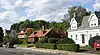 Railway Village Historic District |
6. März 2000 ID-Nr. 00000111 |
42° 15′ 26,9″ N, 71° 2′ 14,2″ W |
Milton | |
| 26 | Refreshment Pavilion | 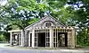 Refreshment Pavilion |
25. Sep. 1980 ID-Nr. 80000659 |
Hillside St. 42° 12′ 31″ N, 71° 5′ 52″ W |
Milton | |
| 27 | Scott’s Woods Historic District | 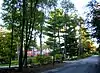 Scott’s Woods Historic District |
5. Nov. 1992 ID-Nr. 92001528 |
Hillside St. 42° 13′ 27″ N, 71° 4′ 50″ W |
Milton | |
| 28 | Suffolk Resolves House | 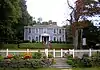 Suffolk Resolves House |
23. Juli 1973 ID-Nr. 73000308 |
1370 Canton Ave. 42° 14′ 3″ N, 71° 6′ 32″ W |
Milton | |
| 29 | Truman Parkway |  Truman Parkway |
5. Jan. 2005 ID-Nr. 04001430 |
Truman Parkway 42° 14′ 53″ N, 71° 6′ 59″ W |
Milton | Erstreckt sich bis nach Boston. |
| 30 | US Post Office-Milton Main | 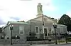 US Post Office-Milton Main weitere Bilder |
30. Mai 1986 ID-Nr. 86001213 |
499 Adams St. 42° 15′ 30″ N, 71° 2′ 34″ W |
Milton |
Siehe auch
Weblinks
Einzelnachweise
- Auszug aus dem National Register of Historic Places - Norfolk County Abgerufen am 29. Mai 2016
- Die Nummerierung in dieser Listenspalte ist an der vom National Park Service vorgelegten Reihenfolge der Einträge orientiert; die Farben unterscheiden verschiedene Schutzgebietstypen des National Park Systems mit landesweiter Bedeutung (z. B. National Historic Landmarks) von den sonstigen Einträgen im National Register of Historic Places.
- National Register Information System. In: National Register of Historic Places. National Park Service. Abgerufen am 2. November 2013.
| Countys |
Barnstable • Berkshire • Bristol • Dukes • Essex • Franklin • Hampden • Hampshire • Middlesex • Nantucket • Norfolk • Plymouth • Suffolk • Worcester (Nord | Süd) |
||||||||||||||||
| Städte |
|