Liste der Einträge im National Register of Historic Places im Hampshire County (Massachusetts)
Die Liste der Einträge im National Register of Historic Places im Hampshire County in Massachusetts führt alle Bauwerke, National Historic Landmarks und historischen Stätten im Hampshire County auf, die in das National Register of Historic Places aufgenommen wurden.[1]

Legende
| NRHP | Historic Place |
|---|---|
| NHL | Historic Landmark |
| NHLD | Historic Landmark District |
| HD | Historic District |
Aktuelle Einträge
| [2] | Name[3] | Bild | Eintragsdatum | Lage | Ort | Beschreibung |
|---|---|---|---|---|---|---|
| 1 | Amherst Central Business District | 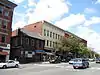 Amherst Central Business District |
27. Dez. 1991 ID-Nr. 91001859 |
42° 22′ 38″ N, 72° 31′ 13″ W |
Amherst | |
| 2 | Amherst West Cemetery | 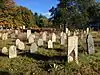 Amherst West Cemetery |
26. Mai 2000 ID-Nr. 00000534 |
Triangle St. 42° 22′ 45″ N, 72° 31′ 7″ W |
Amherst | |
| 3 | Baird House | 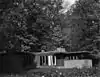 Baird House |
3. Jan. 1985 ID-Nr. 85000026 |
38 Shays St. 42° 21′ 0″ N, 72° 31′ 9″ W |
Amherst | |
| 4 | Belchertown Center Historic District |  Belchertown Center Historic District |
2. Juni 1982 ID-Nr. 82001913 |
42° 16′ 37″ N, 72° 24′ 6″ W |
Belchertown | |
| 5 | Belchertown State School | 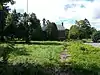 Belchertown State School |
19. Juli 1994 ID-Nr. 94000688 |
30 State St. 42° 16′ 28″ N, 72° 25′ 27″ W |
Belchertown | |
| 6 | Bisbee Mill | 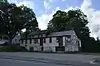 Bisbee Mill |
31. März 2005 ID-Nr. 05000219 |
66 East St. 42° 22′ 36″ N, 72° 49′ 9″ W |
Chesterfield | |
| 7 | Bradstreet Historic District | 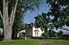 Bradstreet Historic District |
17. Juli 1997 ID-Nr. 97000724 |
42° 24′ 19″ N, 72° 35′ 26″ W |
Hatfield | |
| 8 | William Cullen Bryant Homestead | 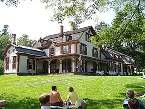 William Cullen Bryant Homestead weitere Bilder |
15. Okt. 1966 ID-Nr. 66000136 |
42° 28′ 19″ N, 72° 56′ 9″ W |
Cummington | |
| 9 | Building at 8-22 Graves Avenue |  Building at 8-22 Graves Avenue |
7. Nov. 1985 ID-Nr. 85002784 |
8-22 Graves Ave. 42° 19′ 19″ N, 72° 37′ 44″ W |
Northampton | |
| 10 | Center Cemetery | 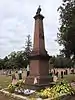 Center Cemetery |
16. Apr. 2013 ID-Nr. 13000170 |
178 College Hwy. (Route 10) 42° 14′ 5,5″ N, 72° 43′ 37,3″ W |
Southampton | |
| 11 | Center Cemetery | 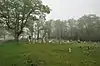 Center Cemetery |
26. Feb. 2004 ID-Nr. 04000084 |
Sam Hill Rd. 42° 23′ 40″ N, 72° 56′ 36″ W |
Worthington | |
| 12 | Chesterfield Center Historic District | 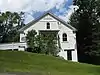 Chesterfield Center Historic District |
11. Dez. 2008 ID-Nr. 08001177 |
Main Rd., South St., North Rd., Bagg Rd., Bryant St. 42° 23′ 30″ N, 72° 50′ 27″ W |
Chesterfield | |
| 13 | Church Street Historic District | 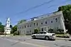 Church Street Historic District |
23. Mai 1986 ID-Nr. 86001246 |
42° 15′ 57″ N, 72° 13′ 53″ W |
Ware | |
| 14 | Conkey-Stevens House | 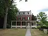 Conkey-Stevens House |
10. Mai 1979 ID-Nr. 79000352 |
664 Main St. 42° 22′ 33″ N, 72° 30′ 20″ W |
Amherst | |
| 15 | Calvin Coolidge House | 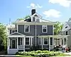 Calvin Coolidge House |
12. Dez. 1976 ID-Nr. 76000262 |
19-21 Massasoit St. 42° 19′ 29″ N, 72° 38′ 49″ W |
Northampton | |
| 16 | Cushman Village Historic District | 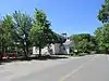 Cushman Village Historic District |
5. Nov. 1992 ID-Nr. 92001553 |
42° 25′ 3″ N, 72° 30′ 26″ W |
Amherst | |
| 17 | Dickinson Historic District | 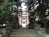 Dickinson Historic District |
16. Aug. 1977 ID-Nr. 77000182 |
Kellogg Ave., Main, Gray, und Lessey Sts. 42° 22′ 35″ N, 72° 30′ 55″ W |
Amherst | |
| 18 | Emily Dickinson House | 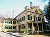 Emily Dickinson House weitere Bilder |
15. Okt. 1966 ID-Nr. 66000363 |
280 Main St. 42° 22′ 33″ N, 72° 30′ 52″ W |
Amherst | |
| 19 | Dorsey-Jones House | 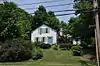 Dorsey-Jones House |
2. Sep. 2005 ID-Nr. 05000931 |
191 Nonotuck St. 42° 19′ 52″ N, 72° 40′ 18″ W |
Northampton | Standort der Underground Railroad. |
| 20 | East Village Historic District | 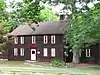 East Village Historic District |
6. Juli 1986 ID-Nr. 86001408 |
Main, N. und S. East Sts. 42° 22′ 36″ N, 72° 30′ 4″ W |
Amherst | |
| 21 | Elm Street Historic District | 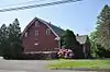 Elm Street Historic District |
7. Dez. 2000 ID-Nr. 00001481 |
Elm, Sunset, und Scotland Sts., Little Neponset Rd. 42° 21′ 35″ N, 72° 37′ 0″ W |
Hatfield | |
| 22 | First Congregational Church | 3. März 2020 ID-Nr. 100003963 |
1 Church St. 42° 15′ 30,8″ N, 72° 34′ 37,1″ W |
South Hadley | ||
| 23 | Fort Hill Historic District |  Fort Hill Historic District |
7. Apr. 1989 ID-Nr. 88000910 |
42° 18′ 43″ N, 72° 38′ 1″ W |
Northampton | |
| 24 | Gate Cemetery |  Gate Cemetery |
1. Juli 2009 ID-Nr. 09000470 |
Ireland Street 42° 23′ 33,5″ N, 72° 53′ 2″ W |
Chesterfield | |
| 25 | Goodwin Memorial African Methodist Episcopal Zion Church |  Goodwin Memorial African Methodist Episcopal Zion Church |
28. Apr. 2000 ID-Nr. 00000416 |
Woodside Ave. 42° 22′ 15″ N, 72° 31′ 23″ W |
Amherst | |
| 26 | Goshen Town Hall |  Goshen Town Hall |
28. Aug. 2018 ID-Nr. 100002829 |
42 Main St. 42° 26′ 29,4″ N, 72° 48′ 7,2″ W |
Goshen | |
| 27 | Grove Hill Mansion |  Grove Hill Mansion weitere Bilder |
11. Aug. 1982 ID-Nr. 82001910 |
Florence Rd. und Front St. 42° 21′ 11″ N, 72° 41′ 58″ W |
Northampton | |
| 28 | Hadley Center Historic District |  Hadley Center Historic District |
2. Dez. 1977 ID-Nr. 77000185 |
Middle und Russell Sts. 42° 20′ 28″ N, 72° 35′ 22″ W |
Hadley | |
| 29 | Hatfield Center Historic District |  Hatfield Center Historic District |
27. Juli 1994 ID-Nr. 94000737 |
42° 21′ 43″ N, 72° 36′ 1″ W |
Hatfield | |
| 30 | Haydenville Historic District |  Haydenville Historic District |
26. März 1976 ID-Nr. 76000273 |
Main und High Sts. und Kingsley Ave. 42° 22′ 31″ N, 72° 42′ 9″ W |
Williamsburg | |
| 31 | Hockanum Rural Historic District |  Hockanum Rural Historic District |
30. Dez. 1993 ID-Nr. 93001474 |
42° 17′ 52″ N, 72° 35′ 53″ W |
Hadley | |
| 32 | Huntington Village Historic District |  Huntington Village Historic District |
15. Sep. 1999 ID-Nr. 99001080 |
42° 14′ 7″ N, 72° 52′ 54″ W |
Huntington | |
| 33 | Ireland Street Cemetery | 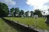 Ireland Street Cemetery |
1. Juli 2009 ID-Nr. 09000471 |
Ireland Street 42° 21′ 54″ N, 72° 53′ 3″ W |
Chesterfield | |
| 34 | Lincoln-Sunset Historic District | 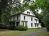 Lincoln-Sunset Historic District |
22. Feb. 1993 ID-Nr. 93000008 |
42° 22′ 33″ N, 72° 31′ 33″ W |
Amherst | |
| 35 | Lockville Historic District |  Lockville Historic District |
24. Jan. 2001 ID-Nr. 00001657 |
College Hwy. 42° 12′ 42″ N, 72° 43′ 52″ W |
Southampton | |
| 36 | Main Street Historic District | 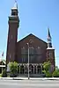 Main Street Historic District |
17. März 1986 ID-Nr. 86000451 |
42° 16′ 11″ N, 72° 40′ 22″ W |
Easthampton | |
| 37 | The Manse | 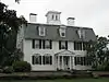 The Manse |
14. Okt. 1976 ID-Nr. 76000263 |
54 Prospect St. 42° 19′ 20″ N, 72° 38′ 12″ W |
Northampton | |
| 38 | Middlefield-Becket Stone Arch Railroad Bridge District | 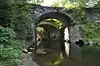 Middlefield-Becket Stone Arch Railroad Bridge District weitere Bilder |
11. Apr. 1980 ID-Nr. 80000502 |
42° 18′ 44″ N, 73° 1′ 10″ W |
Middlefield | |
| 39 | Middlefield Center Historic District |  Middlefield Center Historic District |
3. Okt. 2012 ID-Nr. 12000827 |
138-188 Skyline Trail, & 7 Bell Rd. 42° 20′ 55,4″ N, 73° 0′ 55,4″ W |
Middlefield | |
| 40 | Mill-Prospect Street Historic District |  Mill-Prospect Street Historic District |
22. Okt. 2002 ID-Nr. 02001188 |
Prospect, Chestnut, Bridge, School Sts., Raymond Ave., Prospect Court 42° 22′ 31″ N, 72° 36′ 47″ W |
Hatfield | |
| 41 | Miss Florence Diner | 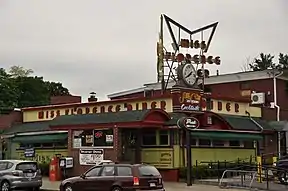 Miss Florence Diner |
22. Sep. 1999 ID-Nr. 99001123 |
99 Main St. 42° 20′ 7″ N, 72° 40′ 18″ W |
Northampton | |
| 42 | Mountain Rest | 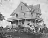 Mountain Rest |
10. Nov. 1983 ID-Nr. 83003984 |
42° 27′ 36″ N, 72° 50′ 23″ W |
Goshen | |
| 43 | Nashawannuck Mills Historic District | 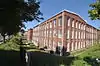 Nashawannuck Mills Historic District |
12. Feb. 2015 ID-Nr. 15000001 |
1-15 Cottage St. 42° 15′ 57,2″ N, 72° 40′ 2″ W |
Easthampton | |
| 44 | North Amherst Center Historic District | 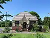 North Amherst Center Historic District |
13. Dez. 1991 ID-Nr. 91001824 |
1184-1136 N. Pleasant St., 1-39 Pine St., 11-13 Meadow St. 42° 24′ 33″ N, 72° 31′ 52″ W |
Amherst | |
| 45 | North Cemetery |  North Cemetery |
3. März 2004 ID-Nr. 04000121 |
Cold St. 42° 25′ 22″ N, 72° 56′ 49″ W |
Worthington | |
| 46 | North Hadley Historic District | 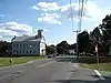 North Hadley Historic District |
30. Dez. 1993 ID-Nr. 93001475 |
42° 23′ 23″ N, 72° 34′ 50″ W |
Hadley | |
| 47 | North Hatfield Historic District | 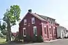 North Hatfield Historic District |
30. Okt. 1997 ID-Nr. 97000879 |
42° 24′ 33″ N, 72° 37′ 26″ W |
Hatfield | |
| 48 | Northampton Downtown Historic District | 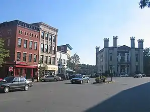 Northampton Downtown Historic District |
17. Mai 1976 ID-Nr. 85001464 |
42° 19′ 5″ N, 72° 37′ 57″ W |
Northampton | |
| 49 | Northampton State Hospital | 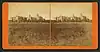 Northampton State Hospital |
25. Juli 1994 ID-Nr. 94000696 |
1 Prince St. 42° 18′ 45″ N, 72° 39′ 15,8″ W |
Northampton | In den 2000er Jahren größtenteils abgerissen. |
| 50 | Northampton Veterans Administration Hospital Historic District | 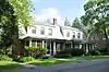 Northampton Veterans Administration Hospital Historic District |
4. Dez. 2012 ID-Nr. 12000994 |
421 N. Main St. 42° 20′ 59,1″ N, 72° 40′ 53,9″ W |
Northampton | |
| 51 | Old Chapel | 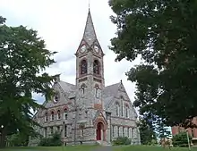 Old Chapel |
11. Mai 2015 ID-Nr. 15000211 |
144 Hicks Way 42° 23′ 20,4″ N, 72° 31′ 40,8″ W |
Amherst | Eines der ältesten Gebäude auf dem Campus der University of Massachusetts Amherst. |
| 52 | Old Mill Site Historic District |  Old Mill Site Historic District |
2. Juni 1982 ID-Nr. 82001911 |
48 und 50 Prospect St. 42° 22′ 16″ N, 72° 35′ 49″ W |
Hatfield | |
| 53 | Otis Company Mill No. 1 |  Otis Company Mill No. 1 |
2. Mai 1982 ID-Nr. 82001909 |
E. Main St. 42° 15′ 31″ N, 72° 14′ 20″ W |
Ware | |
| 54 | Parsons, Shepherd, und Damon Houses Historic District | 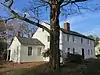 Parsons, Shepherd, und Damon Houses Historic District |
6. Juni 2001 ID-Nr. 01000627 |
46, 58 und 66 Bridge St. 42° 19′ 20″ N, 72° 37′ 35″ W |
Northampton | |
| 55 | Pelham Town Hall Historic District | 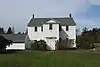 Pelham Town Hall Historic District |
23. Nov. 1971 ID-Nr. 71000085 |
Amherst Rd. at the corner of Daniel Shays Hwy. 42° 23′ 32″ N, 72° 24′ 16″ W |
Pelham | |
| 56 | Plainfield Center Historic District | 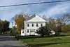 Plainfield Center Historic District |
27. Juli 2015 ID-Nr. 15000468 |
42° 30′ 58,3″ N, 72° 54′ 47,9″ W |
Plainfield | |
| 57 | Pomeroy Terrace Historic District |  Pomeroy Terrace Historic District |
11. Mai 2018 ID-Nr. 100002420 |
42° 19′ 16,3″ N, 72° 37′ 34,6″ W |
Northampton | |
| 58 | Porter-Phelps-Huntington House |  Porter-Phelps-Huntington House |
26. März 1973 ID-Nr. 73000303 |
130 River Dr. 42° 22′ 19″ N, 72° 35′ 24″ W |
Hadley | |
| 59 | Prospect-Gaylord Historic District |  Prospect-Gaylord Historic District |
4. Feb. 1993 ID-Nr. 93000007 |
42° 22′ 33″ N, 72° 31′ 22″ W |
Amherst | |
| 60 | Ringville Cemetery |  Ringville Cemetery |
11. Feb. 2004 ID-Nr. 04000024 |
Witt Hill Rd. 42° 22′ 13″ N, 72° 54′ 56″ W |
Worthington | |
| 61 | Ross Farm |  Ross Farm |
8. Jan. 2008 ID-Nr. 07001360 |
123 Meadow St. 42° 20′ 2″ N, 72° 40′ 49″ W |
Northampton | Standort der Underground Railroad |
| 62 | Smith Alumnae Gymnasium |  Smith Alumnae Gymnasium |
30. Apr. 1976 ID-Nr. 76000259 |
Smith College campus Green St. 42° 19′ 1″ N, 72° 38′ 18″ W |
Northampton | |
| 63 | South Amherst Common Historic District | 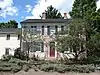 South Amherst Common Historic District |
17. Feb. 1995 ID-Nr. 95000100 |
42° 20′ 29″ N, 72° 30′ 18″ W |
Amherst | |
| 64 | South Hadley Canal Historic District | _map.jpg.webp) South Hadley Canal Historic District |
11. März 1992 ID-Nr. 92000077 |
42° 13′ 14,9″ N, 72° 36′ 33,1″ W |
South Hadley | |
| 65 | South Worthington Historic District | 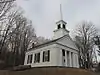 South Worthington Historic District |
1. Sep. 2005 ID-Nr. 05000935 |
42° 20′ 47″ N, 72° 53′ 36″ W |
Worthington und Chesterfield | |
| 66 | Southampton Center Historic District | 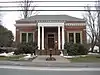 Southampton Center Historic District |
4. Apr. 1991 ID-Nr. 91000363 |
42° 13′ 25″ N, 72° 43′ 55″ W |
Southampton | |
| 67 | Strong House | 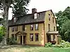 Strong House |
5. Juli 1984 ID-Nr. 84002457 |
67 Amity St. 42° 22′ 33″ N, 72° 31′ 19″ W |
Amherst | |
| 68 | The Town Farm |  The Town Farm |
12. Sep. 1996 ID-Nr. 96000950 |
75 Oliver St. 42° 16′ 50″ N, 72° 41′ 51″ W |
Easthampton | |
| 69 | Upper Main Street Historic District |  Upper Main Street Historic District |
22. Juli 1994 ID-Nr. 94000735 |
42° 23′ 15″ N, 72° 35′ 52″ W |
Hatfield | |
| 70 | US Post Office-Easthampton Main |  US Post Office-Easthampton Main |
1. Apr. 1986 ID-Nr. 86000714 |
19 Union St. 42° 16′ 10″ N, 72° 40′ 19″ W |
Easthampton | |
| 71 | US Post Office-South Hadley Main |  US Post Office-South Hadley Main |
28. Mai 1986 ID-Nr. 86001188 |
1 Hadley St. 42° 15′ 30″ N, 72° 34′ 31″ W |
South Hadley | |
| 72 | Walker-Collis House |  Walker-Collis House |
30. Sep. 1982 ID-Nr. 82001903 |
1 Stadler St. 42° 16′ 21″ N, 72° 24′ 38″ W |
Belchertown | |
| 73 | Ware Center Historic District |  Ware Center Historic District |
8. Mai 1986 ID-Nr. 86001013 |
MA 9 und Greenwich Plains Rd. 42° 15′ 40″ N, 72° 16′ 42″ W |
Ware | |
| 74 | Ware Millyard Historic District |  Ware Millyard Historic District |
21. Nov. 1986 ID-Nr. 86003508 |
42° 15′ 33″ N, 72° 14′ 17″ W |
Ware | |
| 75 | Ware Town Hall |  Ware Town Hall |
26. Juni 1986 ID-Nr. 86001403 |
Main und West Sts. 42° 15′ 36″ N, 72° 14′ 35″ W |
Ware | |
| 76 | Ware-Hardwick Covered Bridge |  Ware-Hardwick Covered Bridge |
8. Mai 1986 ID-Nr. 86001006 |
Old Gilbertville Rd. und Bridge St. 42° 18′ 37″ N, 72° 12′ 45″ W |
Ware | |
| 77 | West Chesterfield Historic District |  West Chesterfield Historic District weitere Bilder |
25. Sep. 2008 ID-Nr. 08000950 |
42° 24′ 12″ N, 72° 52′ 37″ W |
Chesterfield | |
| 78 | West Hatfield Historic District |  West Hatfield Historic District |
24. Feb. 2005 ID-Nr. 05000079 |
3-12 Church Ave., 2 Linseed Rd., 23-42 West St. 42° 22′ 19″ N, 72° 38′ 12″ W |
Hatfield | |
| 79 | Westside Historic District |  Westside Historic District |
25. Juli 2000 ID-Nr. 00000793 |
Baker und Snell Sts., Northampton Rd., und Hazel Ave. 42° 22′ 0″ N, 72° 31′ 51″ W |
Amherst | |
| 80 | Williamsburg Center Historic District |  Williamsburg Center Historic District |
22. Juni 1980 ID-Nr. 80000506 |
MA 9 42° 23′ 32″ N, 72° 43′ 49″ W |
Williamsburg | |
| 81 | Woodbridge Street Historic District |  Woodbridge Street Historic District |
14. Nov. 1983 ID-Nr. 83003987 |
3 und 7 Silver St., 25-82 Woodbridge St. 42° 15′ 52″ N, 72° 34′ 21″ W |
South Hadley |
Siehe auch
Weblinks
Einzelnachweise
- Auszug aus dem National Register of Historic Places - Hampshire County Abgerufen am 21. November 2015
- Die Nummerierung in dieser Listenspalte ist an der vom National Park Service vorgelegten Reihenfolge der Einträge orientiert; die Farben unterscheiden verschiedene Schutzgebietstypen des National Park Systems mit landesweiter Bedeutung (z. B. National Historic Landmarks) von den sonstigen Einträgen im National Register of Historic Places.
- National Register Information System. In: National Register of Historic Places. National Park Service. Abgerufen am 13. März 2009.
| Countys |
Barnstable • Berkshire • Bristol • Dukes • Essex • Franklin • Hampden • Hampshire • Middlesex • Nantucket • Norfolk • Plymouth • Suffolk • Worcester (Nord | Süd) |
||||||||||||||||
| Städte |
|