Liste der Berge oder Erhebungen in Niger
Die Liste der Berge oder Erhebungen in Niger ist absteigend nach Höhe über dem Meeresspiegel sortiert.
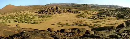
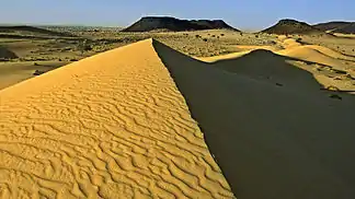
Das Gebirge Monts Bagzane, in dem sich mit dem Idoukal-n-Taghès (2022 m) der höchste Berg Nigers befindet
Liste
Takolokouzet (1295 m)
Djado-Plateau (1000 m)
Blaue Berge (921 m)
Termit-Massiv (710 m)
Siehe auch
Literatur
- Aboubacar Adamou, Alain Morel: Niger, Agadez et les montagnes de l’Aïr. Aux portes du Sahara. Éditions de la Boussole, Grenoble 2005, ISBN 2-915592-06-3.
- Alain Morel: Les hauts massifs de l’Aïr (Niger) et leurs piémonts. Etude géomorphologique. Thèse de doctorat. Université scientifique et médicale de Grenoble, Grenoble 1985.
Weblinks
Commons: Berge oder Erhebungen in Niger – Sammlung von Bildern, Videos und Audiodateien
Einzelnachweise
- Réserves naturelles de l’Aïr et du Ténéré. Carte des limites de la réserve (en vert). UNESCO Centre du patrimoine mondial, abgerufen am 3. Dezember 2020.
- André Salifou: Le Niger. L’Harmattan, Paris 2003, ISBN 2-7475-2639-9, S. 20.
- République du Niger. Niamey et ses environs. Echelle 1 : 20000. Karte. Institut Géographique National, Paris 1978 (esdac.jrc.ec.europa.eu [PDF; abgerufen am 11. April 2021]).
Berge oder Erhebungen in Afrika nach Staat
Ägypten | Algerien | Angola | Äquatorialguinea | Äthiopien | Benin | Botswana | Burkina Faso | Burundi | Dschibuti | Elfenbeinküste | Eritrea | Eswatini | Gabun | Gambia | Ghana | Guinea | Guinea-Bissau | Kamerun | Kap Verde | Kenia | Komoren | Demokratische Republik Kongo | Republik Kongo | Lesotho | Liberia | Libyen | Madagaskar | Malawi | Mali | Marokko | Mauretanien | Mauritius | Mosambik | Namibia | Niger | Nigeria | Ruanda | Sambia | São Tomé und Príncipe | Senegal | Seychellen | Sierra Leone | Simbabwe | Somalia | Südafrika | Sudan | Südsudan | Tansania | Togo | Tschad | Tunesien | Uganda | Zentralafrikanische Republik
This article is issued from Wikipedia. The text is licensed under Creative Commons - Attribution - Sharealike. The authors of the article are listed here. Additional terms may apply for the media files, click on images to show image meta data.