Kota (Staat)
Kota (auch Kotah; Hindi: कोटा, Koṭā) war einer der Fürstenstaaten der Rajputen im heutigen Rajasthan (Britisch-Indien), benannt nach seiner gleichnamigen Hauptstadt.
| Kota | |||||
| 17. Jh.–1949 | |||||
| |||||
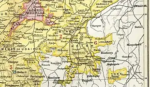
| Hauptstadt | Kota | ||||
| Fläche | 14.827 km² | ||||
| Einwohnerzahl | 790.000 (1941) | ||||
| Gründung | 17. Jh. | ||||
| Auflösung | 7. April 1949 | ||||
| Staatsreligion: Hinduismus Dynastie: Hada-Chauhan | |||||
 | |||||


Rao Madho Singh (1631–1656), der den Fürstenstaat begründete, war ein jüngerer Sohn des Rao Raja Ratan Singh von Bundi. Kota war 1707–1713 zeitweilig wieder mit Bundi vereinigt. Rao Bhim Singh (1707–1720) wurde vom Großmogul von Delhi der Titel „Maharao“ verliehen. Kota wurde 1817 britisches Protektorat. Es hatte 1941 eine Fläche von 14.827 km² und 790.000 Einwohner. Ein großer Teil der Bevölkerung gehörte zum indigenen Volk der Bhil.
Kota verfügte zwischen 1874 und 1901 über eine eigene Staatspost, für die zwischen 1883 und 1886 sehr einfach gestaltete Briefmarken herausgegeben wurden.[1]
Am 25. März 1948 erfolgte der Beitritt zur Union von Rajasthan, am 7. April 1949 der Anschluss an Indien. Der letzte Maharao Bhim Singh II. (1940–1956) war 1948–1956 stellvertretender Rajpramukh des Staates Rajasthan. Am 1. November 1956 wurde der Fürstenstaat aufgelöst.
Siehe auch
Literatur
- William Barton: The princes of India. With a Chapter on Nepal. Nisbet, London 1934, (Reprinted edition. Cosmo, New Delhi 1983).
- Andreas Birken: Philatelic Atlas of British India. CD-ROM. Birken, Hamburg 2004.
- Ian Copland: The princes of India in the endgame of empire, 1917–1947 (= Cambridge Studies in Indian History and Society. 2). Cambridge University Press, Cambridge u. a. 1997, ISBN 0-521-57179-0.
- George B. Malleson: An historical sketch of the native states of India. Longmans, Green & Co., London 1875, (Digitalisat).
- Paul E. Roberts: India (= A Historical Geography of the British Dominions. Bd. 7, Tl. 1–2). 2 Bände (Bd. 1: History to the End of the East India Company. Bd. 2: History under the Government of the Crown.). Clarendon Press, Oxford 1916–1923, (Reprinted edition: Historical Geography of India. 2 Bände. Printwell, Jaipur 1995).
- Joseph E. Schwartzberg (Hrsg.): A historical atlas of South Asia (= Association for Asian Studies. Reference Series. 2). 2nd impression, with additional material. Oxford University Press, New York NY u. a. 1992, ISBN 0-19-506869-6.