Kap Roberts
Das Kap Roberts ist eine Landzunge an der Scott-Küste des ostantarktischen Viktorialands Das Kap bildet am nordöstlichen Ende des Wilson-Piedmont-Gletschers die südliche Begrenzung der Einfahrt zum Granite Harbor.
| Kap Roberts | ||
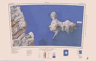
 Karte mit Kap Roberts (oben links) | ||
| Geographische Lage | ||
| ||
| Koordinaten | 77° 2′ S, 163° 12′ O | |
| Lage | Viktorialand, Ostantarktika | |
| Küste | Scott-Küste | |
| Gewässer | Granite Harbor | |
| Gewässer 2 | Wilson-Piedmont-Gletscher | |
Teilnehmer der Nimrod-Expedition (1907–1909) unter der Leitung des britischen Polarforschers Ernest Shackleton entdeckten es. Namensgeber ist William Roberts (* 1872), Assistenzzoologe und Koch der Expeditionsmannschaft. Von 1997 bis 1999 wurden vor dem Kap im Rahmen des Cape Roberts Project Bohrkerne zur Rekonstruktion der Vereisungsgeschichte Antarktikas entnommen.
Weblinks
- Cape Roberts im Geographic Names Information System des United States Geological Survey (englisch)
- Cape Roberts auf geographic.org
- Cape Roberts. In: Kenneth J. Bertrand und Fred G. Alberts, Geographic names of Antarctica, U.S. Govt. Print. Off., Washington 1956, S. 260. (englisch)
This article is issued from Wikipedia. The text is licensed under Creative Commons - Attribution - Sharealike. The authors of the article are listed here. Additional terms may apply for the media files, click on images to show image meta data.
