Johannes-Paul-II.-Halbinsel
Die Johannes-Paul-II.-Halbinsel (bulgarisch полуостров Йоан Павел II poluostrow Joan Pawel II) ist eine vereiste Halbinsel im Norden der Livingston-Insel im Archipel der Südlichen Shetlandinseln. Sie ist 12,8 km lang, maximal 8,5 km breit und trennt die Hero Bay von der westlich gelegenen Barclay Bay. Das Kap Shirreff stellt das nördliche Ende der Halbinsel dar.
| Johannes-Paul-II.-Halbinsel | ||
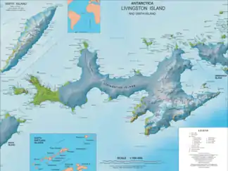
 Karte von Livingston Island mit der Johannes-Paul-II.-Halbinsel | ||
| Geographische Lage | ||
| ||
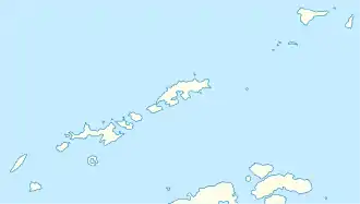
| Koordinaten | 62° 31′ 43″ S, 60° 45′ 58″ W | |
| Gewässer 1 | Drakestraße | |
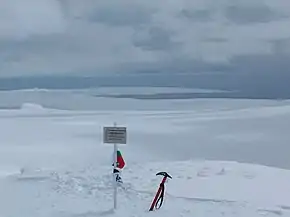
 Blick vom Kuzman Knoll auf die Johannes-Paul-II.-Halbinsel | ||
Bulgarische Wissenschaftler benannten sie am 11. April 2005 nach dem neun Tage zuvor gestorbenen Papst Johannes Paul II. (1920–2005) für dessen Leistungen um Frieden und Völkerverständigung.
Weblinks
- Ioannes Paulus II Peninsula. Informationen auf der Homepage des Scientific Committee on Antarctic Research (SCAR) (englisch).
- Ivanov, L. General Geography and History of Livingston Island. In: Bulgarian Antarctic Research: A Synthesis. C. Pimpirev and N. Chipev (Hrsg.), St. Kliment Ohridski University Press, Sofia 2015. S. 17–28. ISBN 978-954-07-3939-7
This article is issued from Wikipedia. The text is licensed under Creative Commons - Attribution - Sharealike. The authors of the article are listed here. Additional terms may apply for the media files, click on images to show image meta data.
