Ilhéu da Cal
Ilhéu da Cal, oft auch als Ilhéu de Baixo bezeichnet, ist eine kleine, unbewohnte Insel in der portugiesischen autonomen Region Madeira.
| Ilhéu da Cal | ||
|---|---|---|
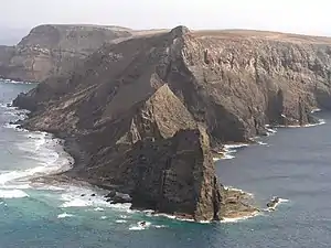 Ilhéu da Cal von Porto Santo aus gesehen | ||
| Gewässer | Atlantischer Ozean | |
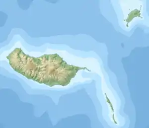
| Inselgruppe | Madeira | |
| Geographische Lage | 33° 0′ 30″ N, 16° 23′ 12″ W | |
| ||
| Länge | 2,8 km | |
| Breite | 1,3 km | |
| Fläche | 1 km² | |
| Höchste Erhebung | 179 m | |
| Einwohner | unbewohnt | |
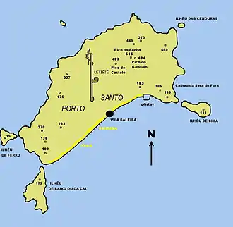 Karte von Porto Santo, Ilhéu da Cal im Süden | ||
Geographie
Die Insel liegt nur wenige hundert Meter südlich der zur Inselgruppe Madeira gehörenden Insel Porto Santo. Die Insel ist in Nord-Süd-Richtung etwa 2,8 km lang, bis zu 1,5 km breit und erreicht eine Höhe von 179 m über dem Meer. Der 33. Breitengrad Nord läuft annähernd durch die Inselmitte. Wie sämtliche der Insel Porto Santo vorgelagerte Eilande, den sogenannten Ilhéus do Porto Santo, ist auch Ilhéu da Cal ein Natura 2000-Schutzgebiet.
Weblinks
- Über die Fauna der Porto Santo vorgelagerten Inseln (port.; PDF)
- Die portugiesischen Natura 2000-Gebiete (Karte und Liste; PDF; 2,55 MB)
This article is issued from Wikipedia. The text is licensed under Creative Commons - Attribution - Sharealike. The authors of the article are listed here. Additional terms may apply for the media files, click on images to show image meta data.