Ilhéu Laja Branca
Die unbewohnte Insel Ilhéu Laja Branca (Kapverdisches Kreol: Idjéu Laja Branka) liegt etwa 500 m nördlich vom kapverdischen Maio entfernt. Das ehemals mit ihrer größeren Nachbarinsel verbundene vegetationslose Eiland ist etwa 400 m lang und 300 m breit.
| Ilhéu Laja Branca | ||
|---|---|---|
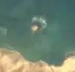 Satellitenbild | ||
| Gewässer | Atlantischer Ozean | |
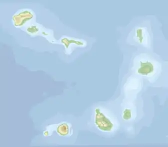
| Inselgruppe | Ilhas de Sotavento | |
| Geographische Lage | 15° 18′ 47″ N, 23° 8′ 12″ W | |
| ||
| Länge | 400 m | |
| Breite | 300 m | |
| Höchste Erhebung | 10 m | |
| Einwohner | unbewohnt | |
This article is issued from Wikipedia. The text is licensed under Creative Commons - Attribution - Sharealike. The authors of the article are listed here. Additional terms may apply for the media files, click on images to show image meta data.